MyTopo
Classic USGS Bicknell Utah 7.5'x7.5' Topo Map
Couldn't load pickup availability
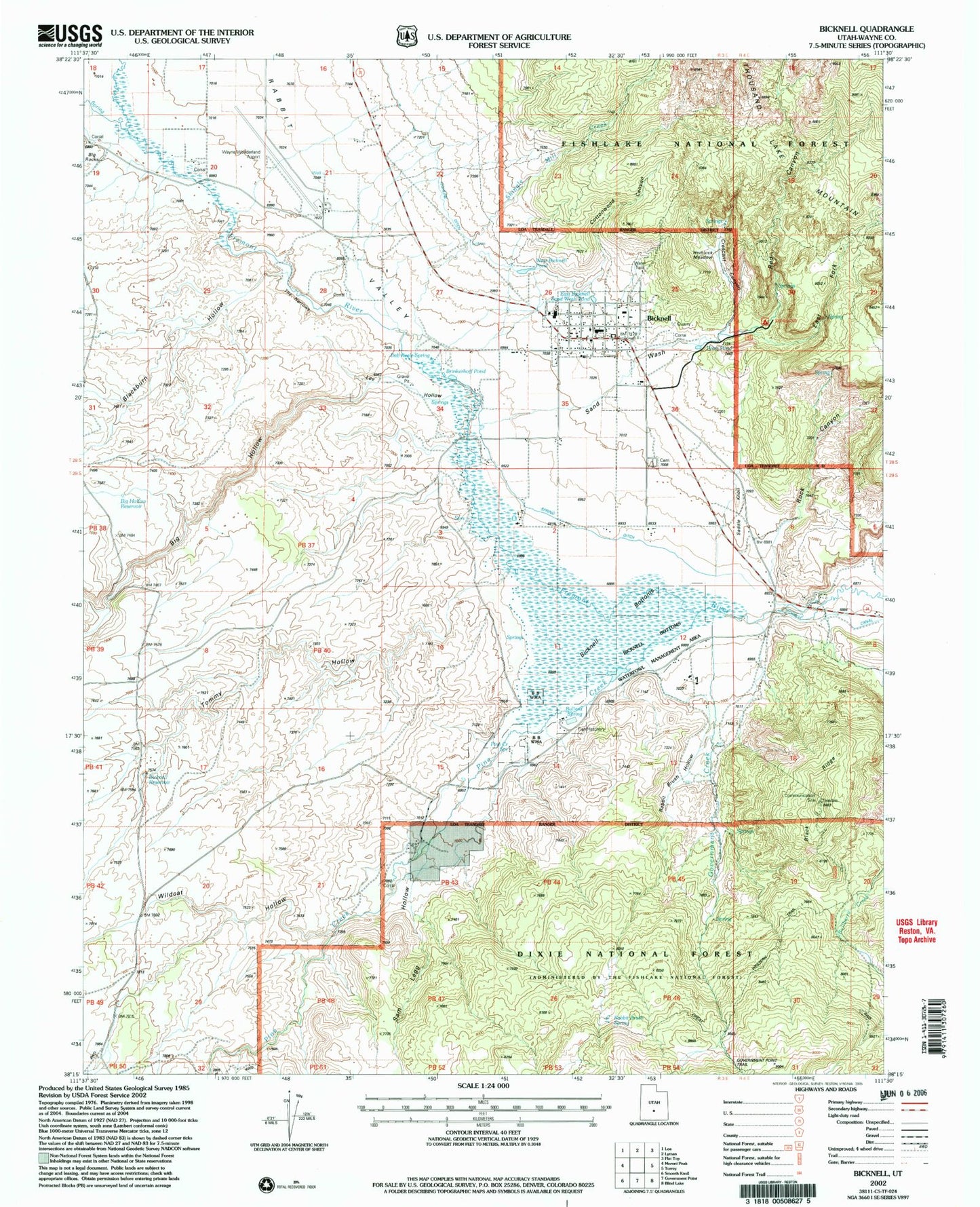
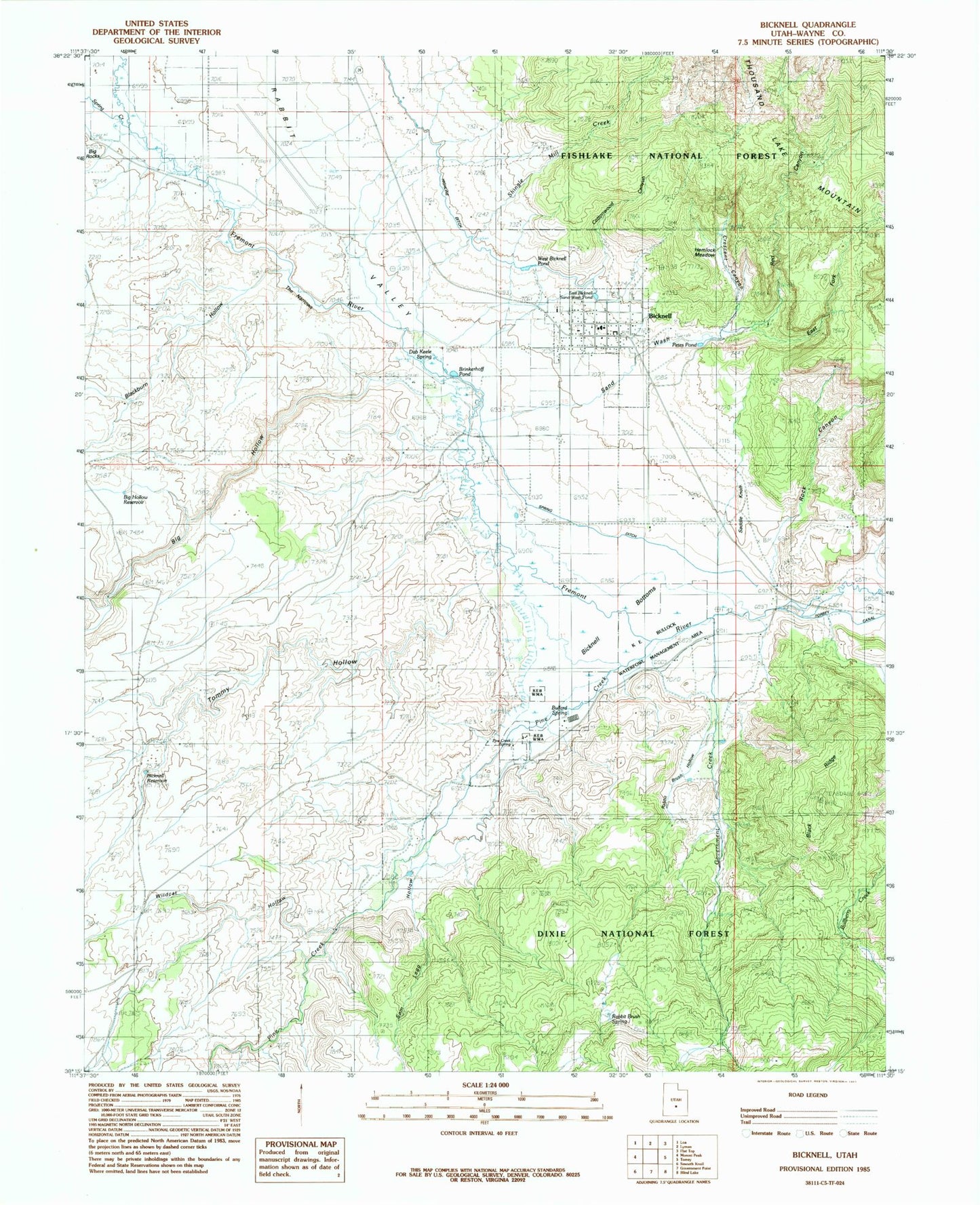
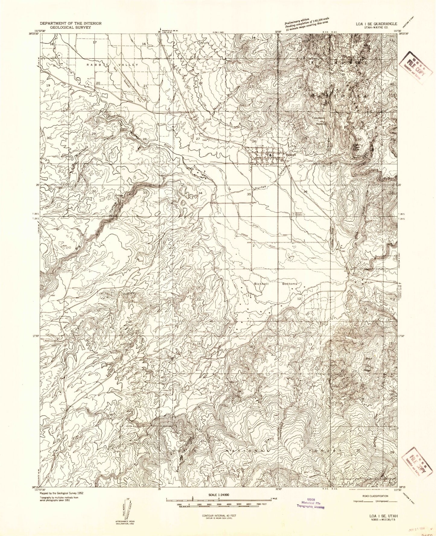
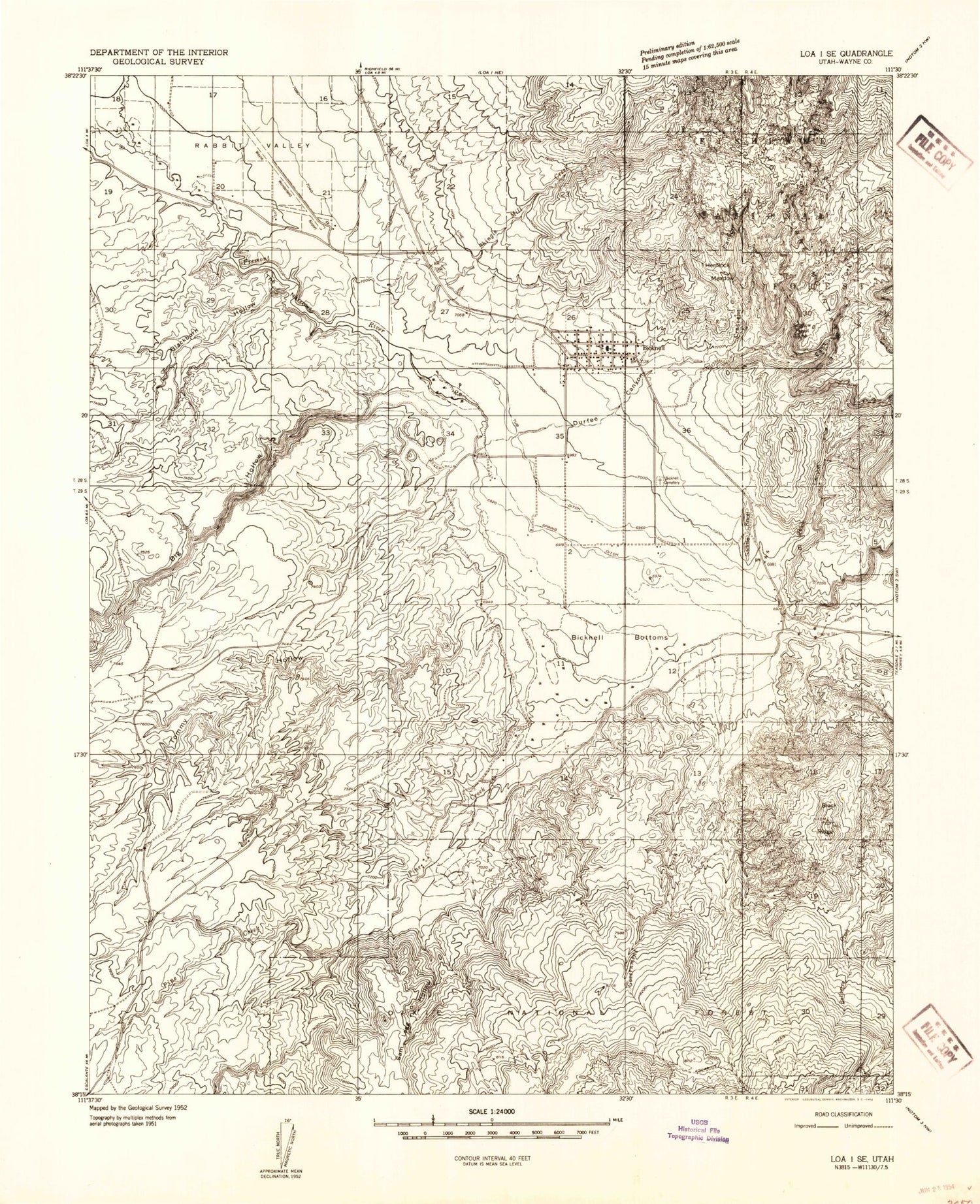
Historical USGS topographic quad map of Bicknell in the state of Utah. Map scale may vary for some years, but is generally around 1:24,000. Print size is approximately 24" x 27"
This quadrangle is in the following counties: Wayne.
The map contains contour lines, roads, rivers, towns, and lakes. Printed on high-quality waterproof paper with UV fade-resistant inks, and shipped rolled.
Contains the following named places: Aquarius Mobile and RV Campground, Bicknell, Bicknell Bottoms, Bicknell Cemetery, Bicknell Fire Department, Bicknell Post Office, Bicknell Reservoir, Big Hollow, Big Hollow Reservoir, Black Ridge, Blackburn Hollow, Brinkerhoff Pond, Bullard Spring, Cottonwood Canyon, Crescent Canyon, Dab Keele Spring, East Bicknell Sand Wash Pond, East Fork Red Canyon, Government Creek, Hemlock Meadow, KE Bullock Waterfowl Management Area, Lee Hollow, Loa Division, Petes Pond, Pine Creek, Pine Creek Spring, Rabbit Brush Hollow, Rabbit Brush Spring, Rabbit Valley, Red Canyon, Rock Canyon, Saddle Knoll, Sage Flat Draw, Sam Legg Hollow, Sand Wash, Shingle Mill Creek, Spring Creek, Spring Ditch, Sunglow Forest Camp, The Church of Jesus Christ of Latter Day Saints, The Narrows, Tommy Hollow, Town of Bicknell, Trail Creek, Tub Ditch, Upper Corral Canyon, Wayne County Ambulance - Bicknell, Wayne High School, Wayne Middle School, Wayne Wonderland Airport, West Bicknell Pond, Wildcat Hollow, ZIP Code: 84715