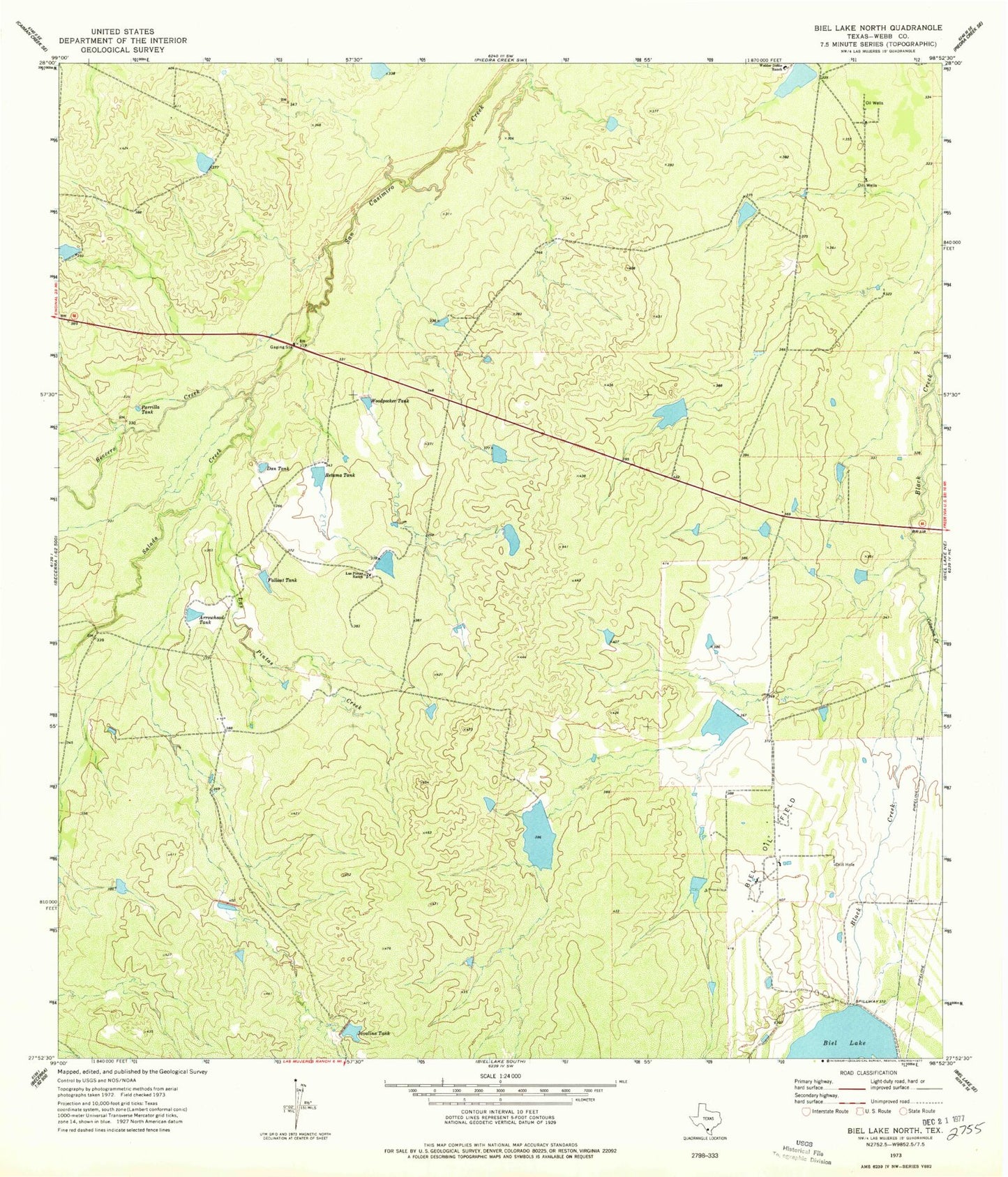
MyTopo
Classic USGS Biel Lake North Texas 7.5'x7.5' Topo Map
Regular price
$16.95
Regular price
Sale price
$16.95
Unit price
per
Couldn't load pickup availability
Historical USGS topographic quad map of Biel Lake North in the state of Texas. Map scale may vary for some years, but is generally around 1:24,000. Print size is approximately 24" x 27"
This quadrangle is in the following counties: Webb.
The map contains contour lines, roads, rivers, towns, and lakes. Printed on high-quality waterproof paper with UV fade-resistant inks, and shipped rolled.
Contains the following named places: Arrowhead Tank, Becerra Creek, Biel Lake, Biel Oil Field, Colmena Creek, Dan Tank, Fallout Tank, Las Pintas Creek, Las Pintas Ranch, Parrilla Tank, Retama Tank, Salado Creek, Seven C's Ranch Airport, Welder Dobie Ranch, Woodpecker Tank