MyTopo
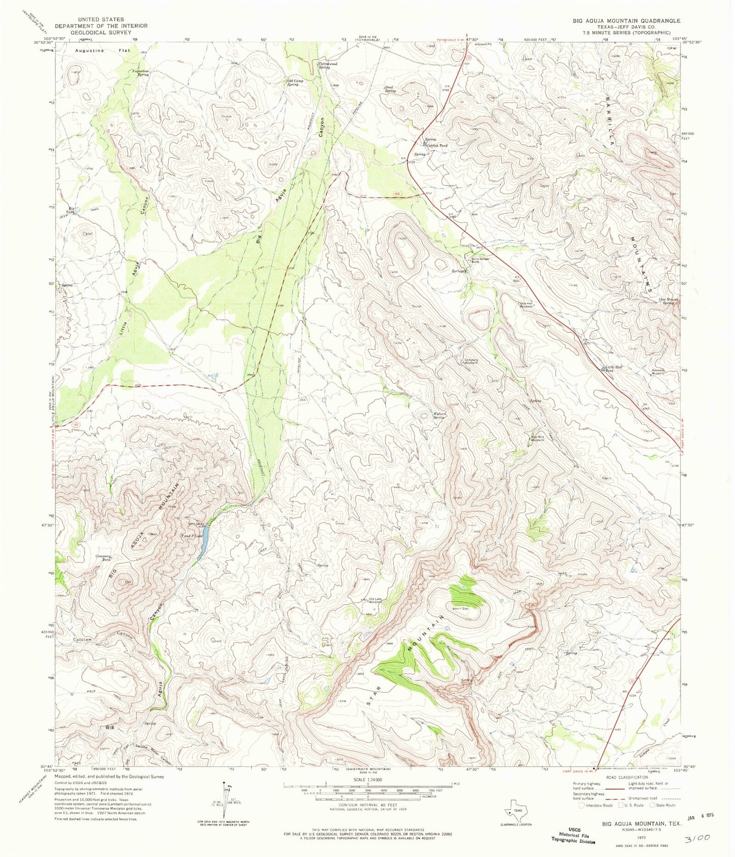
Classic USGS Big Aguja Mountain Texas 7.5'x7.5' Topo Map
Couldn't load pickup availability
Historical USGS topographic quad map of Big Aguja Mountain in the state of Texas. Map scale may vary for some years, but is generally around 1:24,000. Print size is approximately 24" x 27"
This quadrangle is in the following counties: Jeff Davis, Reeves.
The map contains contour lines, roads, rivers, towns, and lakes. Printed on high-quality waterproof paper with UV fade-resistant inks, and shipped rolled.
Contains the following named places: Augustine Spring, Big Aguja Mountain, Big Aguja Springs, Big Tank, Catclaw Canyon, Catfish Tank, Company Tank, Company Windmill, Cottonwood Spring, Cow Heaven Spring, Dark Canyon Springs, Dry Canyon, Dual Spring, Kennedy Windmill, Little Hell Tank, Little Hell Windmill, Ojo Grande Spring, Old Camp Spring, Old Lake Windmill, Second Water Canyon, Seven Springs, Seven Springs Ranch, Star Mountain, Star Mountain Windmill, T and P Lake, T and P Railroad Lake Dam, Walnut Spring