MyTopo
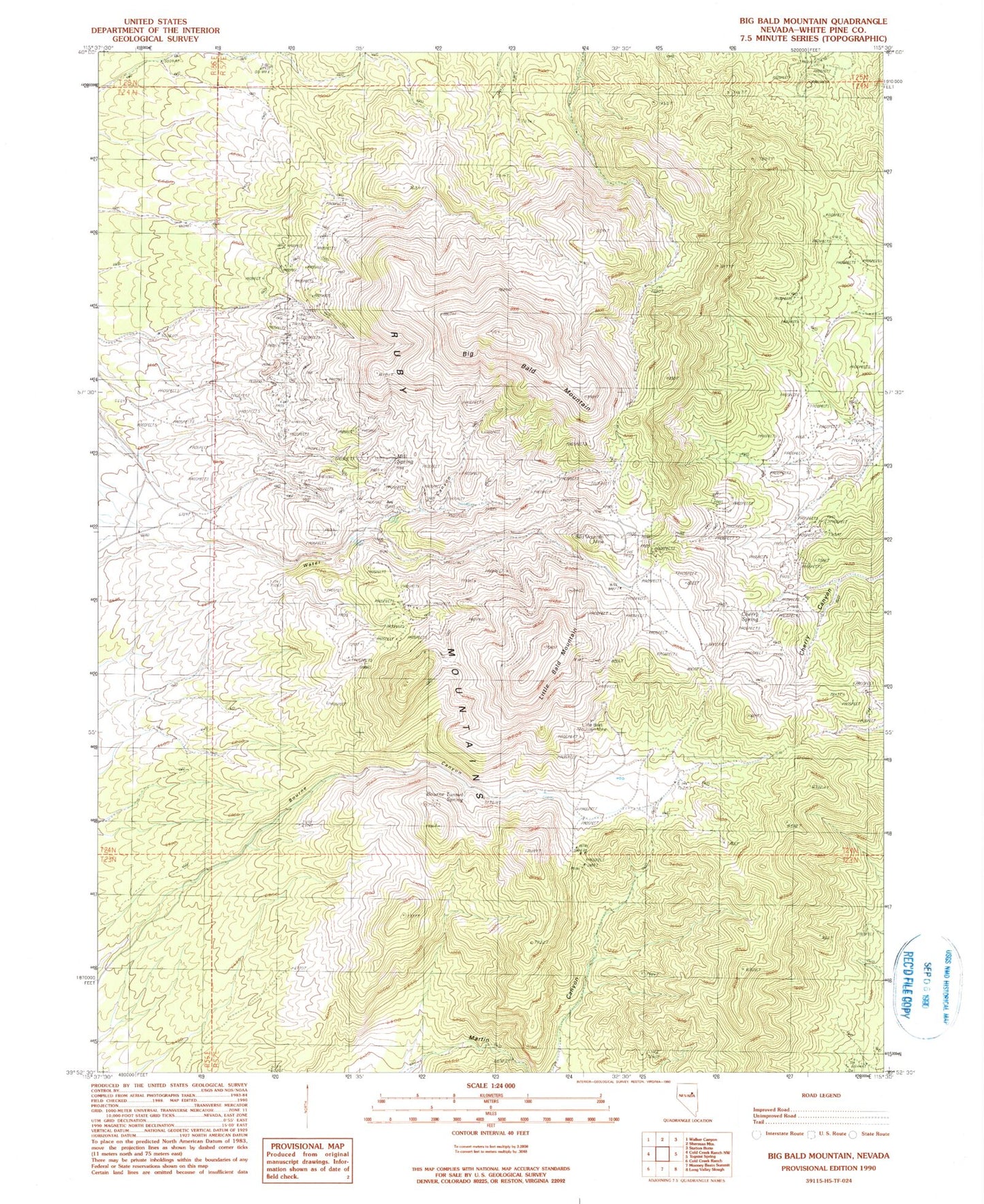
Classic USGS Big Bald Mountain Nevada 7.5'x7.5' Topo Map
Couldn't load pickup availability
Historical USGS topographic quad map of Big Bald Mountain in the state of Nevada. Map scale may vary for some years, but is generally around 1:24,000. Print size is approximately 24" x 27"
This quadrangle is in the following counties: White Pine.
The map contains contour lines, roads, rivers, towns, and lakes. Printed on high-quality waterproof paper with UV fade-resistant inks, and shipped rolled.
Contains the following named places: Bald Mountain Mining District, Big Bald Mountain, Bourne Canyon, Bourne Tunnel Spring, Carbonate Mine, Cherry Canyon, Cherry Spring, Copper Basin Mine, Crown Point Mine, Dees Antimony Mine, Dees Tungsten Mine, Gold King Mine, Joy, Joy Post Office, Little Bald Mountain, Mill Spring, Nevada Mine, Oddie Tunnel, Water Canyon, Water Canyon Placer Mine