MyTopo
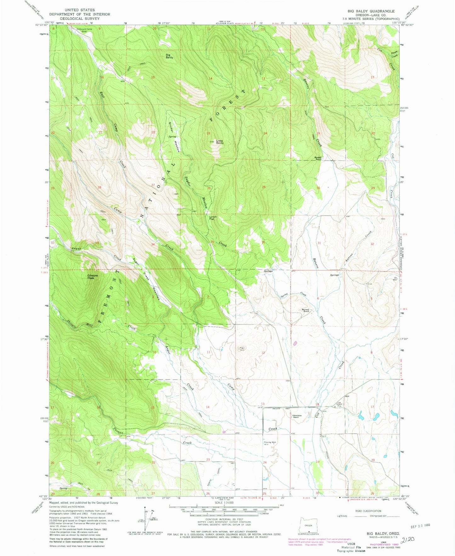
Classic USGS Big Baldy Oregon 7.5'x7.5' Topo Map
Couldn't load pickup availability
Historical USGS topographic quad map of Big Baldy in the state of Oregon. Map scale may vary for some years, but is generally around 1:24,000. Print size is approximately 24" x 27"
This quadrangle is in the following counties: Lake.
The map contains contour lines, roads, rivers, towns, and lakes. Printed on high-quality waterproof paper with UV fade-resistant inks, and shipped rolled.
Contains the following named places: Antone Creek, Augur Creek, Augur Creek Meadows, Barnes Spring, Bauers Creek, Big Baldy, Cox Creek, East Camp Creek, Fawn Creek, Gilmore Peak, Hammersly Ranch, Hotchkiss Ditch, Hotchkiss Ranch, Hotchkiss Springs, Little Baldy, Lynch Flat, Maxwell Ranch, McDonald Camp, Mendell Ranch, Salt Creek, Shingle Mill Creek, Snyder Meadow, Snyder Meadow Creek, Spring Creek, Withrotor Airport