
MyTopo
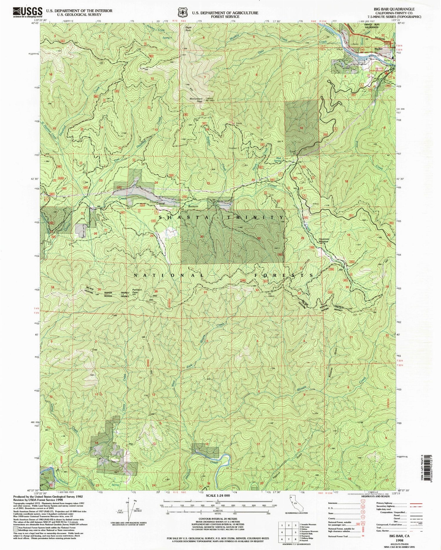
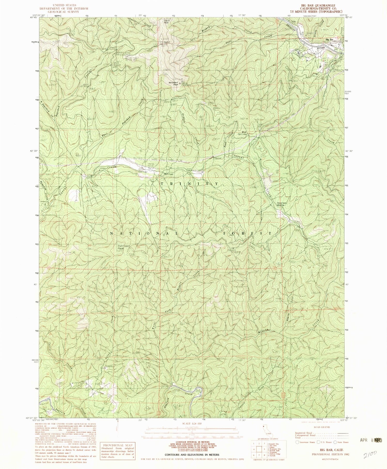
Classic USGS Big Bar California 7.5'x7.5' Topo Map
Couldn't load pickup availability
Historical USGS topographic quad map of Big Bar in the state of California. Map scale may vary for some years, but is generally around 1:24,000. Print size is approximately 24" x 27"
This quadrangle is in the following counties: Trinity.
The map contains contour lines, roads, rivers, towns, and lakes. Printed on high-quality waterproof paper with UV fade-resistant inks, and shipped rolled.
Contains the following named places: Bidden Creek, Big Bar, Big Bar District Ranger Office, Big Bar Post Office, Big Bar Recreation Site, Corral Bottom, Cox Bar School, Deer Creek, Eagle Rock, East Hayshed Creek, Gates Creek, Gates Mountain, Hawk Creek, Haypress Meadow, Hayshed Creek, Hyampom Creek, Knowles Gulch, Miners Creek, Monkey Creek, Monument Peak, Mud Spring, Pattison Peak, Price Creek, Price Creek Cemetery, Treloar Creek, West Fork Miners Creek, West Hayshed Creek


