
MyTopo
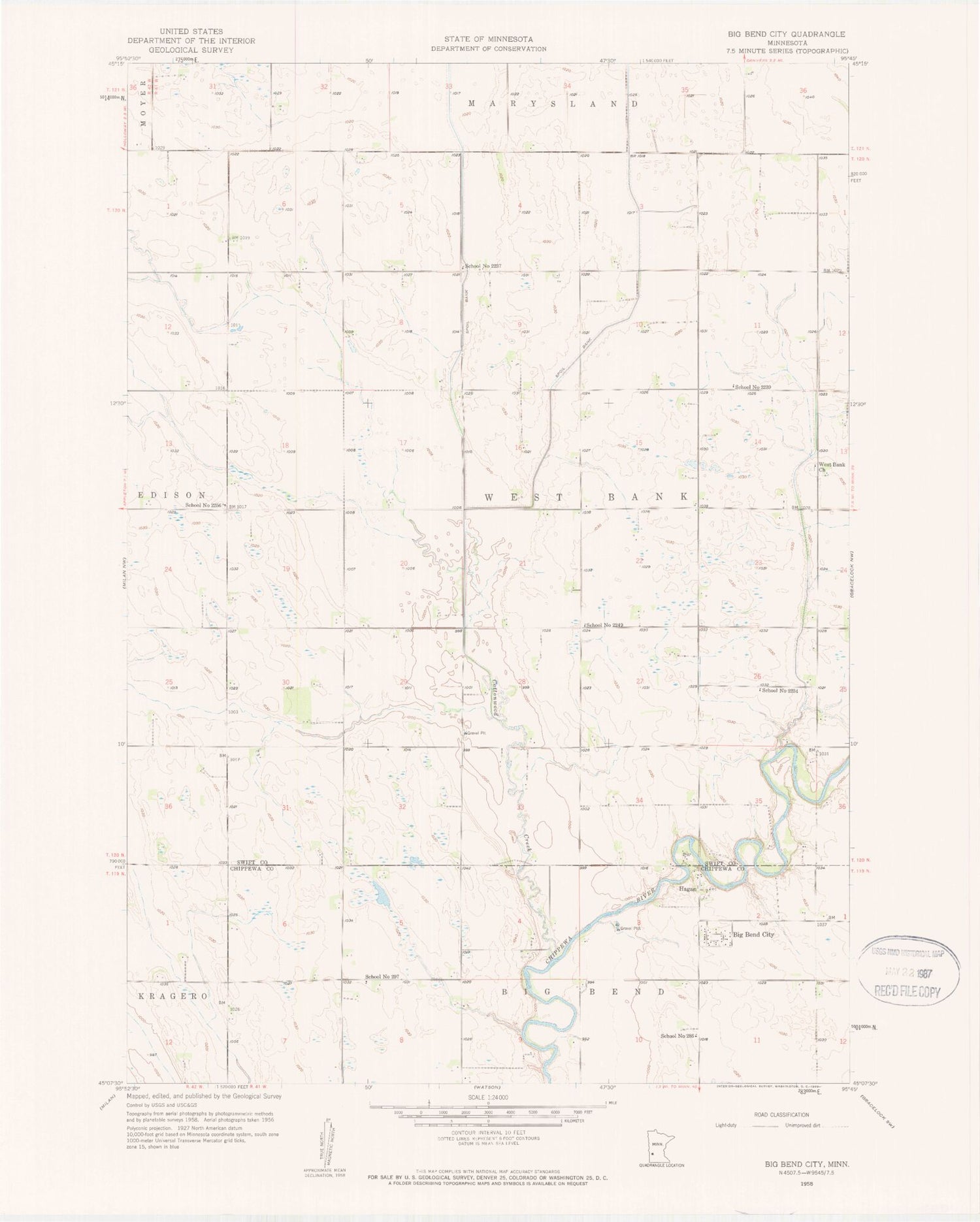
Classic USGS Big Bend City Minnesota 7.5'x7.5' Topo Map
Couldn't load pickup availability
Historical USGS topographic quad map of Big Bend City in the state of Minnesota. Map scale is 1:24000. Print size is approximately 24" x 27"
This quadrangle is in the following counties: Chippewa, Swift.
The map contains contour lines, roads, rivers, towns, and lakes. Printed on high-quality waterproof paper with UV fade-resistant inks, and shipped rolled.
Contains the following named places: Big Bend Church, Big Bend Church, Big Bend City, Big Bend Lutheran Cemetery, Big Bend Lutheran Church Cemetery, Cottonwood Creek, Hagan, Hagan Post Office (historical), Hagan Post Office (historical), School Number 2234, School Number 2237, School Number 2239, School Number 2249, School Number 2256, School Number 286, School Number 297, Township of West Bank, West Bank Cemetery, West Bank Church


