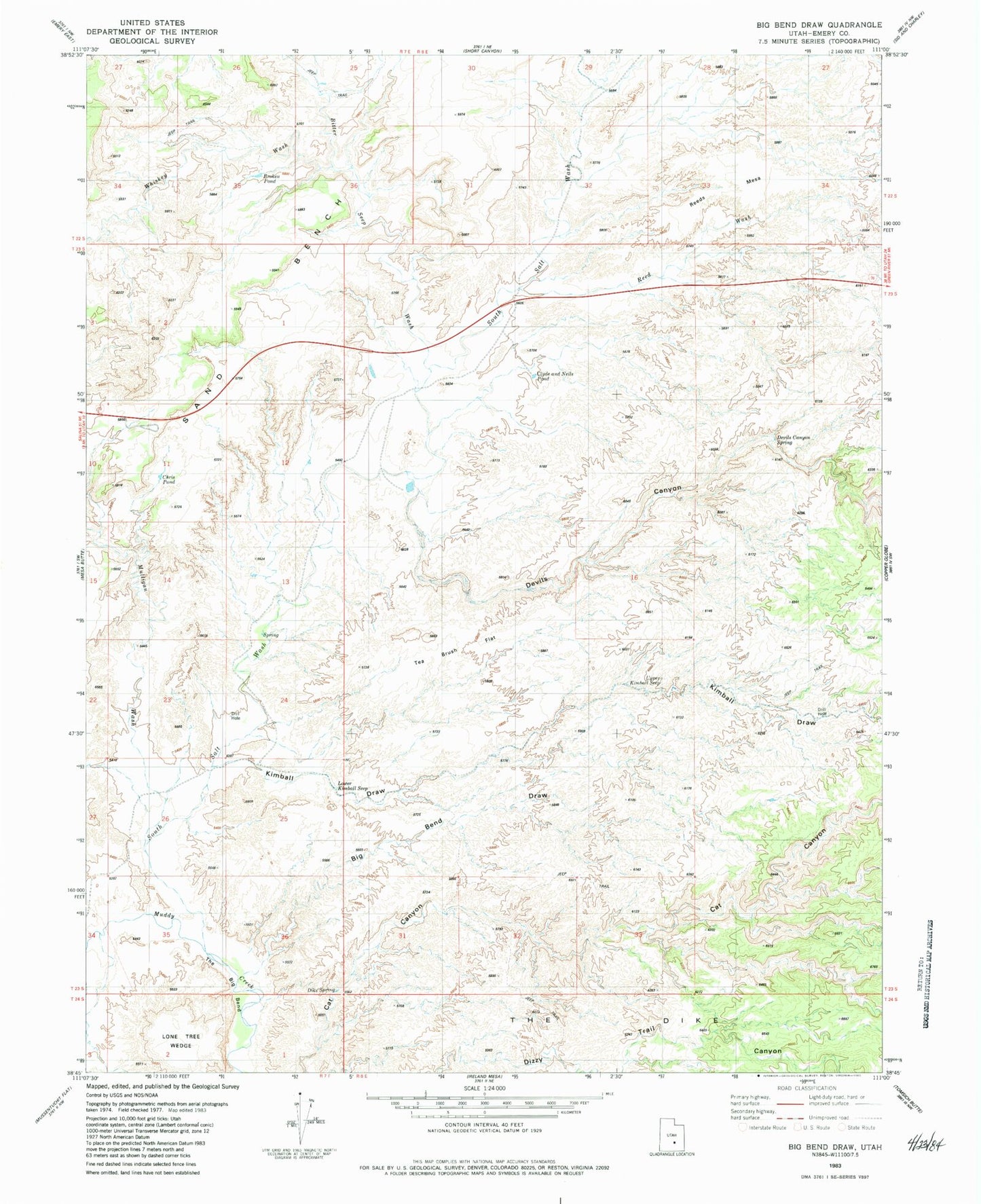
MyTopo
Classic USGS Big Bend Draw Utah 7.5'x7.5' Topo Map
Couldn't load pickup availability
Historical USGS topographic quad map of Big Bend Draw in the state of Utah. Map scale may vary for some years, but is generally around 1:24,000. Print size is approximately 24" x 27"
This quadrangle is in the following counties: Emery.
The map contains contour lines, roads, rivers, towns, and lakes. Printed on high-quality waterproof paper with UV fade-resistant inks, and shipped rolled.
Contains the following named places: Bitter Seep Wash, Broken Pond, Chris Pond, Clyde and Neils Pond, Dennises Well, Devils Canyon, Devils Canyon Spring, Kimball Draw, Lane Tree, Lower Kimball Seep, Mulligan Wash, Reed Wash, Reeds Mesa, Sand Bench, South Salt Wash, Tea Brush Flat, The Big Bend, Upper Kimball Seep, Whiskey Wash