MyTopo
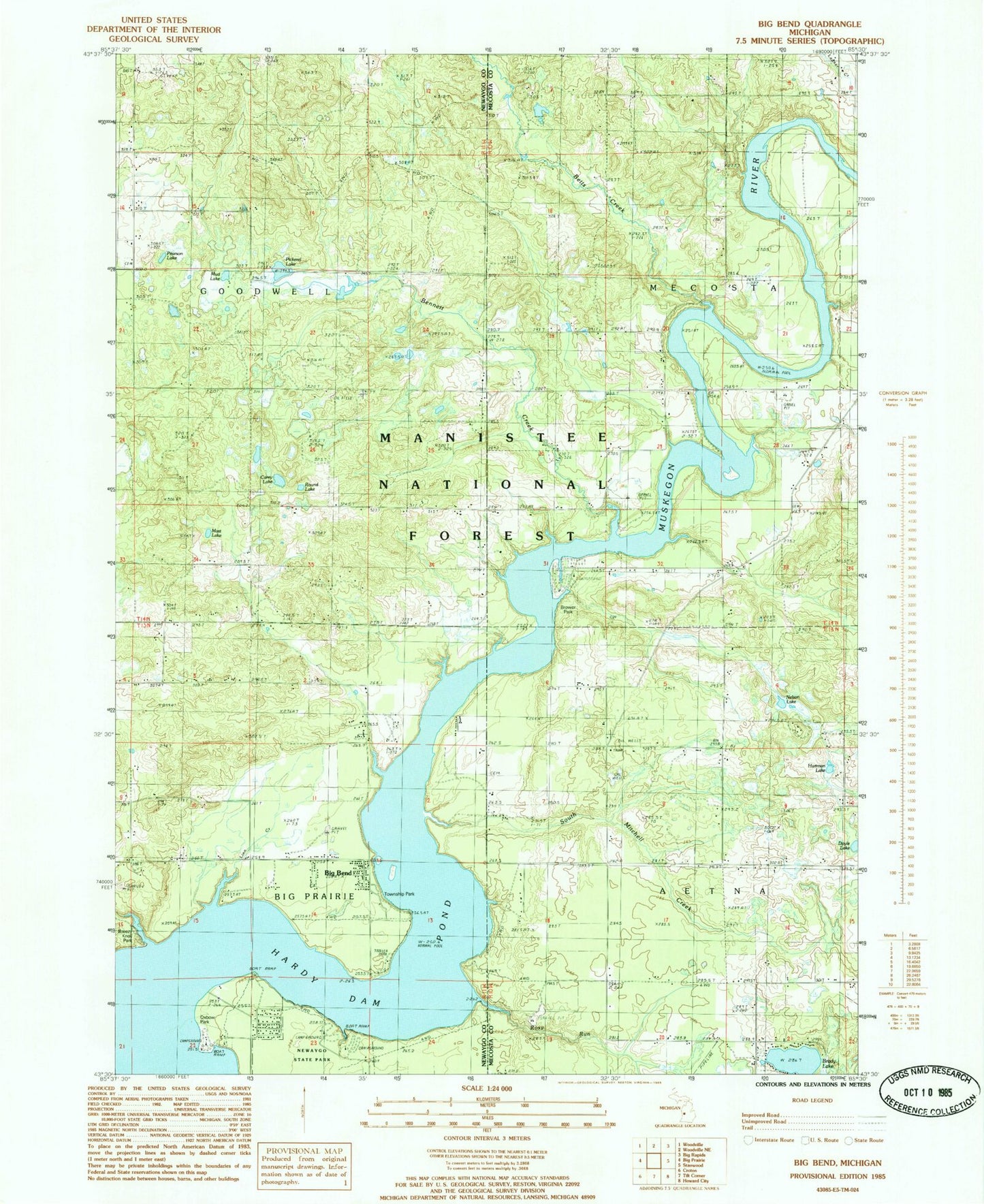
Classic USGS Big Bend Michigan 7.5'x7.5' Topo Map
Couldn't load pickup availability
Historical USGS topographic quad map of Big Bend in the state of Michigan. Map scale is 1:24000. Print size is approximately 24" x 27"
This quadrangle is in the following counties: Mecosta, Newaygo.
The map contains contour lines, roads, rivers, towns, and lakes. Printed on high-quality waterproof paper with UV fade-resistant inks, and shipped rolled.
Contains the following named places: Bennett Creek, Betts Creek, Big Bend, Big Bend Township Park, Big Prairie Township Park, Brady Lake, Breezy Knoll Park, Brower Park, Carey Lake, Davis Park Bridge, Fairview Cemetery, Goodwell Township Cemetery, Hardy Dam Pond, Hartman Lake, Hodgers Creek, Laverne Creek, Lee Lake, Linn Creek, Little Bear Creek, Mast Lake, Mud Lake, Nelson Lake, Newaygo State Park, Newaygo State Park Rustic Campground, Oxbow Park, Pearson Lake, Pickerel Lake, Rosy Run, Round Lake, Saint Peters Cemetery, South Mitchell Creek, Thumser Creek, Township of Aetna, Township of Big Prairie, Township of Goodwell, Township of Mecosta, West Aetna Cemetery