MyTopo
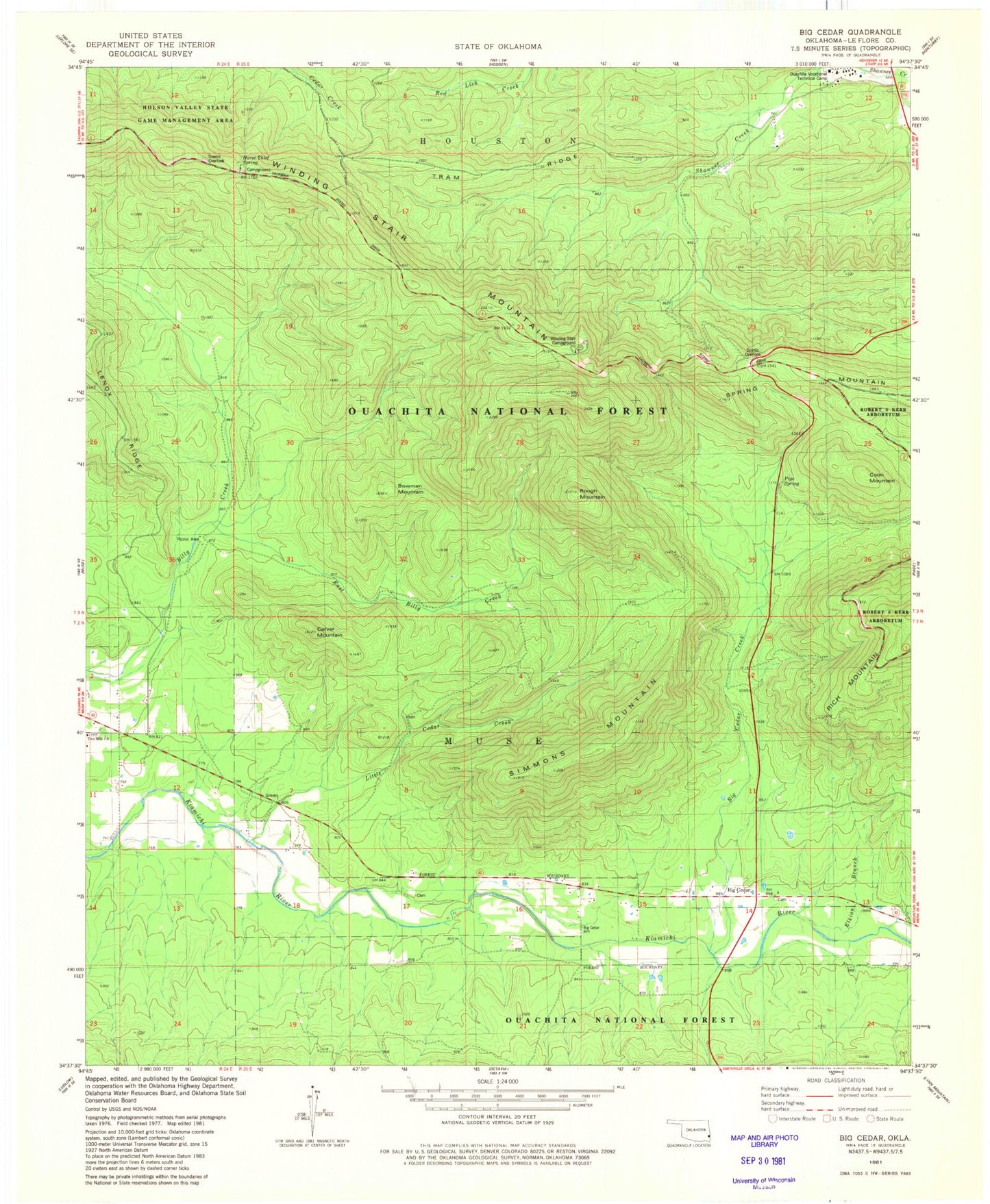
Classic USGS Big Cedar Oklahoma 7.5'x7.5' Topo Map
Couldn't load pickup availability
Historical USGS topographic quad map of Big Cedar in the state of Oklahoma. Typical map scale is 1:24,000, but may vary for certain years, if available. Print size: 24" x 27"
This quadrangle is in the following counties: Le Flore.
The map contains contour lines, roads, rivers, towns, and lakes. Printed on high-quality waterproof paper with UV fade-resistant inks, and shipped rolled.
Contains the following named places: Winding Star Campground, Billy Creek Trail, Billy Creek Campground, Pipe Springs Campground, Big Cedar Work Center, John F Kennedy Memorial, Horse Thief Springs, Jim E Hamilton Correctional Center, Big Cedar, Big Cedar Creek, Bowman Mountain, Carver Mountain, Coon Mountain, East Billy Creek, Little Cedar Creek, Pipe Spring, Rough Mountain, Simmons Mountain, Spring Mountain, Tram Ridge, Winding Stair Mountain, Emerald Vista Recreation Site, Two Mile Church, Elkins Branch, Robert S Kerr Arboretum, Sallisaw Creek Site 17 Dam, Sallisaw Creek Site 17 Reservoir, Horse Thief Spring Campground, Township of Muse, County District 3, Big Cedar Volunteer Fire Department Station 1 Headquarters, United States Forest Service Big Cedar Work Center, Big Cedar Cemetery