MyTopo
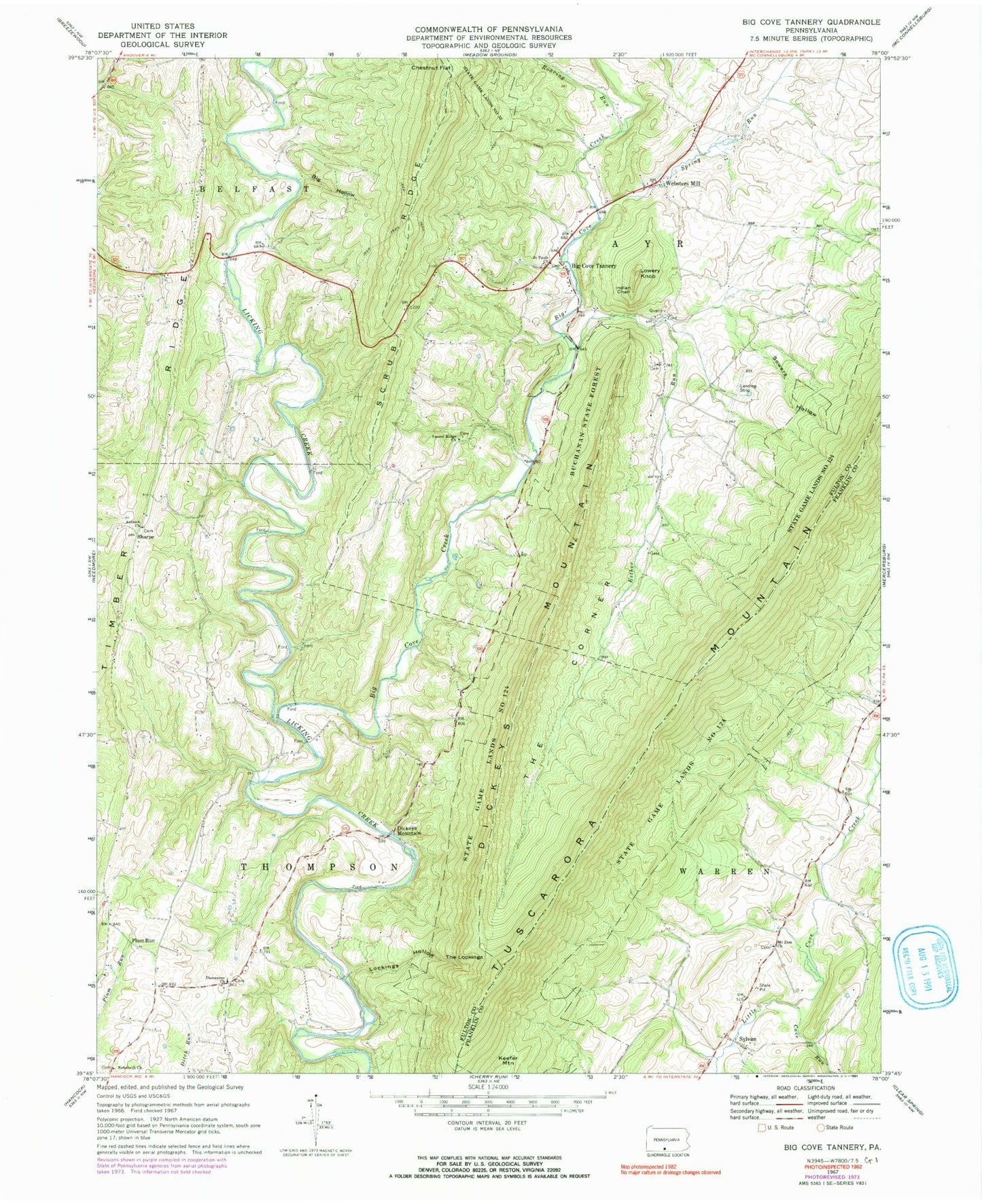
Classic USGS Big Cove Tannery Pennsylvania 7.5'x7.5' Topo Map
Couldn't load pickup availability
Historical USGS topographic quad map of Big Cove Tannery in the state of Pennsylvania. Map scale may vary for some years, but is generally around 1:24,000. Print size is approximately 24" x 27"
This quadrangle is in the following counties: Franklin, Fulton.
The map contains contour lines, roads, rivers, towns, and lakes. Printed on high-quality waterproof paper with UV fade-resistant inks, and shipped rolled.
Contains the following named places: Anthony Ford, Antioch Cemetery, Antioch Church, Bald Eagle School, Big Cove Creek, Big Cove Tannery, Big Hollow, Big Spring, Boardyard School, Brethren Church Cemetery, Cave Run, Center School, Chestnut Flat, Connor School, Damascus Cemetery, Damascus Church, Dickeys Mountain, Esther Run, Indian Chair, Keefer Mountain, Laurel Ridge Cemetery, Laurel Ridge Church, Lockings Hollow, Lowery Knob, Mount Zion Church, Mount Zion Lutheran Church Cemetery, Plum Run, Redbud Valley Nature Center, Rehobeth Church, Rehobeth United Methodist Church Cemetery, Roaring Run, Saint Pauls Church, Saint Pauls Lutheran Cemetery, Sharpe, Simpson Farm Cemetery, Sowers Hollow, Spring Run, State Game Lands Number 124, Sylvan, The Corner, The Lockings, Timber Ridge, Township of Thompson, Township of Warren, Websters Mill, ZIP Code: 17212