MyTopo
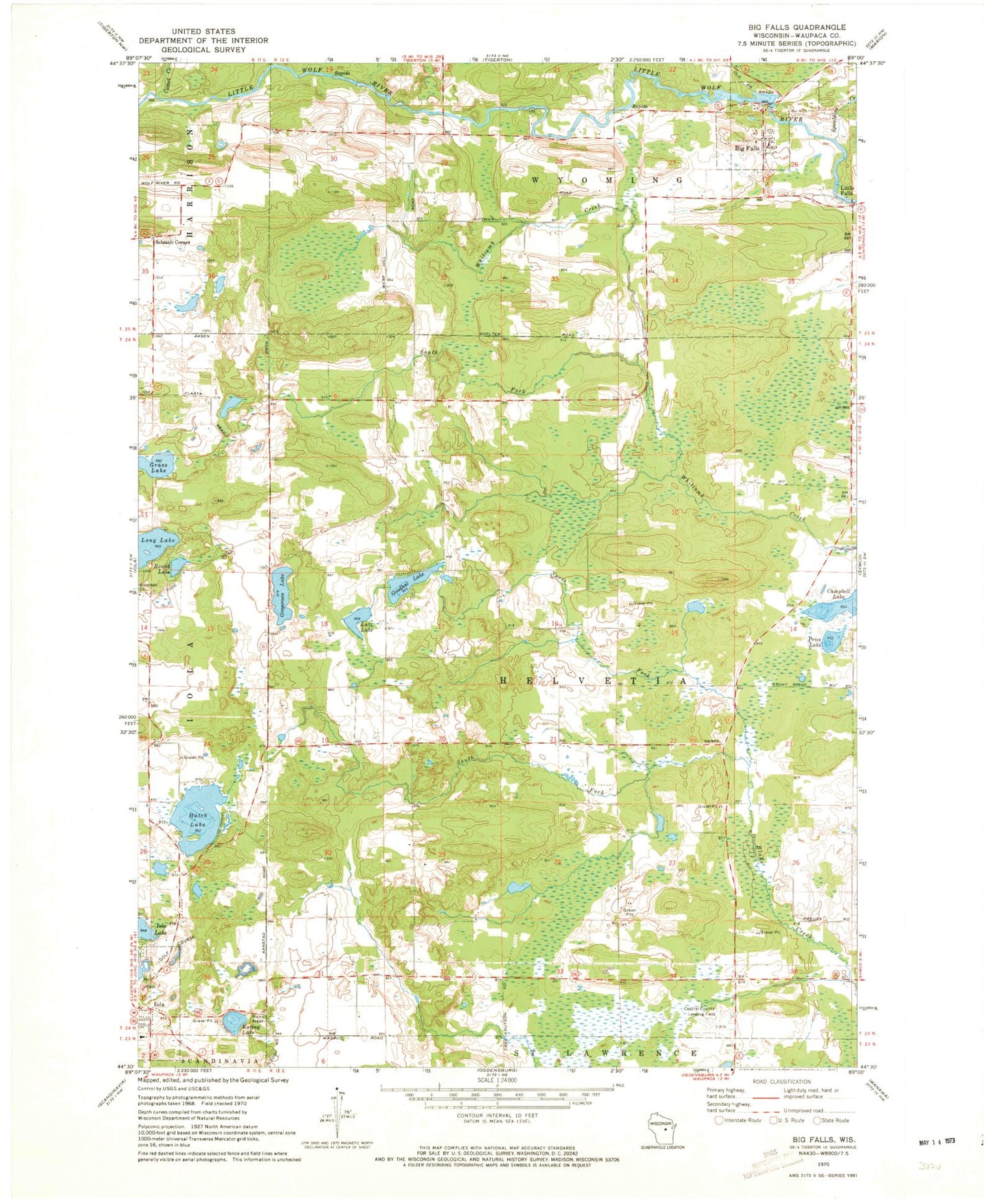
Classic USGS Big Falls Wisconsin 7.5'x7.5' Topo Map
Couldn't load pickup availability
Historical USGS topographic quad map of Big Falls in the state of Wisconsin. Map scale may vary for some years, but is generally around 1:24,000. Print size is approximately 24" x 27"
This quadrangle is in the following counties: Waupaca.
The map contains contour lines, roads, rivers, towns, and lakes. Printed on high-quality waterproof paper with UV fade-resistant inks, and shipped rolled.
Contains the following named places: Big Falls, Big Falls 1907437 Dam, Big Falls Cemetery, Big Falls Dairy Farm, Big Falls Pond 160, Big Falls Post Office, Blake School, Campbell Lake, Central County Airport, Comet Creek, Dou School, Goodhal Lake, Grass Lake, Gregerson Lake, Hatch Lake, Hitterdahl Church, Hitterdahl Lutheran Cemetery, Iola - Scandinavia Elementary School, Iola Cemetery, Iola-Scandinavia High School, Kating Lake, Keller Whitcomb Creek Woods State Natural Area, Little Falls, Long Lake, Lutz Lake, North Fork Blake Creek, Price Lake, Round Lake, Schmidt Corner, Selmer School, South Fork Blake Creek, South Fork Whitcomb Creek, Spaulding Creek, Stony Ridge School, Thoe School, Town of Helvetia, Village of Big Falls, Village of Iola, Wyoming Guernsey Stock Farm