MyTopo
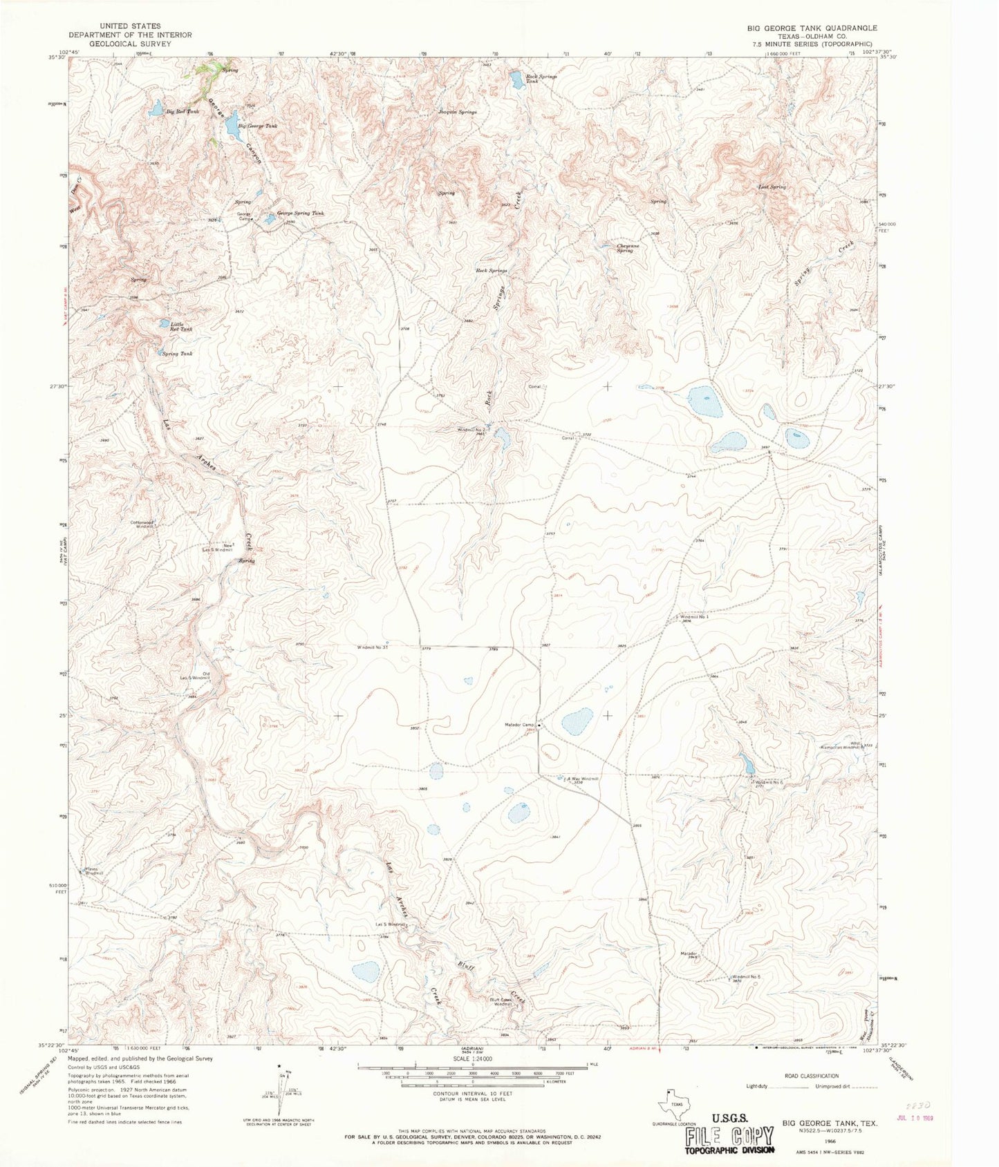
Classic USGS Big George Tank Texas 7.5'x7.5' Topo Map
Couldn't load pickup availability
Historical USGS topographic quad map of Big George Tank in the state of Texas. Map scale may vary for some years, but is generally around 1:24,000. Print size is approximately 24" x 27"
This quadrangle is in the following counties: Oldham.
The map contains contour lines, roads, rivers, towns, and lakes. Printed on high-quality waterproof paper with UV fade-resistant inks, and shipped rolled.
Contains the following named places: Alamocitos Windmill, Big George Tank, Big George Tank Dam, Big Red Tank, Bluff Creek, Bluff Creek Windmill, Cheyenne Spring, Cottonwood Windmill, Four Way Windmill, George Camp, George Spring Tank, Joaquin Springs, Las S Windmill, Little Red Tank, Lost Spring, Matador Camp, New Las S Windmill, Old Las S Windmill, Plains Windmill, Rock Springs, Rock Springs Tank, Rock Springs Tank Dam, Spring Tank, West Alamocitos Windmill, West Dam Creek, Windmill Number Five, Windmill Number One, Windmill Number Six, Windmill Number Three, Windmill Number Two