MyTopo
Classic USGS Big Gum Swamp Florida 7.5'x7.5' Topo Map
Couldn't load pickup availability
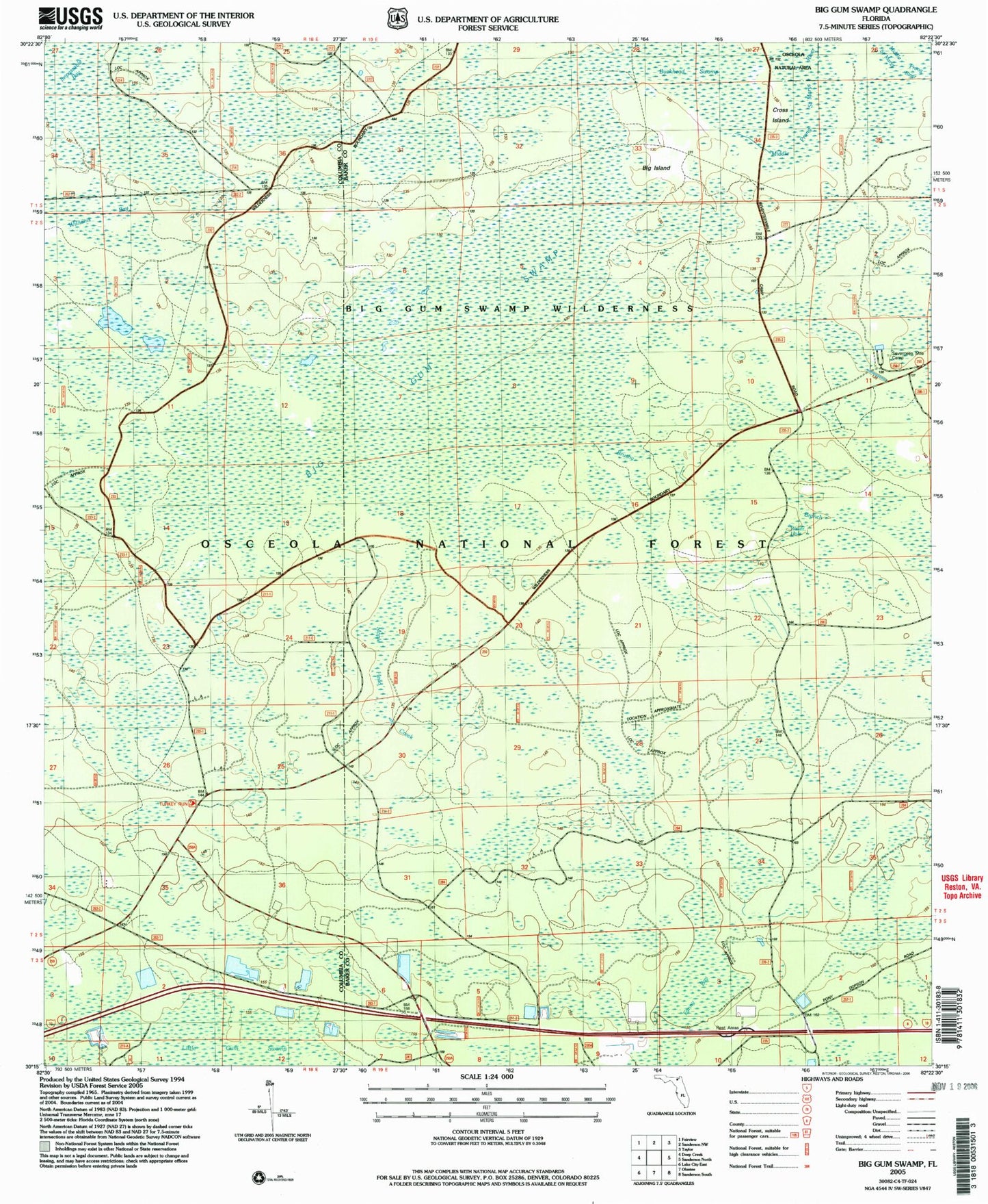
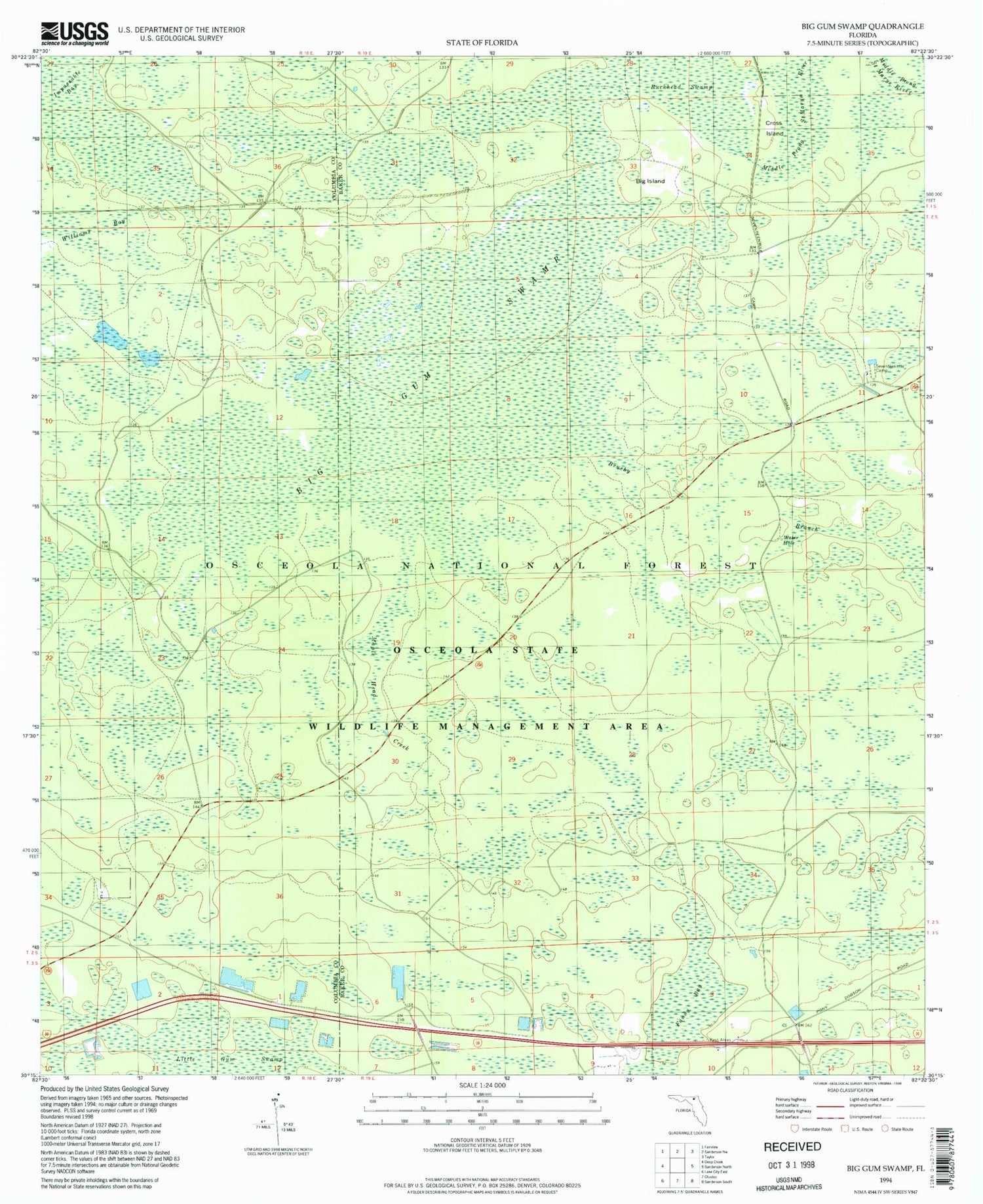
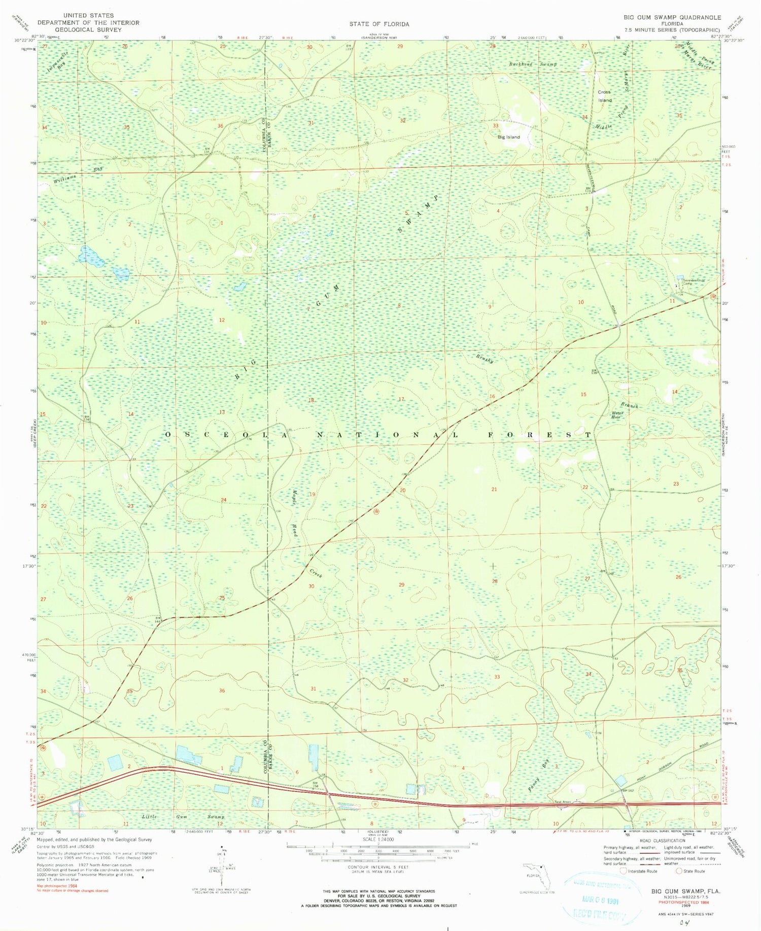
Historical USGS topographic quad map of Big Gum Swamp in the state of Florida. Typical map scale is 1:24,000, but may vary for certain years, if available. Print size: 24" x 27"
This quadrangle is in the following counties: Baker, Columbia.
The map contains contour lines, roads, rivers, towns, and lakes. Printed on high-quality waterproof paper with UV fade-resistant inks, and shipped rolled.
Contains the following named places: Big Gum Swamp, Big Island, Brushy Branch, Cross Island, Fanny Bay, Maple Head Creek, Seventeenmile Camp, Water Hole, Williams Bay, Interstate 10 Rest Area North, Interstate 10 Rest Area South, Big Gum Swamp Wilderness, Osceola National Forest, Osceola Wildlife Management Area, Big Gum Swamp, Big Island, Brushy Branch, Cross Island, Fanny Bay, Maple Head Creek, Seventeenmile Camp, Water Hole, Williams Bay, Interstate 10 Rest Area North, Interstate 10 Rest Area South, Big Gum Swamp Wilderness, Osceola National Forest, Osceola Wildlife Management Area