MyTopo
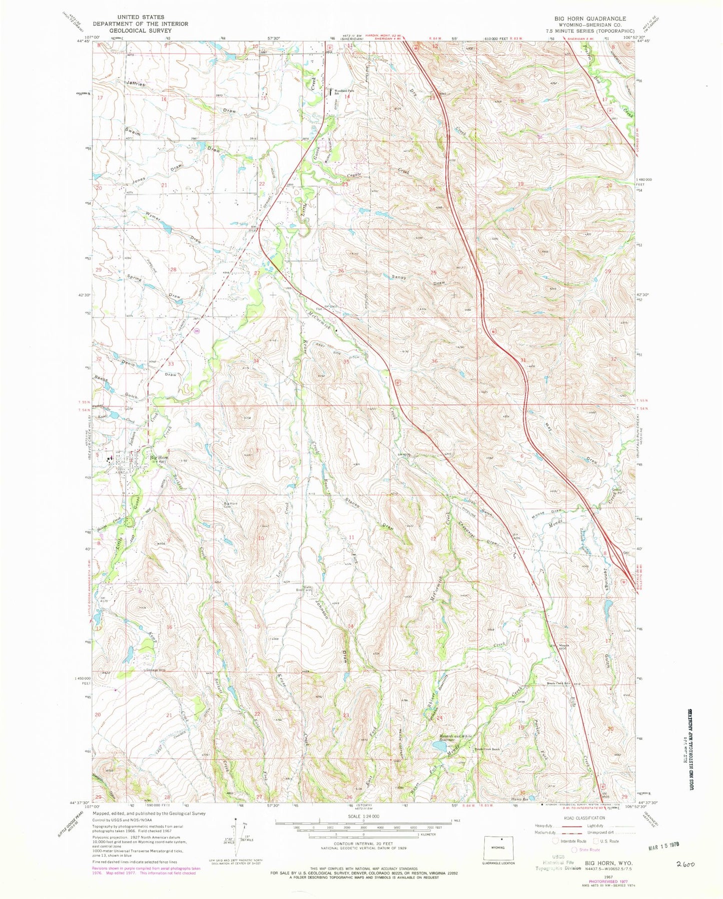
Classic USGS Big Horn Wyoming 7.5'x7.5' Topo Map
Couldn't load pickup availability
Historical USGS topographic quad map of Big Horn in the state of Wyoming. Map scale may vary for some years, but is generally around 1:24,000. Print size is approximately 24" x 27"
This quadrangle is in the following counties: Sheridan.
The map contains contour lines, roads, rivers, towns, and lakes. Printed on high-quality waterproof paper with UV fade-resistant inks, and shipped rolled.
Contains the following named places: Allen Dam, Allen Reservoir, Big Horn, Big Horn Census Designated Place, Big Horn High School, Big Horn Middle School, Big Horn Post Office, Big Horn Rest Home, Big Horn School, Big Horn Volunteer Fire Department, Chapparal Draw, Coyote Creek, Denio Draw, Duncan Dam, Duncan Reservoir, East Fork Kruse Creek, East Fork Sackett Creek, East Side Ditch, Gerdel Ditch, Hanes Fork, Hanes Reservoir, Hanna Creek, Iron Gulch, Jackson Creek, Jeffries Draw, Jennings Gulch, Johnson Draw, Jones Draw, Kemp Creek, Kruse Creek, Kusel Creek, Larison Swale, Last Chance Ditch, Lee Creek, May Draw, McCormick Creek, Meade Creek Ranch, Meade Creek School, Menardi and White Dam, Menardi and White Reservoir, Moose Draw, Mount Hope Cemetery, Parken Fork, Parker Draw, Powder Horn, Powder Horn Census Designated Place, Reese Gulch, Rifle Creek, Sackett Creek, Sandy Draw, Spring Draw, Stanko Draw, Swaim Draw, Woodland Park Elementary School, Wymer Draw