MyTopo
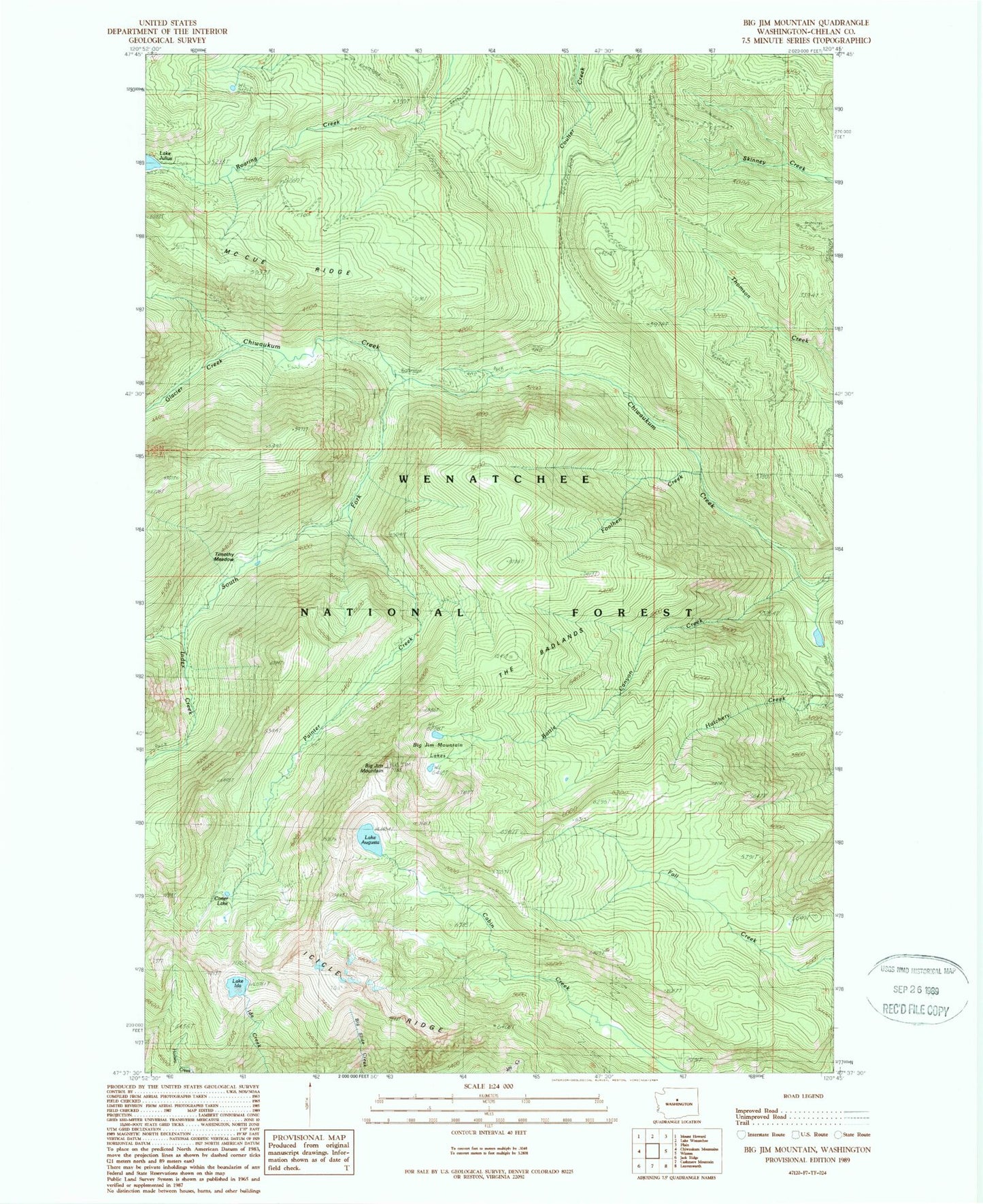
Classic USGS Big Jim Mountain Washington 7.5'x7.5' Topo Map
Couldn't load pickup availability
Historical USGS topographic quad map of Big Jim Mountain in the state of Washington. Typical map scale is 1:24,000, but may vary for certain years, if available. Print size: 24" x 27"
This quadrangle is in the following counties: Chelan.
The map contains contour lines, roads, rivers, towns, and lakes. Printed on high-quality waterproof paper with UV fade-resistant inks, and shipped rolled.
Contains the following named places: Lake Augusta, Battle Canyon Creek, Big Jim Mountain, Big Jim Mountain Lakes, Carter Lake, Foolhen Creek, Glacier Creek, Icicle Ridge, Lake Ida, Index Creek, Painter Creek, South Fork Chiwaukum Creek, The Badlands, Timothy Meadow, Chiwaukum Creek, Nalon Creek Game Reserve, Wenatchee National Forest