MyTopo
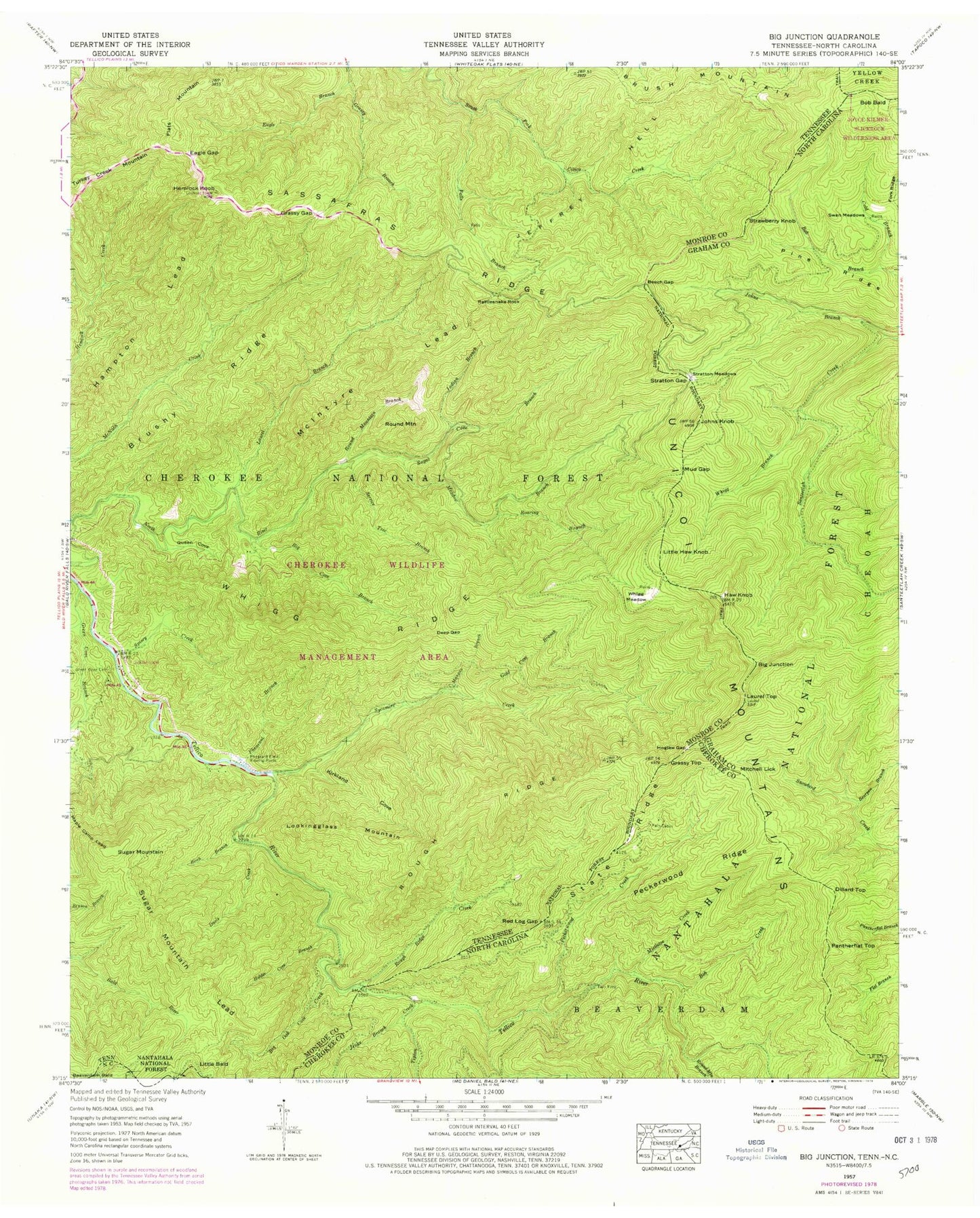
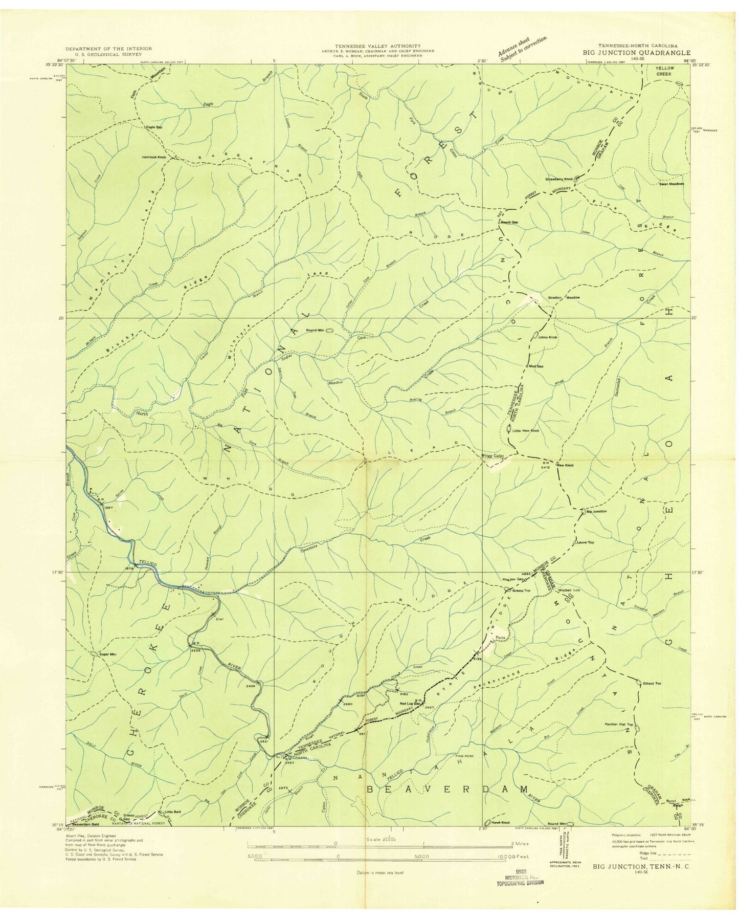
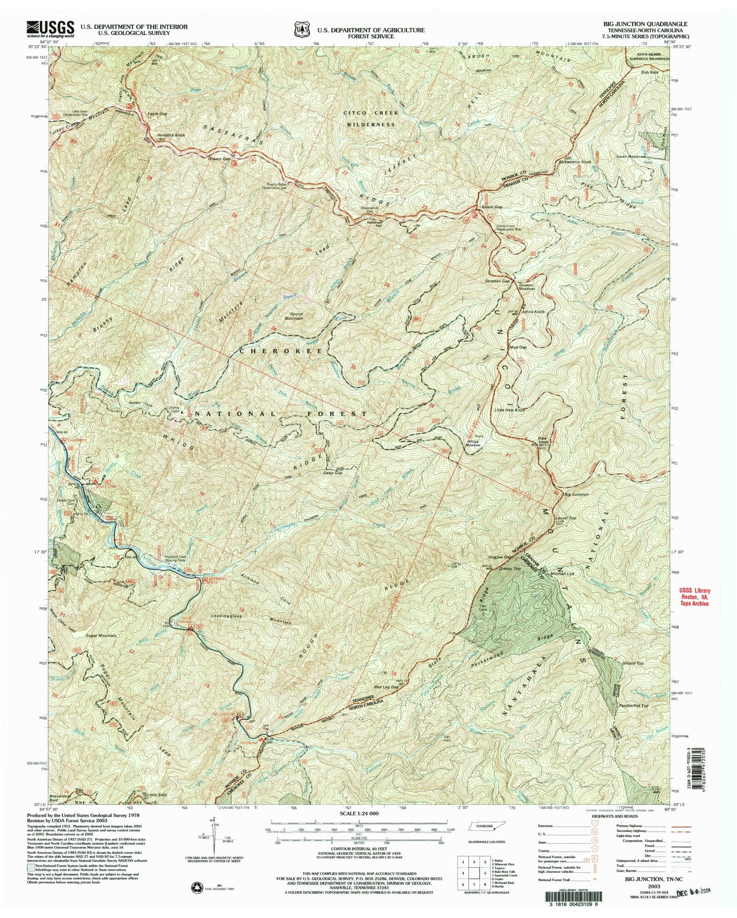
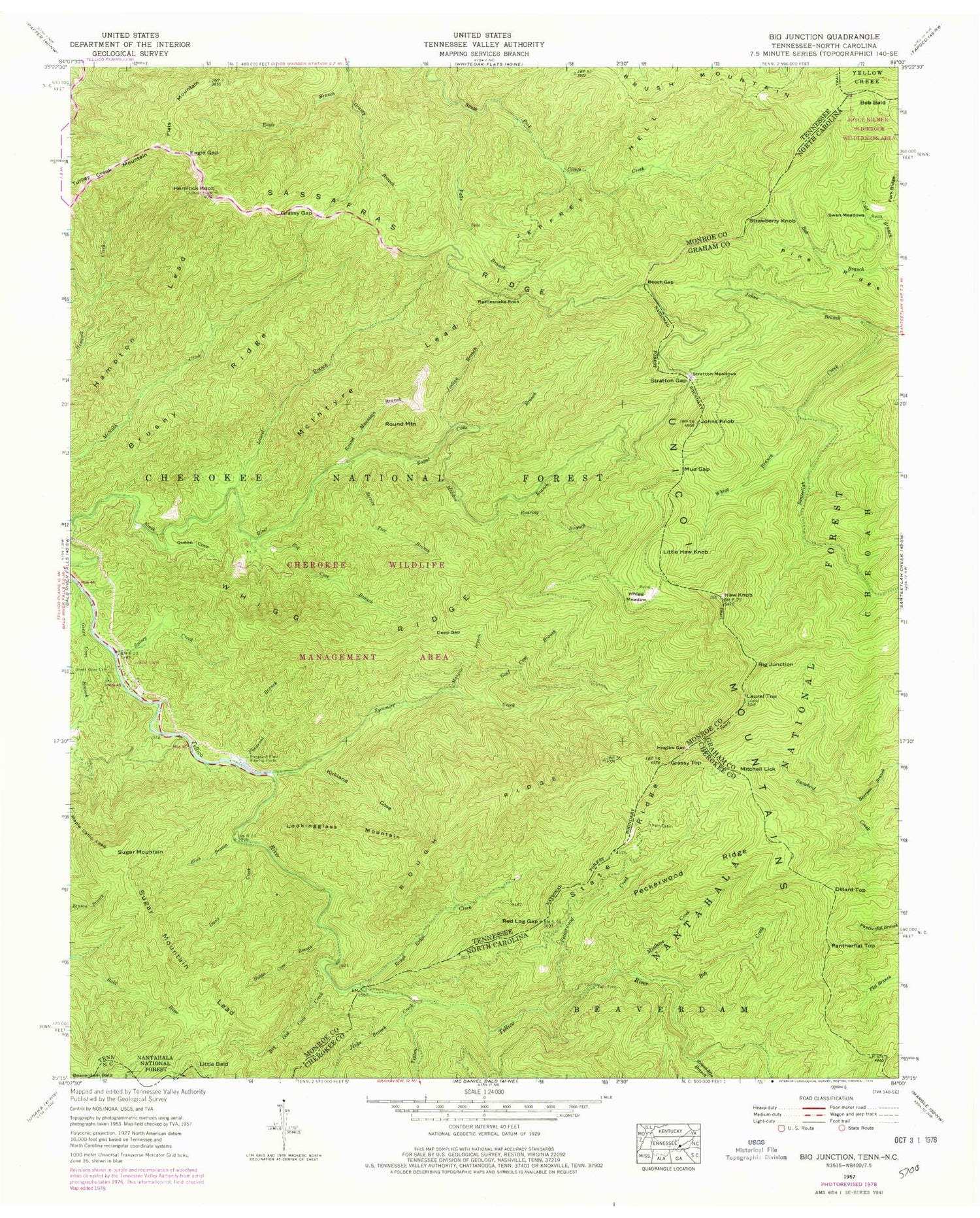
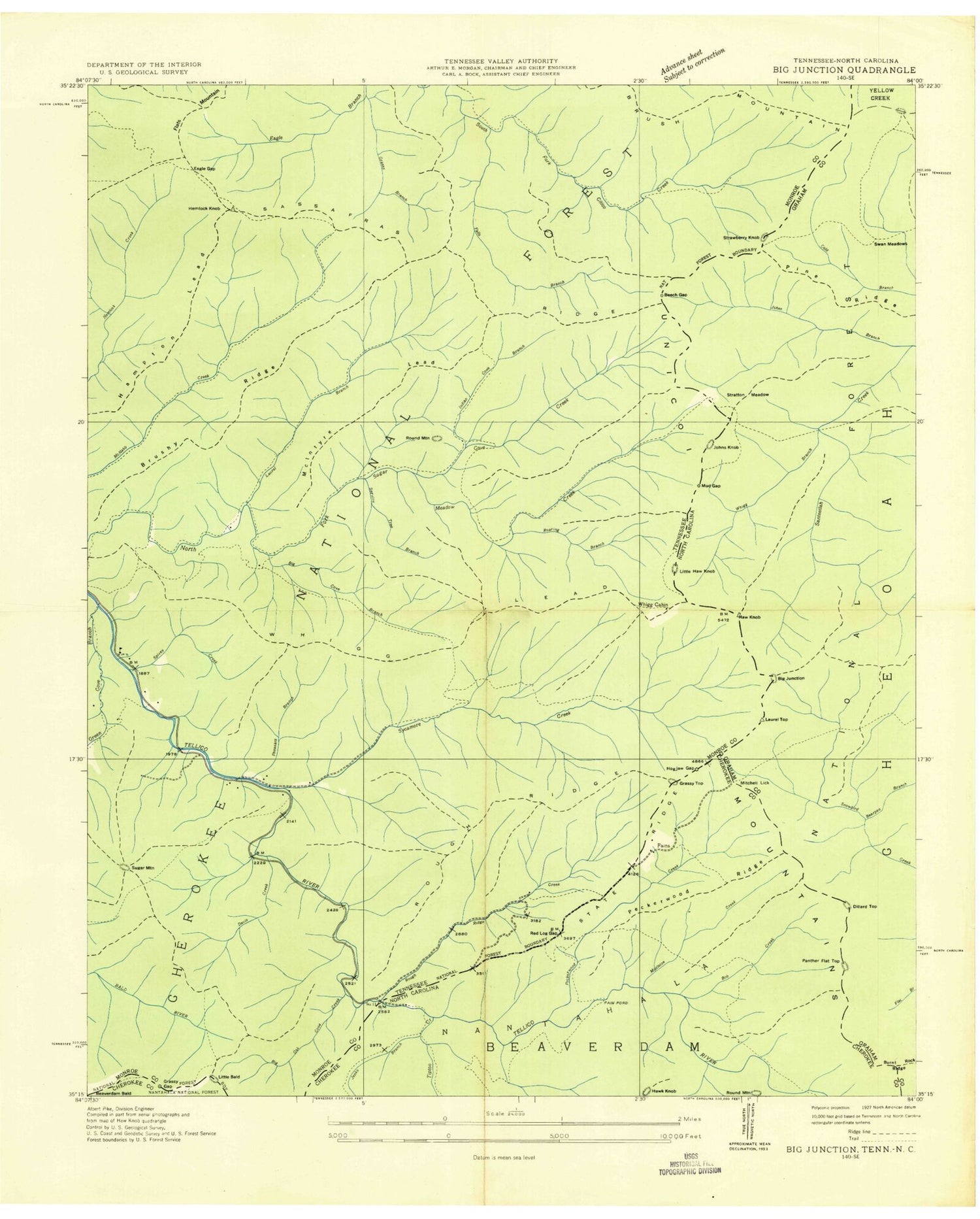
Classic USGS Big Junction Tennessee 7.5'x7.5' Topo Map
Couldn't load pickup availability
Historical USGS topographic quad map of Big Junction in the states of Tennessee, North Carolina. Typical map scale is 1:24,000, but may vary for certain years, if available. Print size: 24" x 27"
This quadrangle is in the following counties: Cherokee, Graham, Monroe.
The map contains contour lines, roads, rivers, towns, and lakes. Printed on high-quality waterproof paper with UV fade-resistant inks, and shipped rolled.
Contains the following named places: Beaverdam Bald, Little Bald, Strawberry Knob, Brush Mountain, Flats Mountain, Pleasant Field Rearing Pools, Spivey Creek, Stratton Meadows, Sugar Cove Branch, Sugar Mountain, Sugar Mountain Lead, Sycamore Creek, Whigg Meadow, Whigg Ridge, Big Cove Branch, Big Oak Cove Creek, Birch Branch, Brushy Ridge, Davis Creek, Deep Gap, Eagle Gap, Falls Branch, Gold Cove Branch, Grassy Branch, Grassy Gap, Green Cove Branch, Green Cove Cemetery, Hampton Lead, Hemlock Knob, Holder Cove Branch, Indian Branch, Kirkland Cove, Laurel Branch, Lookingglass Mountain, Mangan Branch, Maple Camp Lead, McIntyre Lead, Meadow Branch, Mud Gap, Pleasant Branch, Queen Cove, Rattlesnake Rock, Roaring Branch, Rough Ridge, Rough Ridge Creek, Round Mountain, Round Mountain Branch, Sassafras Ridge, Service Tree Branch, Rowe Lake, Rowe Lake Dam, County Corners, Pheasant Field Rearing Pools, Whigg Cabin, Brushy Ridge Observation Site, Lake View Observation Site, Pheasant Field Fishing Site, Big Indian Branch Trail, Big Oak Cove Recreation Area, Dam Creek Recreation Area, Davis Creek Recreation Area, Fall Branch Scenic Area, Falls Branch Trail, Grassy Branch Trail, Hemlock Trail, Jeffrey Trail, Laurel Branch Trail, McNabb Creek Trail, South Fork Citico Trail, Spivey Cove Recreation Area, State Line Recreation Area, Sugar Cove Trail, Sugar Mountain Trail, Tellico River Lodge, Whigg Ridge Trail, Bearpen Branch, Beech Gap, Bob Branch, Bob Creek, Fain Cabin, Fork Ridge, Grassy Gap, Grassy Top, Hogjaw Gap, Jenks Branch, Johns Branch, Johns Knob, Laurel Top, Mistletoe Creek, Peckerwood Creek, Peckerwood Ridge, Pine Ridge, Red Log Gap, Round Mountain Branch, State Ridge, Stratton Gap, Stratton Meadows, Swan Meadows, Tipton Creek, Unicoi Mountains, Whigg Branch, Big Junction, Bob Bald, Dillard Top, Fain Ford, Little Haw Knob, Mitchell Lick, Pantherflat Top, Haw Knob, Beaverdam Bald, Little Bald, Strawberry Knob, Brush Mountain, Flats Mountain, Pleasant Field Rearing Pools, Spivey Creek, Stratton Meadows, Sugar Cove Branch, Sugar Mountain, Sugar Mountain Lead, Sycamore Creek, Whigg Meadow, Whigg Ridge, Big Cove Branch, Big Oak Cove Creek, Birch Branch, Brushy Ridge, Davis Creek, Deep Gap, Eagle Gap, Falls Branch, Gold Cove Branch, Grassy Branch, Grassy Gap, Green Cove Branch, Green Cove Cemetery, Hampton Lead, Hemlock Knob, Holder Cove Branch, Indian Branch, Kirkland Cove, Laurel Branch, Lookingglass Mountain, Mangan Branch, Maple Camp Lead, McIntyre Lead, Meadow Branch, Mud Gap, Pleasant Branch, Queen Cove, Rattlesnake Rock, Roaring Branch, Rough Ridge, Rough Ridge Creek, Round Mountain, Round Mountain Branch, Sassafras Ridge, Service Tree Branch, Rowe Lake, Rowe Lake Dam, County Corners, Pheasant Field Rearing Pools, Whigg Cabin, Brushy Ridge Observation Site, Lake View Observation Site, Pheasant Field Fishing Site, Big Indian Branch Trail, Big Oak Cove Recreation Area, Dam Creek Recreation Area, Davis Creek Recreation Area, Fall Branch Scenic Area, Falls Branch Trail, Grassy Branch Trail, Hemlock Trail, Jeffrey Trail, Laurel Branch Trail, McNabb Creek Trail, South Fork Citico Trail, Spivey Cove Recreation Area, State Line Recreation Area, Sugar Cove Trail, Sugar Mountain Trail, Tellico River Lodge, Whigg Ridge Trail, Bearpen Branch, Beech Gap, Bob Branch, Bob Creek, Fain Cabin, Fork Ridge, Grassy Gap, Grassy Top, Hogjaw Gap, Jenks Branch, Johns Branch, Johns Knob, Laurel Top, Mistletoe Creek, Peckerwood Creek, Peckerwood Ridge, Pine Ridge, Red Log Gap, Round Mountain Branch, State Ridge, Stratton Gap, Stratton Meadows, Swan Meadows, Tipton Creek, Unicoi Mountains, Whigg Branch, Big Junction, Bob Bald, Dillard Top, Fain Ford, Little Haw Knob, Mitchell Lick, Pantherflat Top, Haw Knob