MyTopo
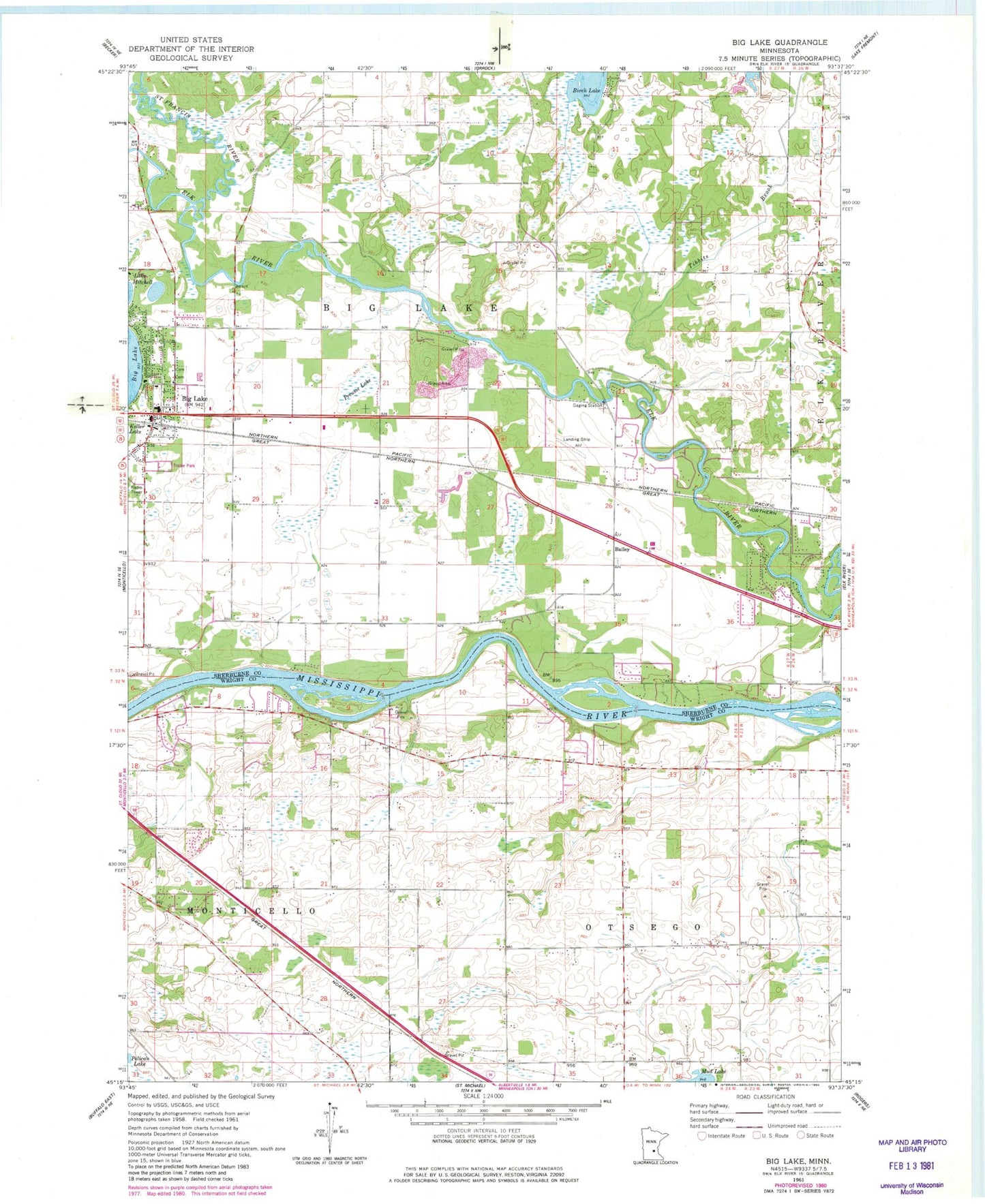
Classic USGS Big Lake Minnesota 7.5'x7.5' Topo Map
Couldn't load pickup availability
Historical USGS topographic quad map of Big Lake in the state of Minnesota. Map scale may vary for some years, but is generally around 1:24,000. Print size is approximately 24" x 27"
This quadrangle is in the following counties: Sherburne, Wright.
The map contains contour lines, roads, rivers, towns, and lakes. Printed on high-quality waterproof paper with UV fade-resistant inks, and shipped rolled.
Contains the following named places: Allina Medical Clinic at Elk River, Bailey, Bailey Station Cemetery, Beaudry Lake, Bethany Evangelical Free Church, Big Lake, Big Lake Cemetery, Big Lake City Hall, Big Lake Estates, Big Lake Fire Department, Big Lake Police Department, Big Lake Post Office, Big Lake Public Schools, Camp Cozy Park, Church of Our Lady of the Lake, City of Big Lake, Cornerstone Baptist Church, Elk Ridge Health Center, Great River Regional Library, Hook Spray Airport, Hope Lutheran Church, Kerber Lake, Lake Shopping Center, Living Waters Church, Lord of Glory Lutheran Church, Pinewood Golf Course, Powell Park, Preusse Lake, Saint Francis River, Saron Lutheran Church, Shady River Campgrounds, Tibbits Brook, Township of Big Lake, Township of Otsego, Vintage Golf Course, Zion Community Church