MyTopo
Classic USGS Big Lake Missouri 7.5'x7.5' Topo Map
Couldn't load pickup availability
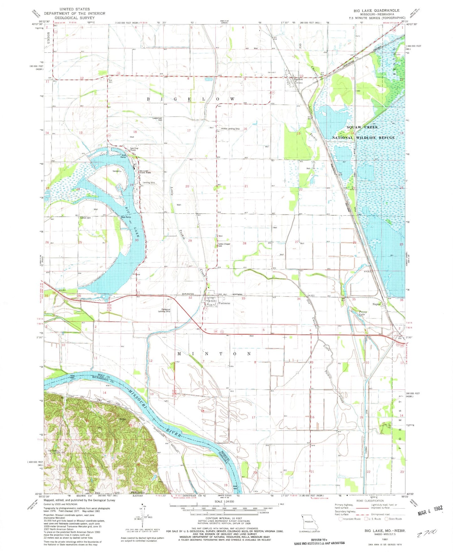
Historical USGS topographic quad map of Big Lake in the states of Missouri, Nebraska. Map scale may vary for some years, but is generally around 1:24,000. Print size is approximately 24" x 27"
This quadrangle is in the following counties: Brown, Holt, Richardson.
The map contains contour lines, roads, rivers, towns, and lakes. Printed on high-quality waterproof paper with UV fade-resistant inks, and shipped rolled.
Contains the following named places: Big Lake, Big Lake State Park, Bigelow, Cottonwood School, Davis Creek Ditch, Elm Grove School, Exodus School, Fortescue, Glendale School, Idlewild School, Main Pool, Mallard Marsh, Napier, Nemaha Bends, Nohart, Nohart Post Office, Old Channel Little Tarkio Creek, Old Channel Tarkio River, Pelican Pool, Pintail Pool, Sixth Principal Meridian Historical Marker, Snow Goose Pool, South Levee, Squaw Bend, Squaw Creek Ditch, Town of Fortescue, Township of Bigelow, Township of Minton, Village of Big Lake, Village of Bigelow, Walnut Grove School, ZIP Code: 64437