MyTopo
Classic USGS Big Lake Nebraska 7.5'x7.5' Topo Map
Regular price
$16.95
Regular price
Sale price
$16.95
Unit price
per
Couldn't load pickup availability
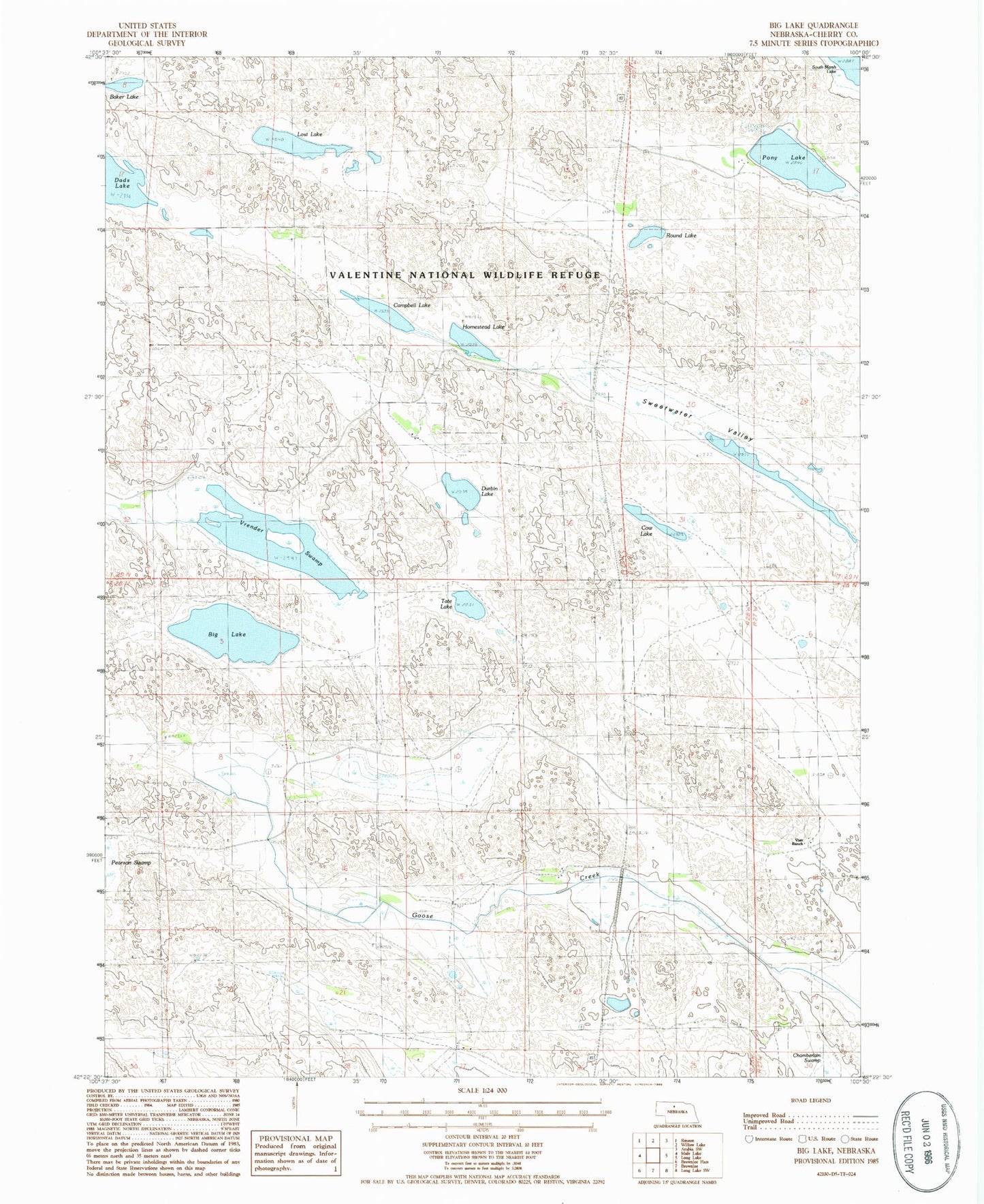
Historical USGS topographic quad map of Big Lake in the state of Nebraska. Map scale may vary for some years, but is generally around 1:24,000. Print size is approximately 24" x 27"
This quadrangle is in the following counties: Cherry.
The map contains contour lines, roads, rivers, towns, and lakes. Printed on high-quality waterproof paper with UV fade-resistant inks, and shipped rolled.
Contains the following named places: Big Lake, Campbell Lake, Cow Lake, Durbin Lake, Homestead Lake, J Lee Ranch, Lost Lake, Pony Lake, Round Lake, School Number 127, Sweetwater Valley, Tate Lake, Valentine National Wildlife Refuge, Vian Ranch, Vrender Swamp