MyTopo
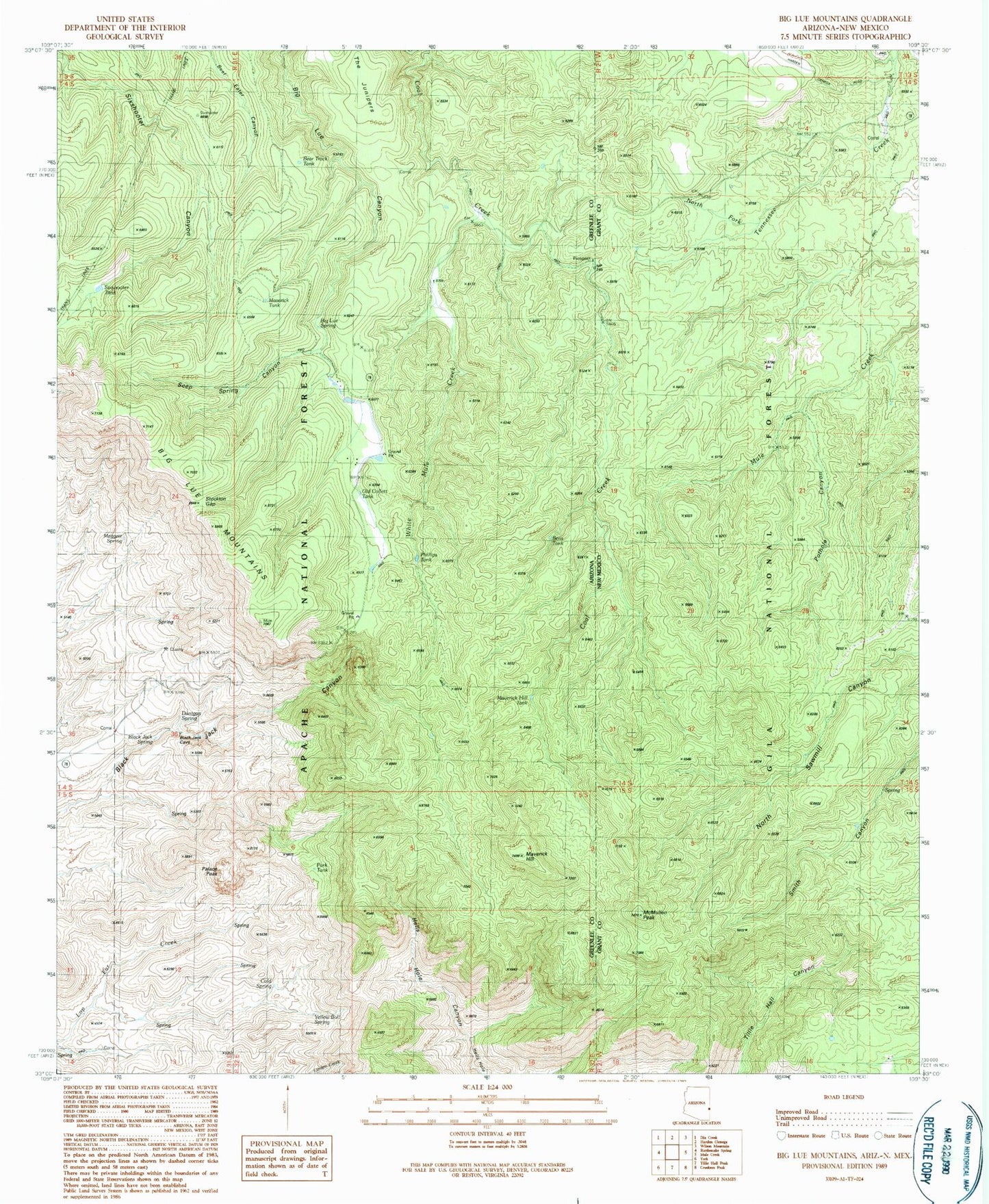
Classic USGS Big Lue Mountains Arizona 7.5'x7.5' Topo Map
Couldn't load pickup availability
Historical USGS topographic quad map of Big Lue Mountains in the states of Arizona, New Mexico. Map scale may vary for some years, but is generally around 1:24,000. Print size is approximately 24" x 27"
This quadrangle is in the following counties: Grant, Greenlee.
The map contains contour lines, roads, rivers, towns, and lakes. Printed on high-quality waterproof paper with UV fade-resistant inks, and shipped rolled.
Contains the following named places: Ball Tank, Base Tanks, Bear Tank, Bear Track Tank, Bee Tree Spring, Bens Tank, Big Lue Corral, Big Lue Mountains, Big Lue Ranch, Big Lue Spring, Black Jack Group Campground, Black Jack Spring, Blackjack Campground, Blackjack Tank, Coal Creek Campground, Coal Creek Tank, Cold Spring, Corral Tank, Cottonwood Spring, Deer Canyon, Dunigan Spring, Fence Line Tank, Holdup Ground Tank, Jeffers Tank, Juniper Corral, Line Tank, Lost Spring, Lower Bee Tree Spring, Maggett Spring, Maverick Basin, Maverick Hill, Maverick Hill Tank, Maverick Tank, Maverick Trailhead, McMullen Peak, Mexican Spring, Neck Tank, Needles Eye, North Fork Tennessee Creek, Old Collett Tank, Palace Peak, Park Tank, Partnership Tank, Phillips Tank, Pig Pen Spring, Pinyon Tank, Pothole Canyon, Pothole Tank, Red Spring, Rock Bottom Tank, Seep Spring Canyon, Sixshooter Tank, Sluff Spring, Stockton Gap, Sweet Spring, Tennessee Tank, The Junipers, Upper Hells Hole Spring, West Coal Creek Corral, West Coal Creek Well, White Mule Creek, White Mule Windmill, Willis Spring, Winchester Tank, Yellow Bull Spring