MyTopo
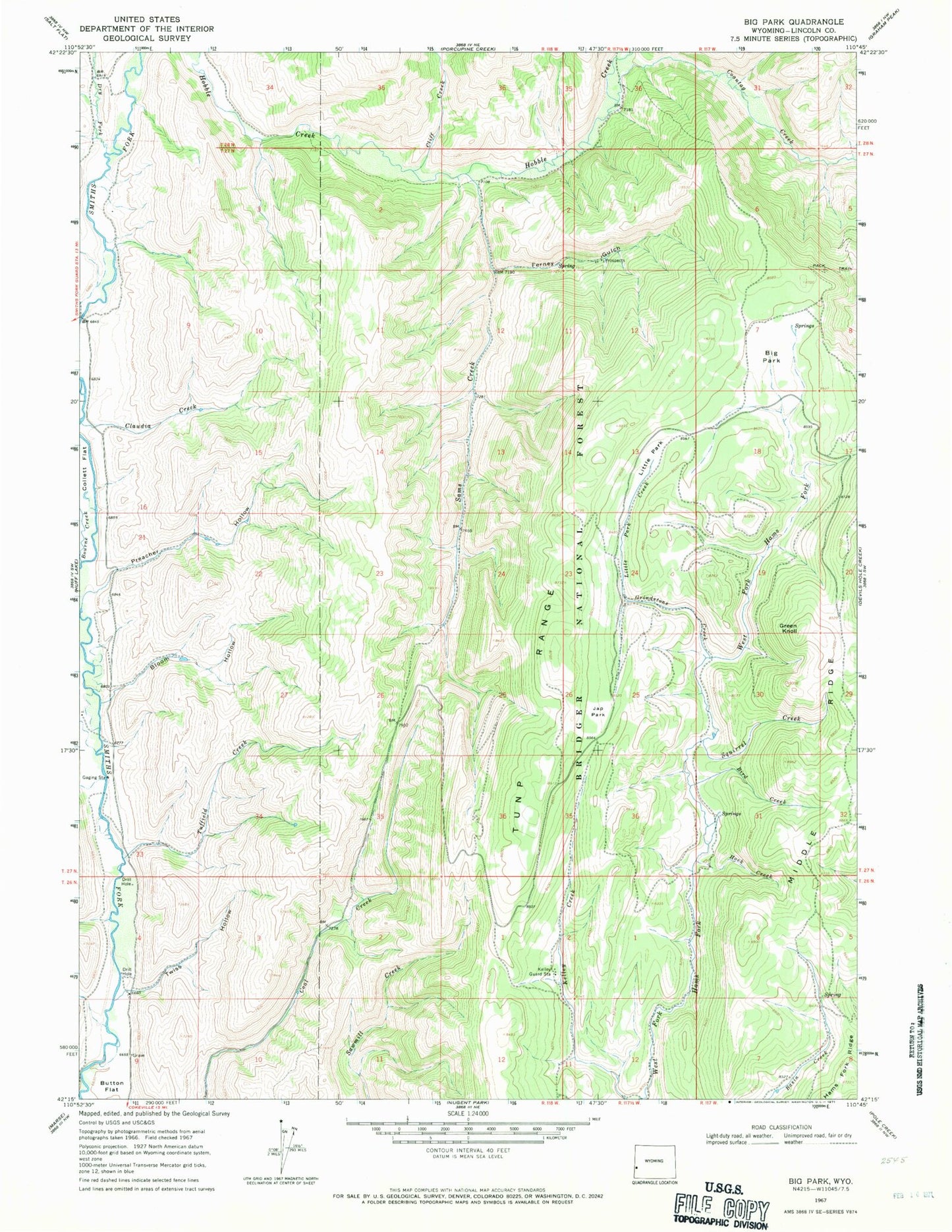
Classic USGS Big Park Wyoming 7.5'x7.5' Topo Map
Couldn't load pickup availability
Historical USGS topographic quad map of Big Park in the state of Wyoming. Map scale may vary for some years, but is generally around 1:24,000. Print size is approximately 24" x 27"
This quadrangle is in the following counties: Lincoln.
The map contains contour lines, roads, rivers, towns, and lakes. Printed on high-quality waterproof paper with UV fade-resistant inks, and shipped rolled.
Contains the following named places: Big Park, Big Park Prospect, Bird Creek, Bloom Hollow, Button Flat, Cliff Creek, Coantag Creek, Dry Fork Smiths Fork, Ferney Gulch, Ferney Gulch Prospects Mine, Green Knoll, Grindstone Creek, Hams Fork Ridge, Hock Creek, Japanese Park, Kelley Guard Station, Little Park, Little Park Creek, Middle Ridge, Sams Creek, Smith Fork Cemetery, Squirrel Creek, Tuffield Creek, Twiss Hollow