MyTopo
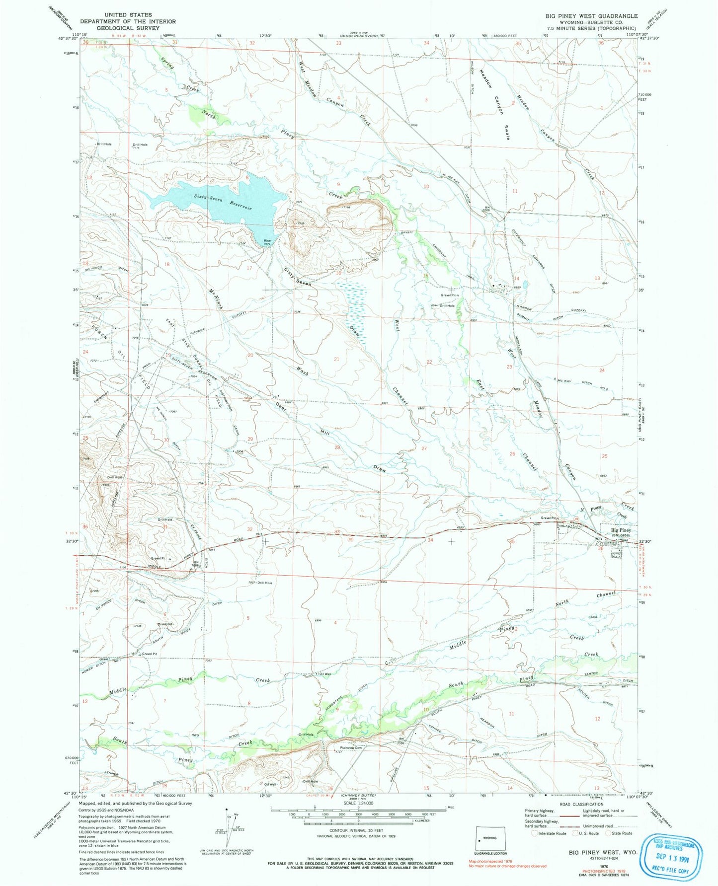
Classic USGS Big Piney West Wyoming 7.5'x7.5' Topo Map
Couldn't load pickup availability
Historical USGS topographic quad map of Big Piney West in the state of Wyoming. Map scale may vary for some years, but is generally around 1:24,000. Print size is approximately 24" x 27"
This quadrangle is in the following counties: Sublette.
The map contains contour lines, roads, rivers, towns, and lakes. Printed on high-quality waterproof paper with UV fade-resistant inks, and shipped rolled.
Contains the following named places: Abo Ditch, D B Budd Butte, Deer Hill Draw, East Channel, East Star Corral Oil Field, H McKay Ditch, Holden Ditch, Homer Ditch Number 1, Homestake Ditch, Lehmer Ditch, McNinch Ditch, McNinch Wash, Meadow Canyon Swale, Osterhout Edwards Ditch, Plainview Cemetery, Reardon Ditch, Sixty-Seven Butte, Sixty-Seven Draw, Sixty-Seven Reservoir, Sixty-Seven Reservoir Dam, Sixty-Seven Reservoir Distribution Canal, South McKay Ditch Number 2, South Piney Ditch, Spring Creek, Summit Ditch, Tarter Ditch, West Channel, Wilson Ditch, Yankee Ditch