MyTopo
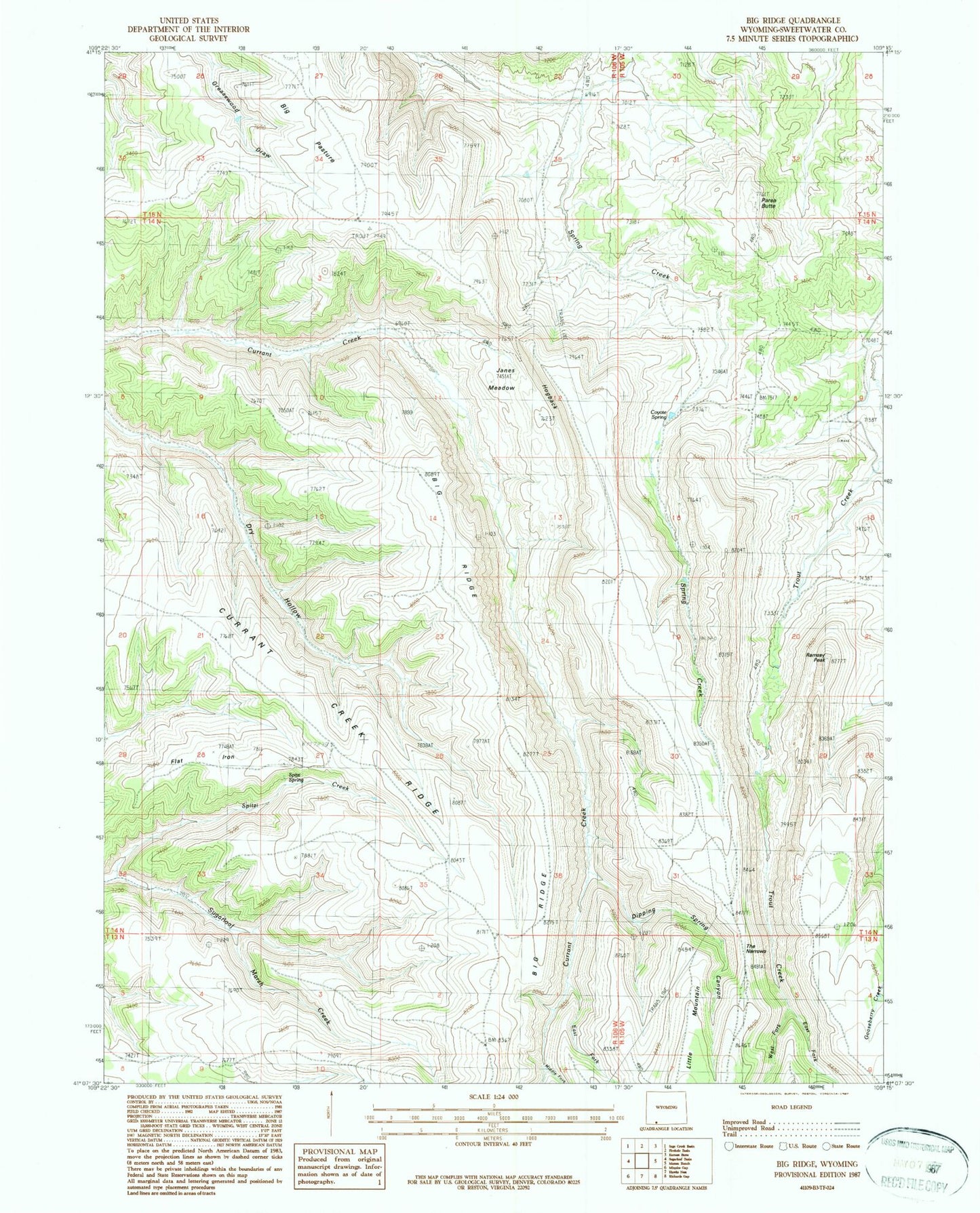
Classic USGS Big Ridge Wyoming 7.5'x7.5' Topo Map
Couldn't load pickup availability
Historical USGS topographic quad map of Big Ridge in the state of Wyoming. Map scale may vary for some years, but is generally around 1:24,000. Print size is approximately 24" x 27"
This quadrangle is in the following counties: Sweetwater.
The map contains contour lines, roads, rivers, towns, and lakes. Printed on high-quality waterproof paper with UV fade-resistant inks, and shipped rolled.
Contains the following named places: Big Pasture, Big Ridge, Coyote Spring, Currant Creek Ridge, Deer Spring, Dipping Spring Canyon, East Fork Currant Creek, East Fork Trout Creek, Flat Iron, Hogback, Janes Meadow, Little Mountain, Middle Fork Currant Creek, Parea Butte, Ramsey Peak, Spitzi Creek, Spitzi Spring, The Narrows, West Fork Currant Creek, West Fork Trout Creek