MyTopo
Classic USGS Big Round Mountain Oklahoma 7.5'x7.5' Topo Map
Couldn't load pickup availability
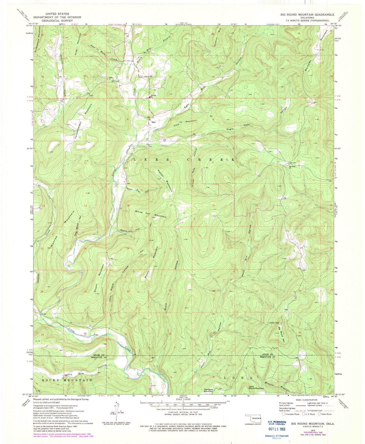
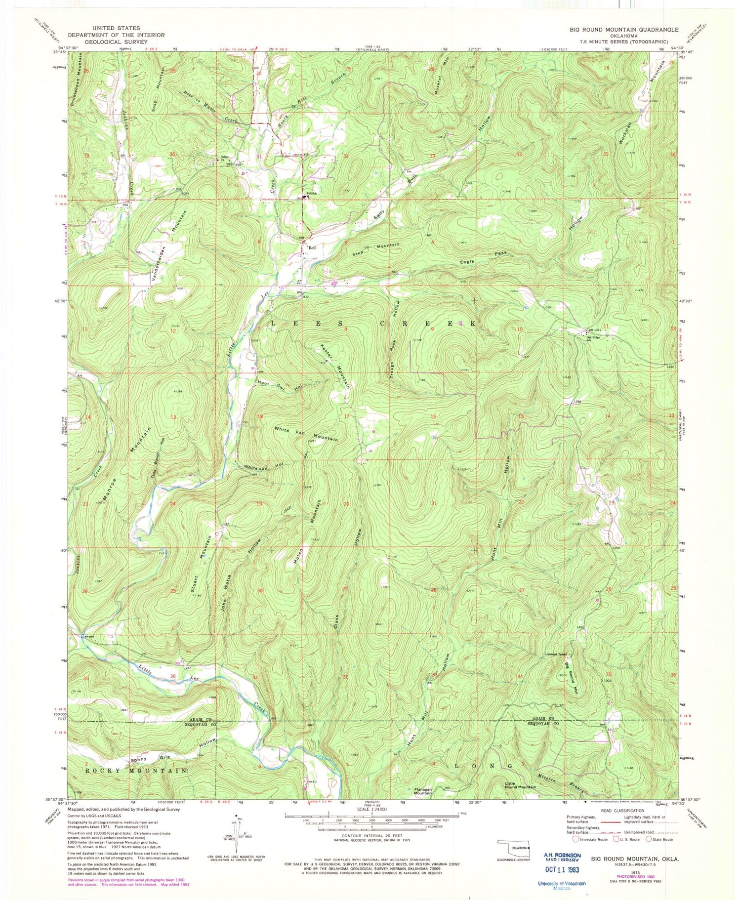
Historical USGS topographic quad map of Big Round Mountain in the state of Oklahoma. Map scale may vary for some years, but is generally around 1:24,000. Print size is approximately 24" x 27"
This quadrangle is in the following counties: Adair, Sequoyah.
The map contains contour lines, roads, rivers, towns, and lakes. Printed on high-quality waterproof paper with UV fade-resistant inks, and shipped rolled.
Contains the following named places: Adair Non-Community, Bell, Bell Census Designated Place, Bell Elementary School, Bell Rural Fire Department, Big Round Mountain, Deer in Water Creek, Eagle Pass Hollow, Elohim City, Elohim City Census Designated Place, Glass Hollow, Honey Hill Branch, Hoot Owl Hollow, Jenkins Creek, John Watie Hollow, Kester Mountain, Little Round Mountain, Monroe Mountain, Moten Mountain, Oak Ridge School, Ozark Plateau National Wildlife Refuge, Rock Fence Cemetery, Salem Cemetery, Salem Church, Sally Bull Hollow, Sonny Gile Hollow, Step Mountain, Stuart Mountain, Township of Lees Creek, Trough Rock Hollow, Tuna Bunch Hollow, Van Hollow, Vanderheiden Mountain, White Van Hollow, White Van Mountain, Workman Mountain