MyTopo
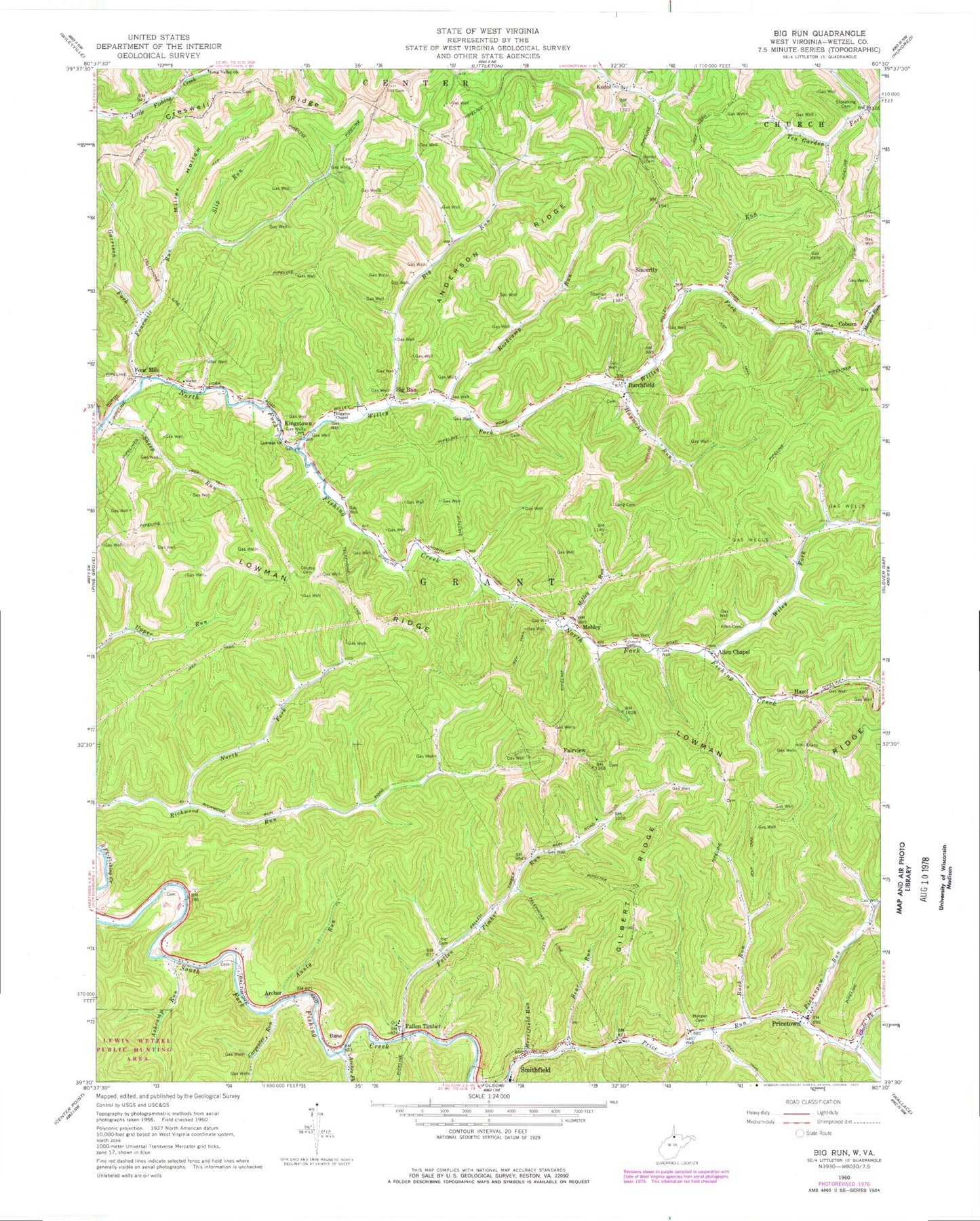
Classic USGS Big Run West Virginia 7.5'x7.5' Topo Map
Couldn't load pickup availability
Historical USGS topographic quad map of Big Run in the state of West Virginia. Map scale is 1:24000. Print size is approximately 24" x 27"
This quadrangle is in the following counties: Wetzel.
The map contains contour lines, roads, rivers, towns, and lakes. Printed on high-quality waterproof paper with UV fade-resistant inks, and shipped rolled.
Contains the following named places: Allen Cemetery, Allen Chapel, Anderson - Bane Cemetery, Anderson Cemetery, Anderson Ridge, Archer, Arches Fork, Ashcamp Run, Aunty Run, Bane, Bear Run, Big Run, Big Run, Big Run Cemetery, Big Run Post Office, Borden Cemetery, Buck Run, Burchfield, Burchfield Cemetery, Burchfield Methodist Church, Carpenter Run, Chutes Cemetery, Coburn, Creswell Ridge, District 1, Elm Grove School (historical), Fairview, Fallen Timber, Fallen Timber Run, Falling Timber School (historical), Four Mile, Fourmile Run, Garrison Fork, Gilbert Ridge, Gilbert School (historical), Glade Fork, Haymond Run, Hazel, Hickory Knob School (historical), Higgins Chapel, Ice Cemetery, Kendall School (historical), Kilcoyne Cemetery, Kingstown, Kodol, Lone Valley Church (historical), Long Cemetery, Long Valley Church, Lowman Church, Lowman Ridge, Lowman School (historical), Merrifield Run, Merrifield School (historical), Miller Hollow, Mobley, Mobley Run, Morgan Cemetery, Morgan Run, North Fork Richwood Run, Oak Grove School (historical), Pickenpaw Run, Pleasant Valley Church (historical), Pricetown, Pricetown Cemetery, Pricetown Church of Christ, Raccoon Run, Rockcamp Run, Sheep Run, Shuman Cemetery, Sincerity, Slip Run, Stoneking Cemetery, Tea Garden School (historical), Tenmile Run, Utt Cemetery, Utt School (historical), Wiley Fork, Willey Cemetery, Willey Fork, Willow Grove School (historical)