MyTopo
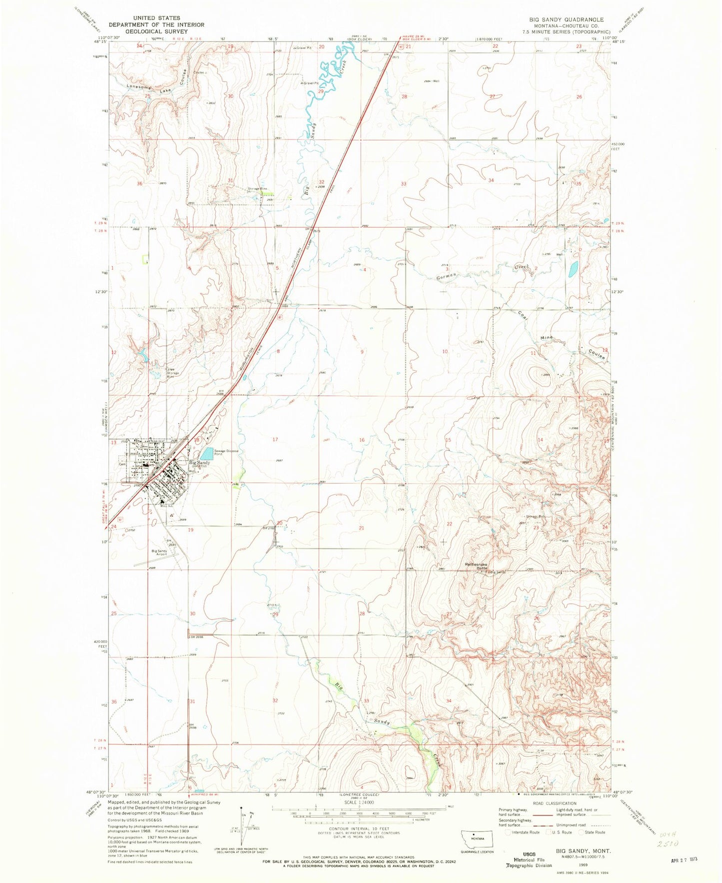
Classic USGS Big Sandy Montana 7.5'x7.5' Topo Map
Couldn't load pickup availability
Historical USGS topographic quad map of Big Sandy in the state of Montana. Map scale may vary for some years, but is generally around 1:24,000. Print size is approximately 24" x 27"
This quadrangle is in the following counties: Chouteau.
The map contains contour lines, roads, rivers, towns, and lakes. Printed on high-quality waterproof paper with UV fade-resistant inks, and shipped rolled.
Contains the following named places: 28N12E01AD__01 Well, 28N12E12AA__01 Well, 28N12E24DB__01 Well, 28N13E05DD__01 Well, 28N13E06CD__01 Well, 28N13E07BB__01 Well, 28N13E18AC__01 Well, 28N13E19BA__01 Well, 28N13E19BA__02 Well, 28N13E19BA__03 Well, 28N13E19BA__04 Well, 28N13E19BA__05 Well, 28N13E19BB__01 Well, 28N13E19BD__01 Well, 28N13E20BB__01 Well, 29N12E25DD__01 Well, 29N13E21DD__01 Well, 29N13E26BB__01 Well, 29N13E27DC__01 Well, 29N13E34ABCB01 Well, Big Sandy, Big Sandy Airport, Big Sandy Branch Library, Big Sandy Cemetery, Big Sandy Christian Fellowship Assembly of God Church, Big Sandy Community Church of God, Big Sandy High School, Big Sandy Medical Center, Big Sandy Medical Center Long Term Care, Big Sandy Post Office, Big Sandy Trailer Court, Big Sandy Volunteer Fire Department and Ambulance Service, Centennial Mills Incorporated Elevator, Choteau County Sheriff's Office Big Sandy, Christ Lutheran Church, Coal Mine Coulee, Coal Spur, General Mills Incorporated Elevator, Gorman Creek, H Earl Clack Elevator, International Elevator, Mackton, Mackton School, McNamara and Marlow Elevator, Methodist Church - Rohrer United, Miley School, Montana Elevator, Rattlesnake Butte, Rocky Mountain Elevator, Saint Anthony and Dakota Elevator, Saint Margaret Marys Catholic Church, Sande Convalescent Home, School Section Coulee, Sibra Dam, Snake Coulee, Town of Big Sandy, Worstell Hospital


