MyTopo
Classic USGS Big Snow Mountain Washington 7.5'x7.5' Topo Map
Couldn't load pickup availability
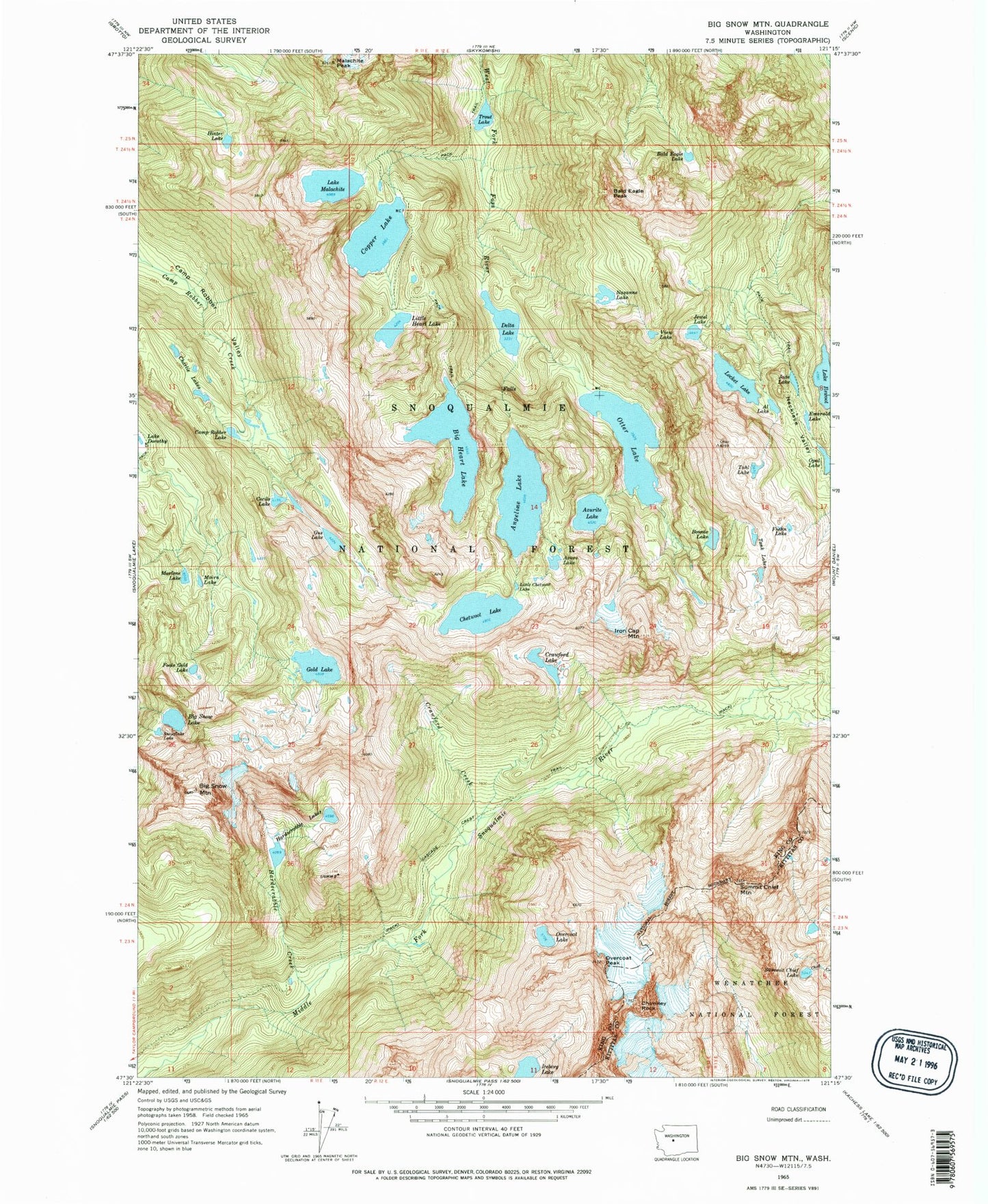
Historical USGS topographic quad map of Big Snow Mountain in the state of Washington. Typical map scale is 1:24,000, but may vary for certain years, if available. Print size: 24" x 27"
This quadrangle is in the following counties: King, Kittitas.
The map contains contour lines, roads, rivers, towns, and lakes. Printed on high-quality waterproof paper with UV fade-resistant inks, and shipped rolled.
Contains the following named places: Angeline Lake, Azure Lake, Azurite Lake, Bald Eagle Lake, Silver Eagle Peak, Big Heart Lake, Big Snow Lake, Big Snow Mountain, Bonnie Lake, Camp Robber Lake, Camp Robber Valley, Cecils Lake, Charlie Lakes, Chetwoot Lake, Chimney Rock, Cloudy Lake, Copper Lake, Crawford Creek, Crawford Lake, Delta Lake, Emerald Lake, Foehn Lake, Fools Gold Lake, Gold Lake, Gus Lake, Hardscrabble Creek, Hardscrabble Lakes, Hinter Lake, Iceberg Lake, Lake Ilswoot, Iron Cap Mountain, Jewel Lake, Little Chetwoot Lake, Little Heart Lake, Locket Lake, Malachite Peak, Lake Malachite, Marlene Lake, Moira Lake, Nazanne Lake, Necklace Valley, Opal Lake, Otter Lake, Overcoat Lake, Overcoat Peak, Snowflake Lake, Summit Chief Lake, Summit Chief Mountain, Tahl Lake, Tank Lakes, Trout Lake, View Lake, Bald Eagle Peak, Necklace Valley Lakes, Malachite Falls, Jade Lake