MyTopo
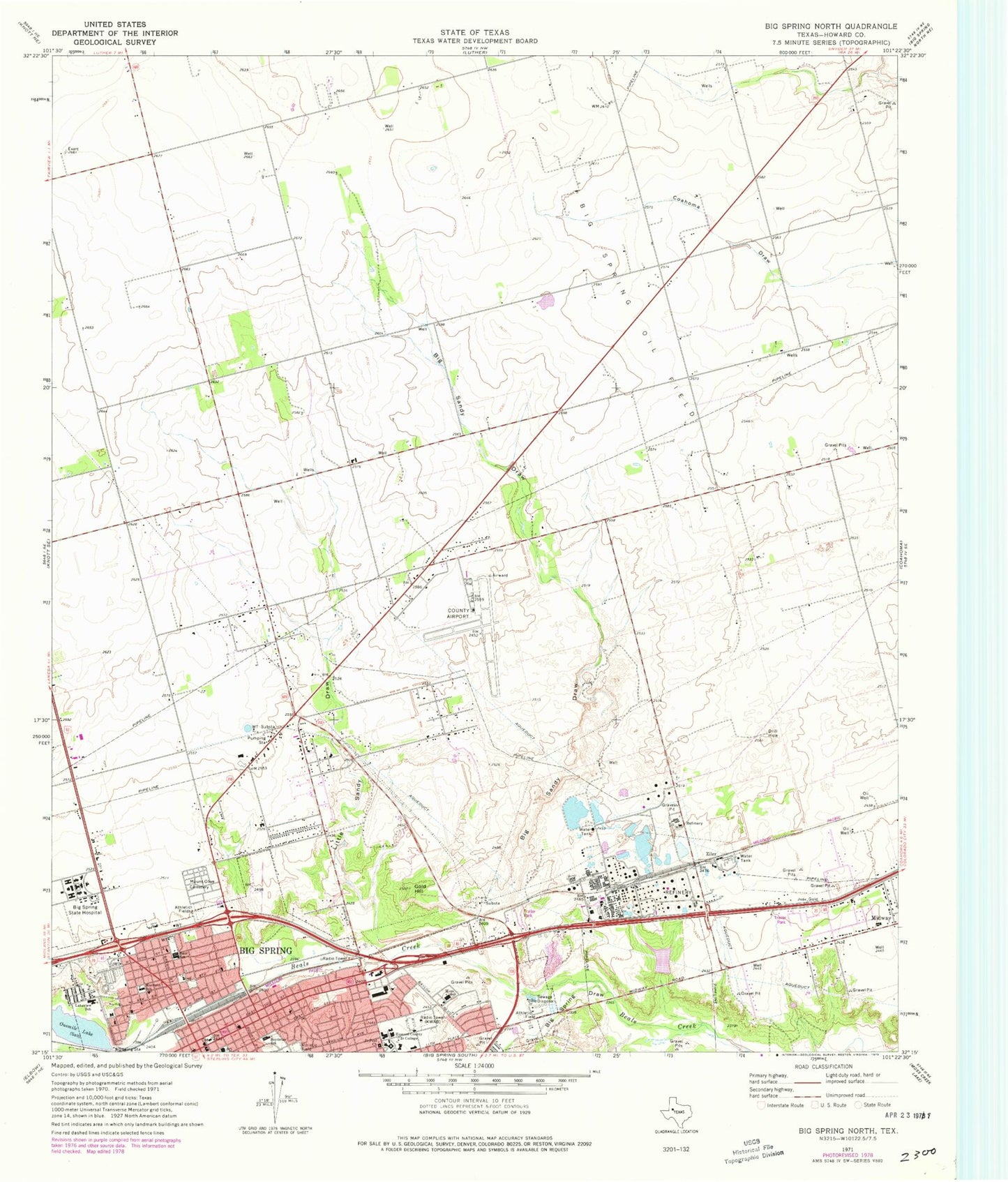
Classic USGS Big Spring North Texas 7.5'x7.5' Topo Map
Couldn't load pickup availability
Historical USGS topographic quad map of Big Spring North in the state of Texas. Map scale may vary for some years, but is generally around 1:24,000. Print size is approximately 24" x 27"
This quadrangle is in the following counties: Howard.
The map contains contour lines, roads, rivers, towns, and lakes. Printed on high-quality waterproof paper with UV fade-resistant inks, and shipped rolled.
Contains the following named places: Bakers Chapel African Methodist Episcopal Church, Bauer Elementary School, Baur School, Big Sandy Draw, Big Spring, Big Spring Alternative School, Big Spring City Hall, Big Spring Draw, Big Spring Fire Department Station 4, Big Spring Junior High School, Big Spring Oil Field, Big Spring Post Office, Big Spring State Hospital, Big Spring State Hospital Cemetery, College Park Church of God, First Mexican Baptist Church, Gold Hill, Goliad Middle School, Howard College, Howard County, Howard County Volunteer Fire Department Jonesboro, KBST-AM (Big Spring), KWAB-TV (Big Spring), KWKI-AM (Big Spring), Lakeview School, Little Sandy Draw, McGee Chapel Church of God in Christ, Morrison School, Moss Elementary School, Mount Olive Cemetery, Northside Baptist Church, Onemile Lake, Potton-Hayden House, Power House Church of God in Christ, Refinery Dam, Refinery Lake, Ritz Theater, Saint Paul Church, State Theater, Ziler, ZIP Code: 79720