MyTopo
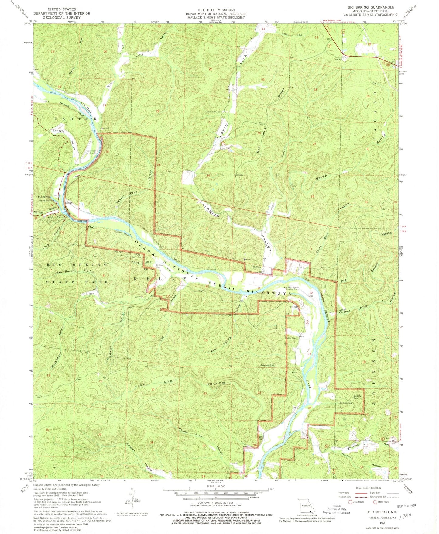
Classic USGS Big Spring Missouri 7.5'x7.5' Topo Map
Couldn't load pickup availability
Historical USGS topographic quad map of Big Spring in the state of Missouri. Map scale is 1:24000. Print size is approximately 24" x 27"
This quadrangle is in the following counties: Carter.
The map contains contour lines, roads, rivers, towns, and lakes. Printed on high-quality waterproof paper with UV fade-resistant inks, and shipped rolled.
Contains the following named places: Aldrich Valley, Aldrich Valley Cemetery, Aldrich Valley School, Beaver Pond Hollow, Bee Gum Ridge, Big Grassy Valley, Big Spring, Big Spring Campgrounds, Big Spring River Access, Big Spring State Park, Brown Hollow, Carter County, Carter Creek, Cataract Hill, Cataract Landing, Cave Spring, CCC Historic District, Chalk Bank Hollow, Chilton, Chilton Cemetery, Chilton Creek, Chub Hollow, Clay Hollow, Clay Hollow, Club House (historical), Colemans Failure Chute, Copper Mine Hollow, Elm Spring Hollow, Hickory Church (historical), Hickory Hollow, Hickory Landing, Kelleys Cemetery, Kinnard Hollow, Latty Valley, Lick Log Hollow, Log Hollow, Long Bay, Long Bay Hollow, McSpadden Hollow, Possum Hollow, Round Pond Hollow, Shelton Hollow, Short (historical), Spring Valley, Sweezie Hollow, Van Buren Hollow, Water Hollow, Water Hollow