MyTopo
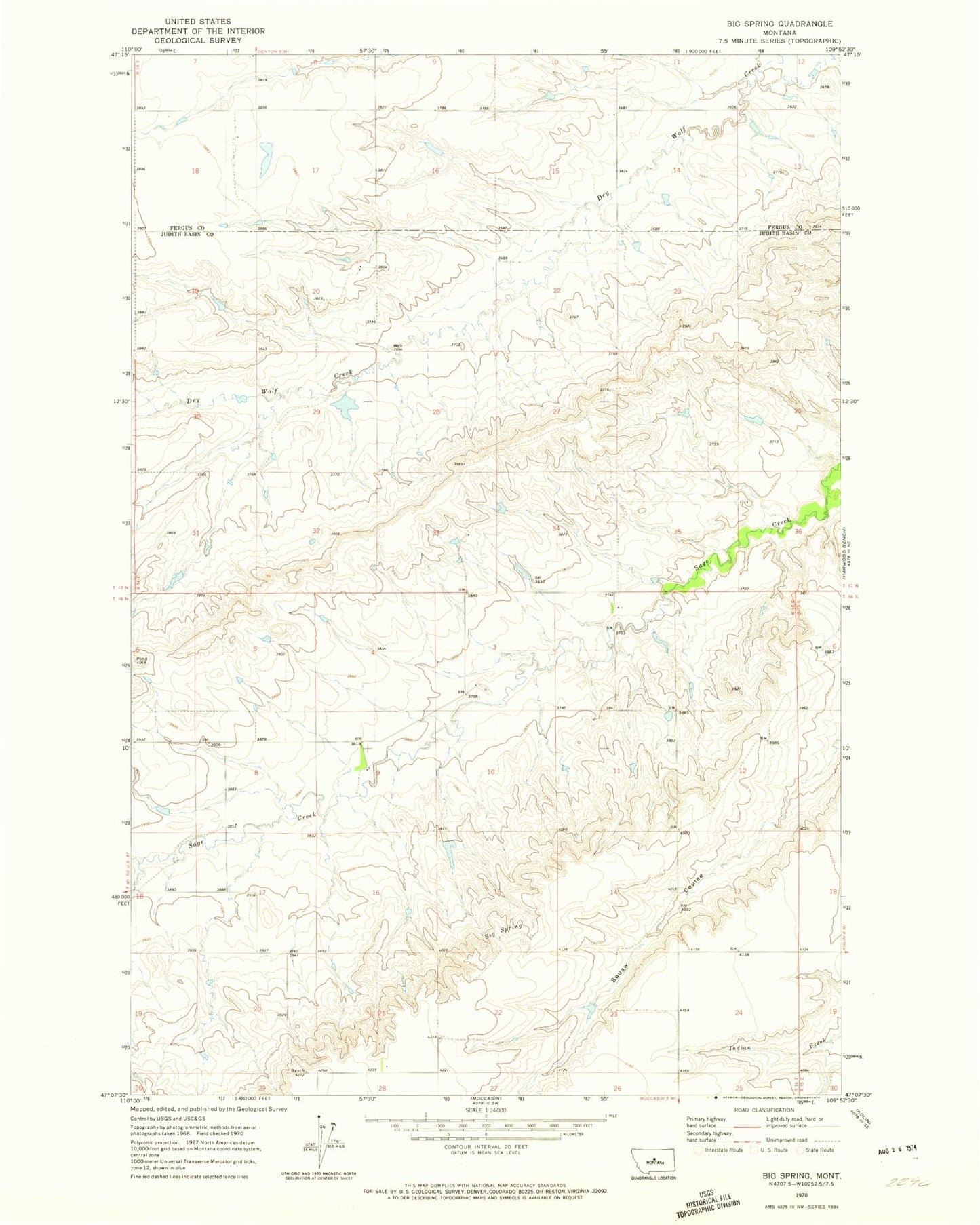
Classic USGS Big Spring Montana 7.5'x7.5' Topo Map
Regular price
$16.95
Regular price
Sale price
$16.95
Unit price
per
Couldn't load pickup availability
Historical USGS topographic quad map of Big Spring in the state of Montana. Map scale may vary for some years, but is generally around 1:24,000. Print size is approximately 24" x 27"
This quadrangle is in the following counties: Fergus, Judith Basin.
The map contains contour lines, roads, rivers, towns, and lakes. Printed on high-quality waterproof paper with UV fade-resistant inks, and shipped rolled.
Contains the following named places: 16N14E03CDB_01 Well, 16N14E08CDC_01 Well, 16N14E09BDD_01 Well, 16N14E20AAB_01 Well, 17N14E07DB__01 Well, 17N14E15AAAA01 Well, 17N14E20ADB_01 Well, 17N14E28DAAD01 Well, 17N14E32BC__01 Well, 17N14E33DBBC01 Well, Big Spring, Coffee Cake Dam, Glendale School, Willow Creek