MyTopo
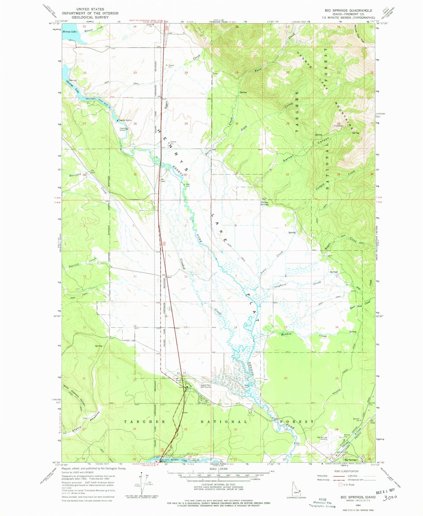
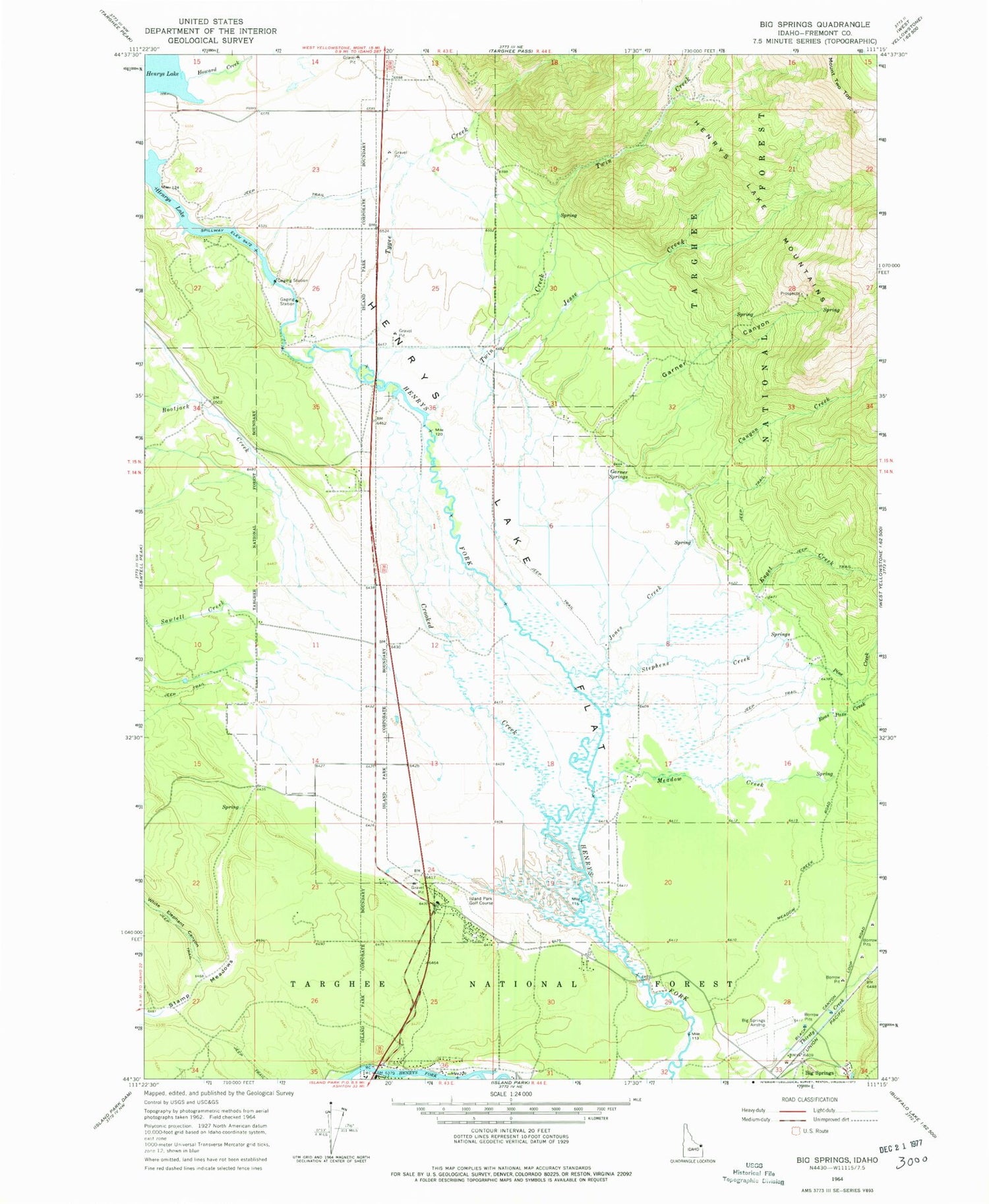
Classic USGS Big Springs Idaho 7.5'x7.5' Topo Map
Couldn't load pickup availability
Historical USGS topographic quad map of Big Springs in the state of Idaho. Map scale is 1:24000. Print size is approximately 24" x 27"
This quadrangle is in the following counties: Fremont.
The map contains contour lines, roads, rivers, towns, and lakes. Printed on high-quality waterproof paper with UV fade-resistant inks, and shipped rolled.
Contains the following named places: Bootjack Creek, Canyon Creek, Crooked Creek, Dry Creek, Enget Creek, Flat Rock, Garner Canyon, Garner Springs, Henrys Lake Dam, Henrys Lake Flat, Henrys Lake State Park, Howard Creek, Island Park Golf Course, Jesse Creek, Jones Creek, Meadow Creek, Mount Two Top, Pine Creek, Reas Pass Creek, Sawtell Creek, Stamp Meadows, Stephens Creek, Twin Creek, Tygee Creek, White Elephant Canyon