MyTopo
Classic USGS Big Table Mountain Idaho 7.5'x7.5' Topo Map
Regular price
$16.95
Regular price
Sale price
$16.95
Unit price
per
Couldn't load pickup availability
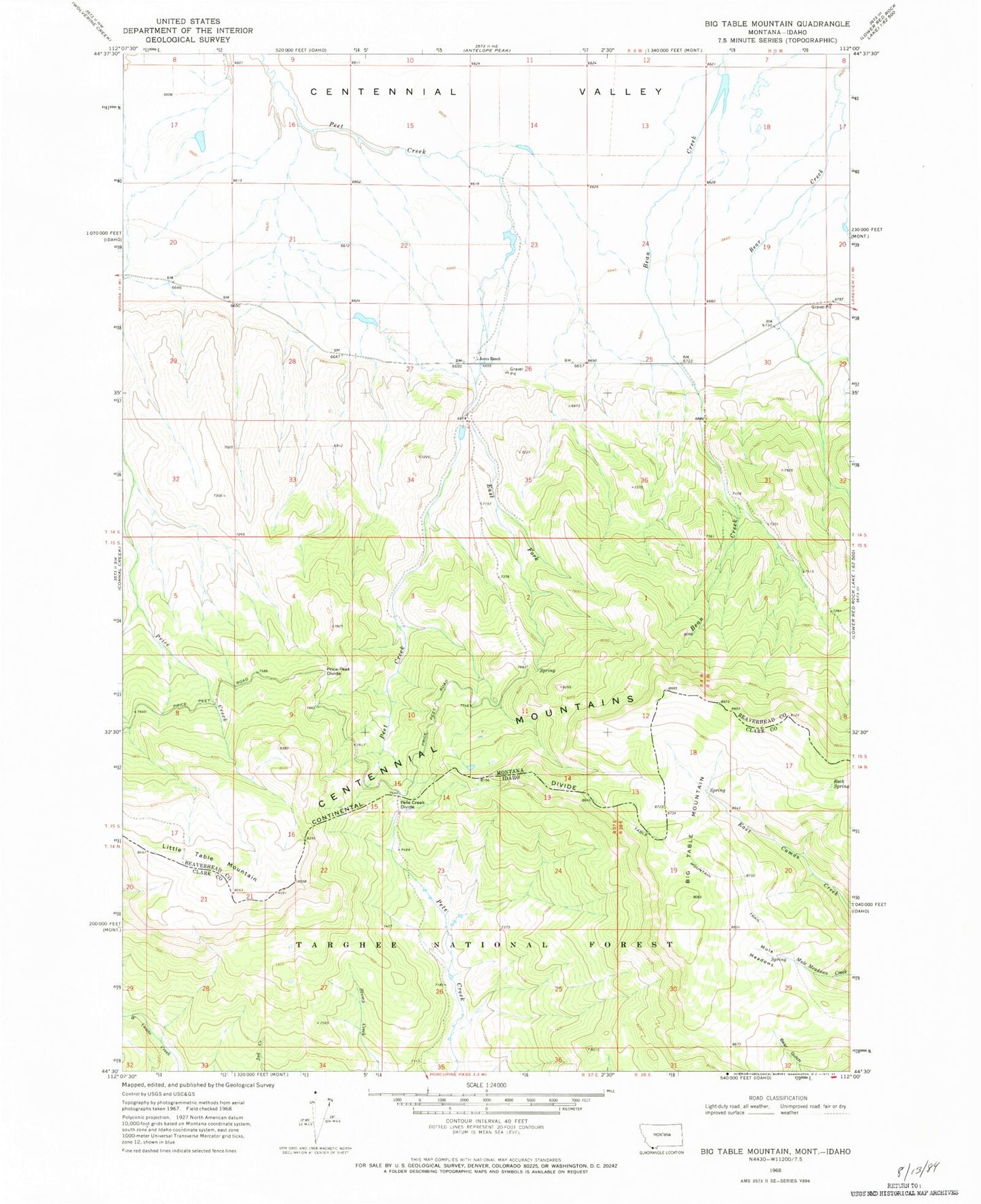
Historical USGS topographic quad map of Big Table Mountain in the states of Idaho, Montana. Map scale may vary for some years, but is generally around 1:24,000. Print size is approximately 24" x 27"
This quadrangle is in the following counties: Beaverhead, Clark.
The map contains contour lines, roads, rivers, towns, and lakes. Printed on high-quality waterproof paper with UV fade-resistant inks, and shipped rolled.
Contains the following named places: Big Table Mountain, Cactus Dam, Chandelier Dam, East Fork Peet Creek, Jones Ranch, Little Table Mountain, Mule Meadows, Pands Dam, Pete Creek Divide, Price-Peet Divide, Rock Spring, Table Mountain Trail, Western Centennial Mountains