MyTopo
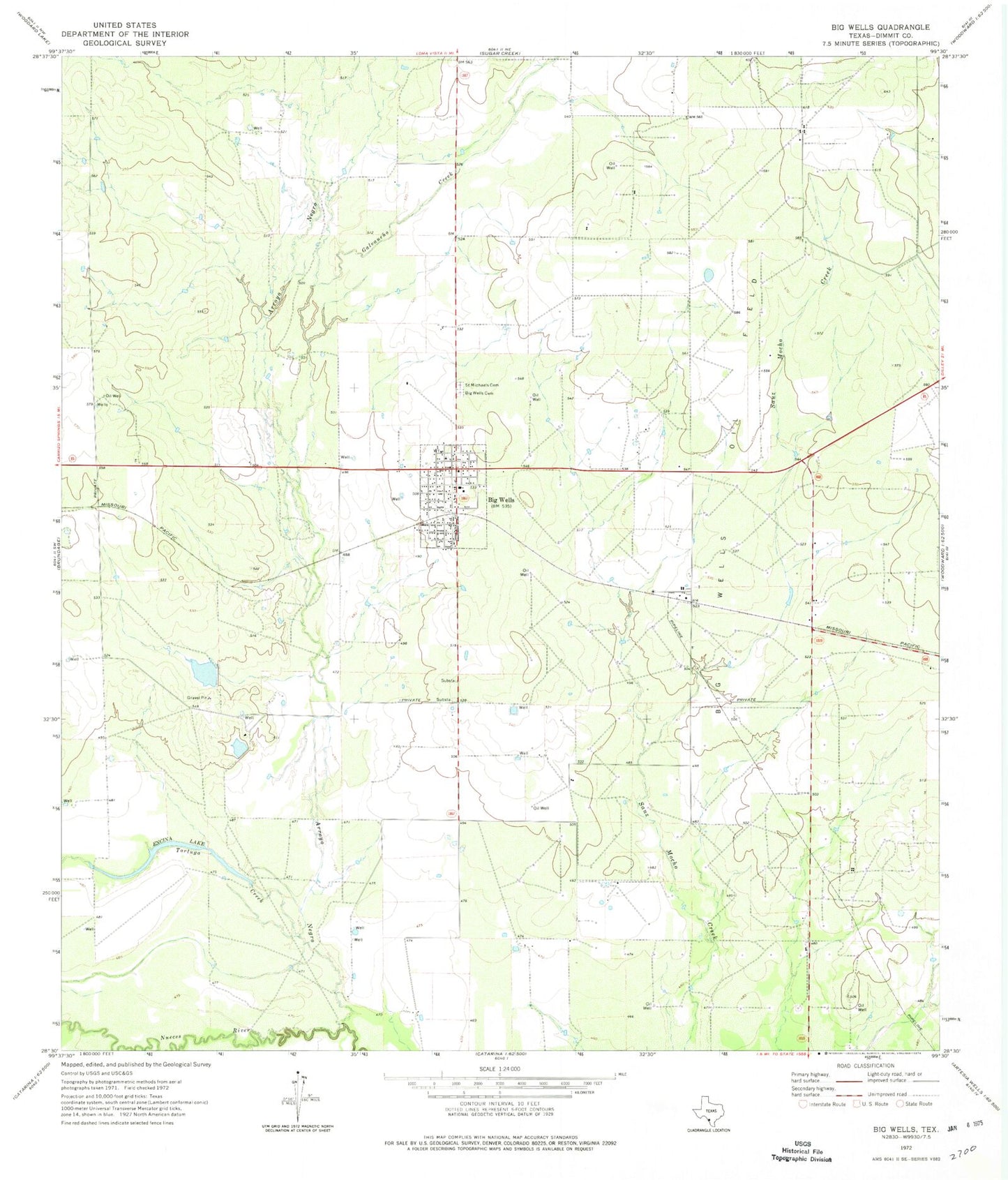
Classic USGS Big Wells Texas 7.5'x7.5' Topo Map
Couldn't load pickup availability
Historical USGS topographic quad map of Big Wells in the state of Texas. Map scale may vary for some years, but is generally around 1:24,000. Print size is approximately 24" x 27"
This quadrangle is in the following counties: Dimmit.
The map contains contour lines, roads, rivers, towns, and lakes. Printed on high-quality waterproof paper with UV fade-resistant inks, and shipped rolled.
Contains the following named places: Arroyo Negro, Big Wells, Big Wells Cemetery, Big Wells City Hall, Big Wells Division, Big Wells Oil Field, Big Wells Post Office, Big Wells Volunteer Fire Department, Bowmen Cattle Company Lake Number 1, Bowmen Cattle Company Lake Number 2, Bowmen Cattle Company Lake Number 2 Dam, Bowmen Cattle Company Number 1 Lake Dam, City of Big Wells, Encina Lake, Galvaneno Creek, Martindale Tank, Martindale Tank Dam, Price Ranch Airport, Saint Michaels Cemetery, Tortuga Creek, ZIP Code: 78830