MyTopo
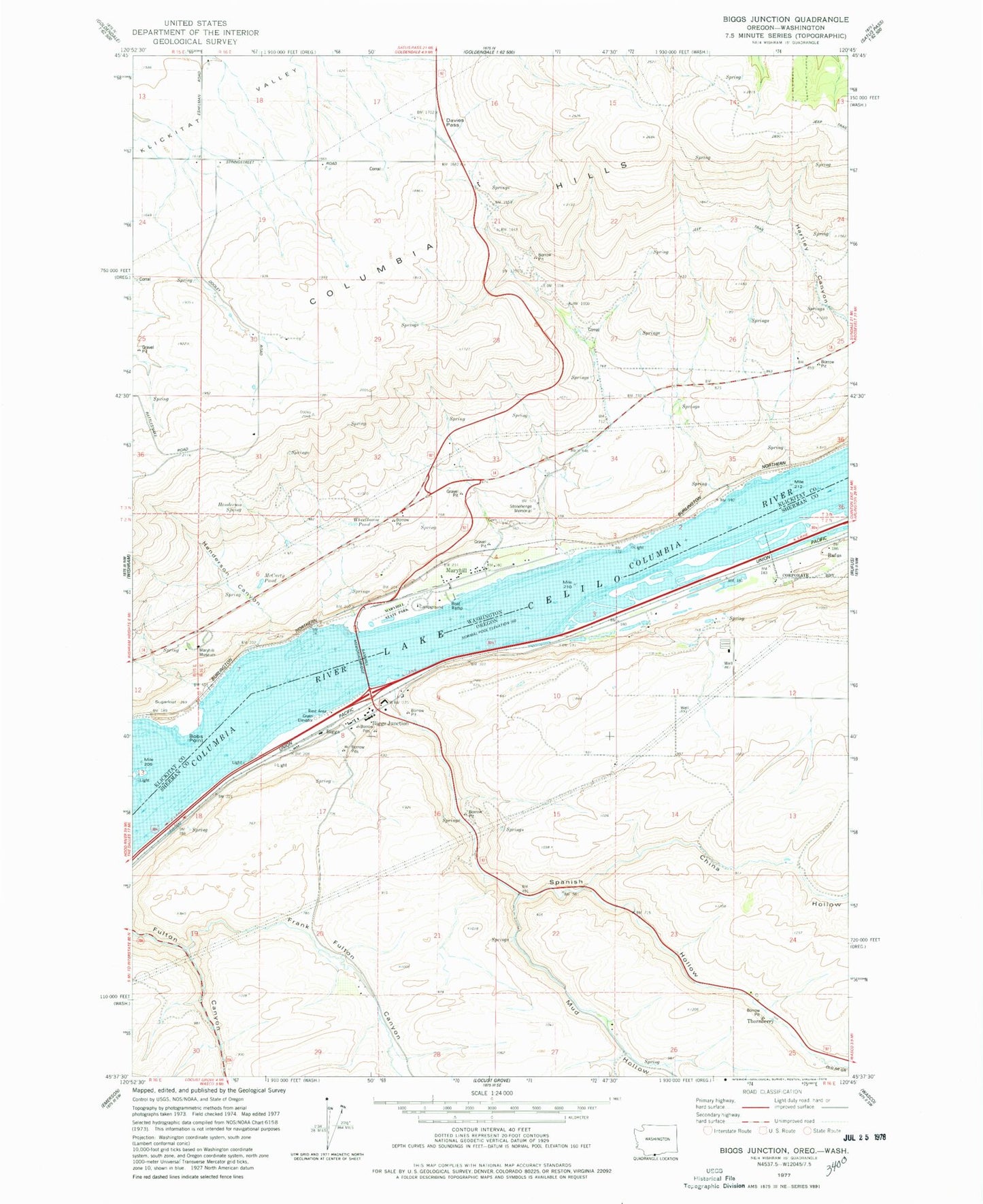
Classic USGS Biggs Junction Oregon 7.5'x7.5' Topo Map
Couldn't load pickup availability
Historical USGS topographic quad map of Biggs Junction in the states of Oregon, Washington. Map scale may vary for some years, but is generally around 1:24,000. Print size is approximately 24" x 27"
This quadrangle is in the following counties: Klickitat, Sherman.
The map contains contour lines, roads, rivers, towns, and lakes. Printed on high-quality waterproof paper with UV fade-resistant inks, and shipped rolled.
Contains the following named places: Biggs, Biggs Arch, Biggs Junction, Biggs Junction Census Designated Place, Biggs Post Office, Biggs Service District Sewer System Facility, Bobs Point, China Hollow, China Hollow Creek, Davies Pass, Frank Fulton Canyon, Grant, Grant Post Office, Grebe, Gunkel Orchards, Hells Gate Channel Range B, Henderson Canyon, Henderson Spring, Mary Hill Vineyards, Maryhill, Maryhill Census Designated Place, Maryhill Ferry, Maryhill Museum, Maryhill Post Office, Maryhill State Park, Maryhill Treaty Fishing Access Site, Matties Hump, McCarty Pond, Mud Hollow, Rattlesnake Rock, Sam Hill Memorial Bridge, Spanish Hollow, Stonehenge Memorial, Sugarloaf, Thornberry, Thornberry Post Office, Villard Post Office, Wheelhouse Pond, ZIP Code: 97050