MyTopo
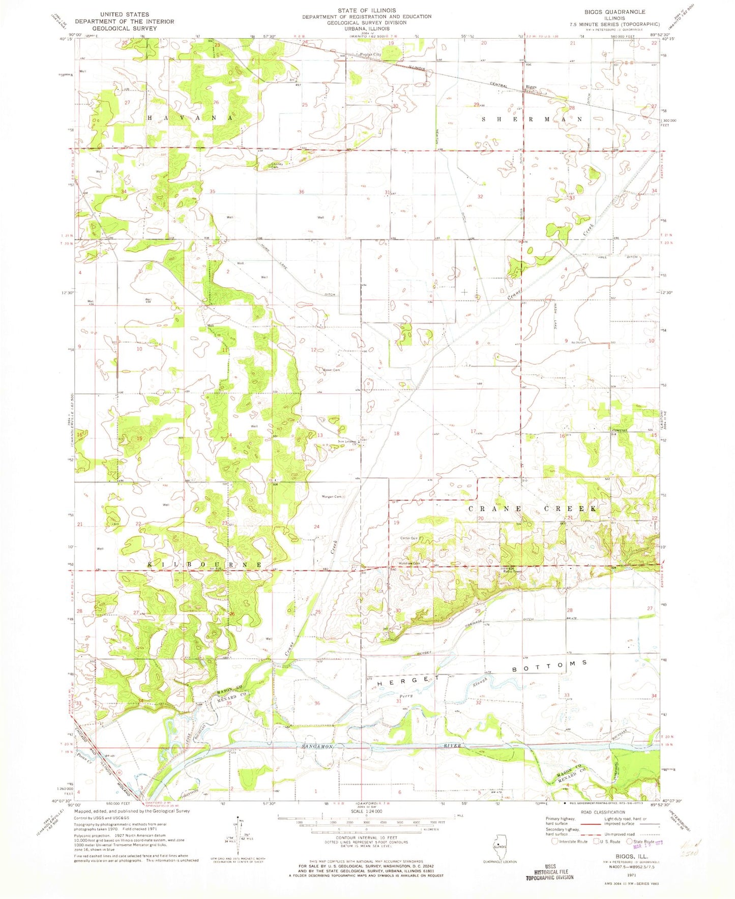
Classic USGS Biggs Illinois 7.5'x7.5' Topo Map
Couldn't load pickup availability
Historical USGS topographic quad map of Biggs in the state of Illinois. Map scale may vary for some years, but is generally around 1:24,000. Print size is approximately 24" x 27"
This quadrangle is in the following counties: Mason, Menard.
The map contains contour lines, roads, rivers, towns, and lakes. Printed on high-quality waterproof paper with UV fade-resistant inks, and shipped rolled.
Contains the following named places: Baker Cemetery, Baker School, Biggs, Biggs Ditch, Carter Cemetery, Chaney Cemetery, Chaney Union School, Crane Creek, Crane Creek Town Hall, Herget Drainage Ditch, Herget Grove School, Holstlaw Cemetery, Hurd Lake Ditch, Mason County, Morgan Cemetery, New Lebanon Cemetery, New Lebanon Church, Newton Ditch, Oneal School, Pecan Creek, Perry Slough, Peterville, Peterville Hall, Peterville School, Poplar City, Sears Cemetery, Sears Grove School, Sherman Valley School, Tomlin Ditch, Township of Crane Creek, Township of Kilbourne, Wash Lake Slough, ZIP Code: 62655