MyTopo
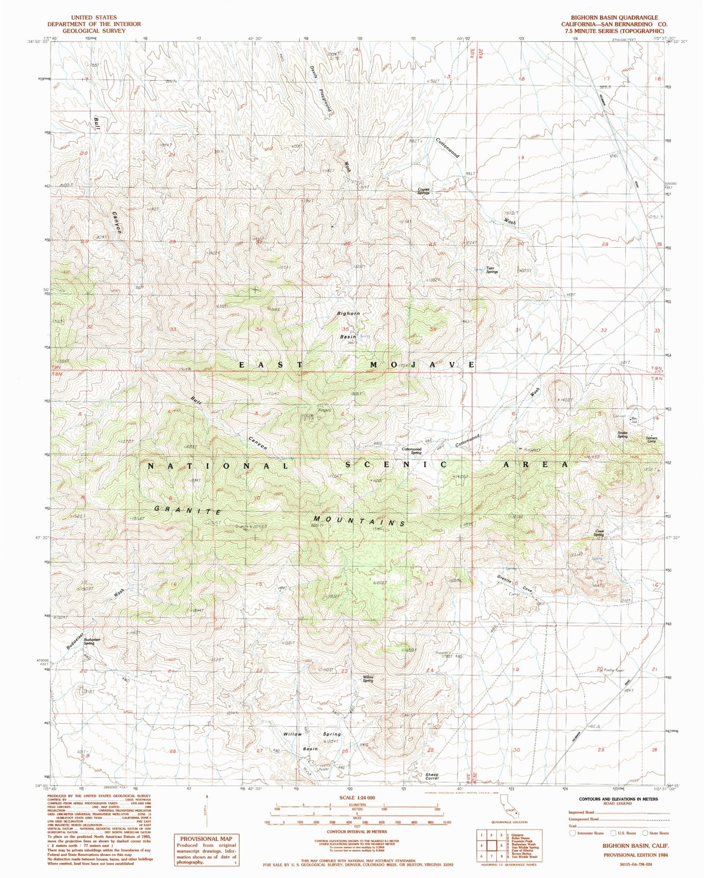
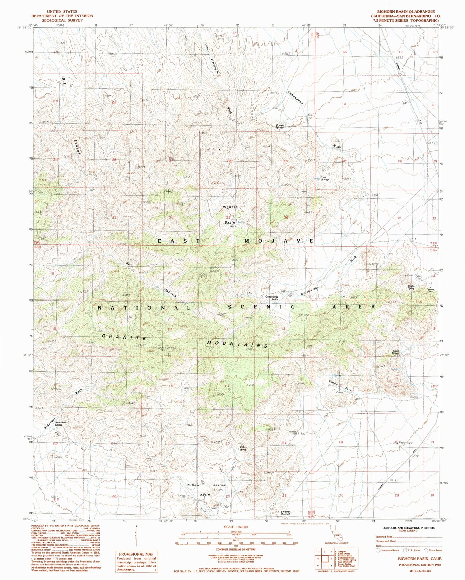
Classic USGS Bighorn Basin California 7.5'x7.5' Topo Map
Regular price
$16.95
Regular price
Sale price
$16.95
Unit price
per
Couldn't load pickup availability
Historical USGS topographic quad map of Bighorn Basin in the state of California. Typical map scale is 1:24,000, but may vary for certain years, if available. Print size: 24" x 27"
This quadrangle is in the following counties: San Bernardino.
The map contains contour lines, roads, rivers, towns, and lakes. Printed on high-quality waterproof paper with UV fade-resistant inks, and shipped rolled.
Contains the following named places: Bighorn Basin, Budweiser Spring, Cottonwood Spring, Cove Spring, Coyote Springs, Dorners Camp, Granite Cove, Granite Mountains, Snake Spring, Twin Springs, Willow Spring Basin, White Fang, Silver Peak, Granite Peak Plateau, Granite Peak, Willow Spring