MyTopo
Classic USGS Bighorn Crags Idaho 7.5'x7.5' Topo Map
Couldn't load pickup availability
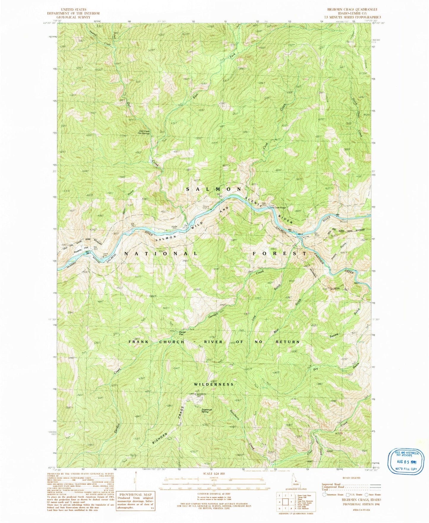
Historical USGS topographic quad map of Bighorn Crags in the state of Idaho. Typical map scale is 1:24,000, but may vary for certain years, if available. Print size: 24" x 27"
This quadrangle is in the following counties: Lemhi.
The map contains contour lines, roads, rivers, towns, and lakes. Printed on high-quality waterproof paper with UV fade-resistant inks, and shipped rolled.
Contains the following named places: Bear Gulch, Corral Flat, Cougar Creek, Cove Creek, Cove Creek Bridge, East Fork Owl Creek, Garden Creek, Line Gulch, Owl Creek, Owl Creek Hot Springs, Panther Creek, Poverty Flat, Pretty Gulch, Pretty Gulch Trail (historical), Rancherio Creek, Sagebrush Lookout, Sagebrush Lookout Trail, Sagebrush Spring, Skull Gulch, Squaw Gulch, Swamp Creek, Sagebrush Mountain