MyTopo
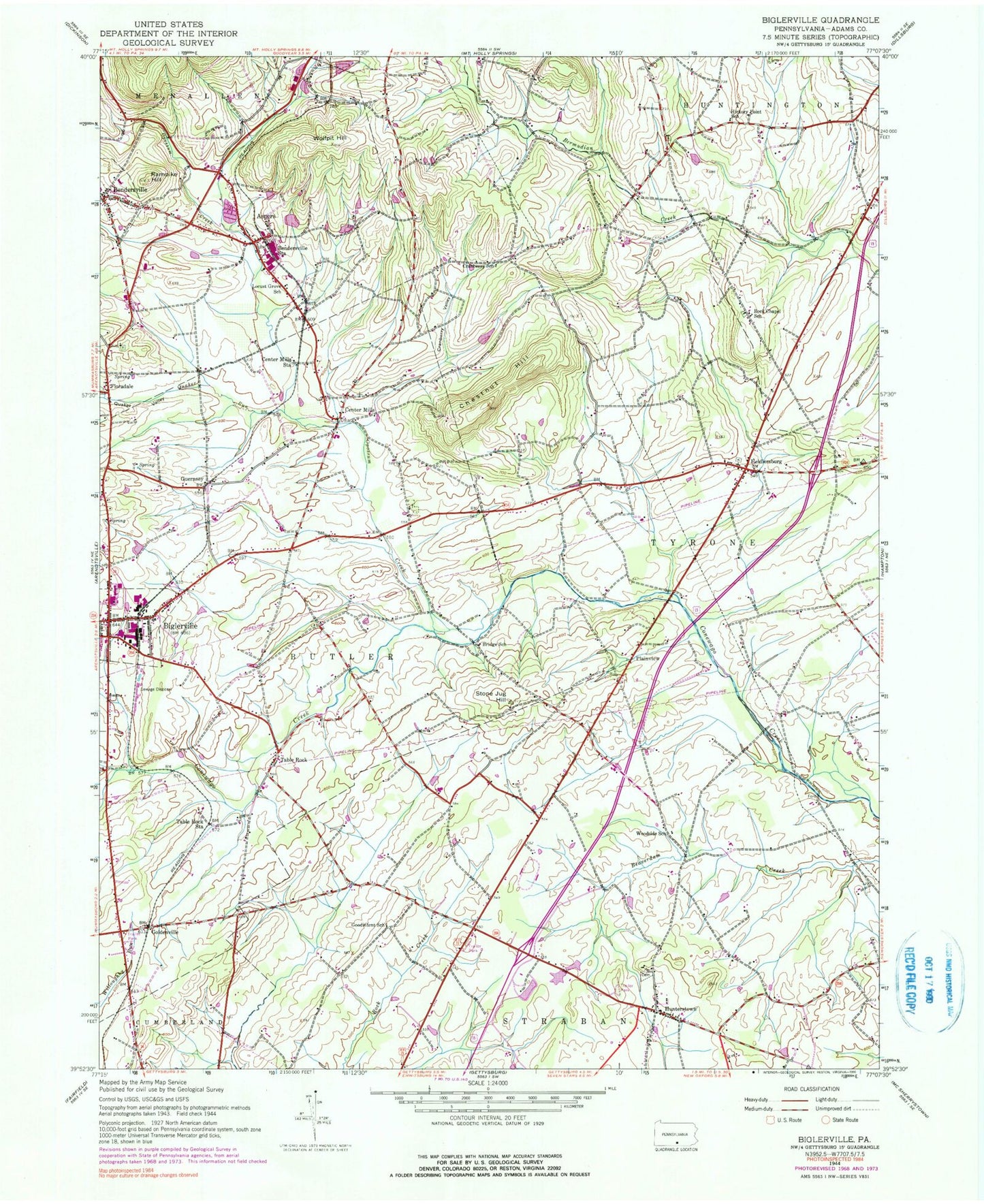
Classic USGS Biglerville Pennsylvania 7.5'x7.5' Topo Map
Couldn't load pickup availability
Historical USGS topographic quad map of Biglerville in the state of Pennsylvania. Map scale may vary for some years, but is generally around 1:24,000. Print size is approximately 24" x 27"
This quadrangle is in the following counties: Adams.
The map contains contour lines, roads, rivers, towns, and lakes. Printed on high-quality waterproof paper with UV fade-resistant inks, and shipped rolled.
Contains the following named places: Ariosa, Aspers, Aspers Census Designated Place, Aspers Fire and Emergency Medical Services, Aspers Post Office, Belmont School, Benders Church, Benders Lutheran Church Cemetery, Bendersville, Bendersville Borough Police Department, Bendersville Community Fire Company Station 7, Bendersville Post Office, Bendersville Station, Bethlehem Church Cemetery, Biglerville, Biglerville Hose Truck Company 1 Station 6, Biglerville Police Department, Borough of Bendersville, Borough of Biglerville, Bowtie Airport, Bream Mill, Bridge School, Butler Township Friends Cemetery, Center Mills, Center Mills Station, Chestnut Hill, Clines United Methodist Church Cemetery, Cranberry School, Cranberry Valley, Fire Company, Flora Dale Census Designated Place, Floradale, Friends Grove School, Fruit Research Labratory of Penn State, Goldenville, Goodintent Mills, Goodintent School, Grace Bible Chapel Cemetery, Great Conewago Presbyterian Church Cemetery, Guernsey, Heidlersburg, Heidlersburg Cemetery, Heidlersburg Census Designated Place, Heidlersburg Fire Company Station 25, Heikes Covered Bridge, Hershey Mill, Hickory Point School, Hunterstown, Hunterstown Census Designated Place, Limerock Mill, Locust Grove School, Menallen Friends Cemetery, Old White Episcopal Church Cemetery, Opossum Creek, Pennsylvania State Police Troop H Gettysburg Station, Plainview, Quaker Run, Quaker Valley, Rampike Hill, Rock Chapel Cemetery, Rock Chapel School, Saw Horse Farm, Shimerfield Airport, Shrivers Corners, State Game Lands Number 249, Stone Jug Hill, Table Rock, Table Rock Census Designated Place, Table Rock Station, Texas, Township of Butler, Township of Huntington, Township of Straban, Township of Tyrone, Upper Bermudian Church Cemetery, Wolfpit Hill, Woodside School, Zeigler Mill, ZIP Codes: 17304, 17306