MyTopo
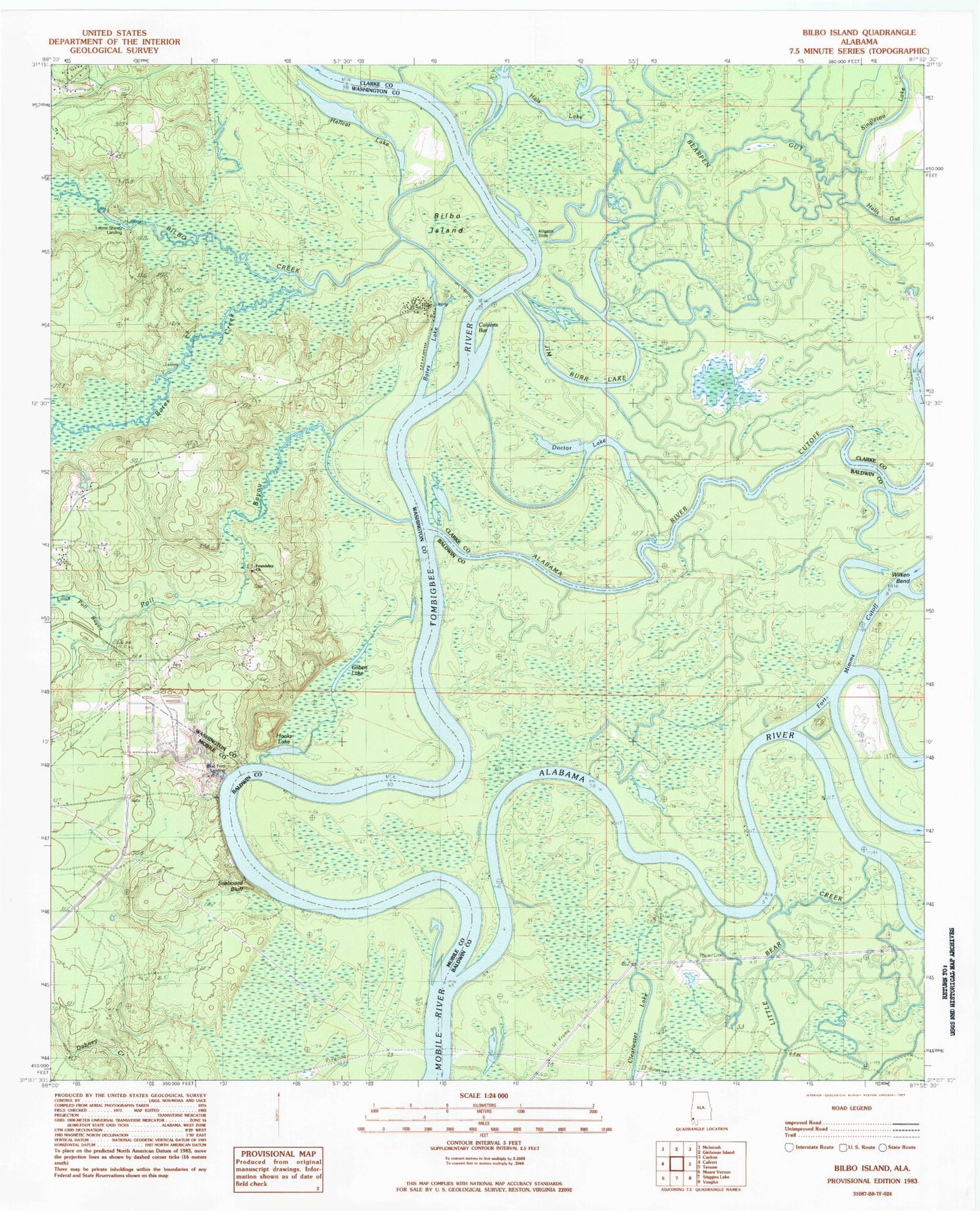
Classic USGS Bilbo Island Alabama 7.5'x7.5' Topo Map
Couldn't load pickup availability
Historical USGS topographic quad map of Bilbo Island in the state of Alabama. Typical map scale is 1:24,000, but may vary for certain years, if available. Print size: 24" x 27"
This quadrangle is in the following counties: Baldwin, Clarke, Mobile, Washington.
The map contains contour lines, roads, rivers, towns, and lakes. Printed on high-quality waterproof paper with UV fade-resistant inks, and shipped rolled.
Contains the following named places: African Methodist Church, Alabama River Cutoff, Alligator Slide, Bates Creek, Bates Lake, Bear Creek, Bearpen Gut, Bilbo Island, Deep Slough, Doctor Lake, East Calvert School, East Malcom School, Gilbert Lake, Hellcat Lake, Hooks Lake, Horsepen Creek, Joe Bayou, Little Poll Bayou, Seaboard Bluff, Singleton Lake, Wilken Bend, Woodyard Gut, Calverts Bar, East Maher Landing, Jim Burns Island, Millers, Pierce Landing, Wilken Bend Landing (historical), Simes Landing (historical), Turpin Slough, West Maher Landing, West River, Bilbos Landing (historical), Franklin (historical), Franklins Landing (historical), Friendship Missionary Baptist Church, Calvert Landing, Greers Landing, Griers Creek, Nanahubba Bluff, Seaboard Landing, Webbs Landing, Bilbo Creek, Big John Baptist Church, Jim Burr Lake, Poll Bayou, Alabama River, Boykin Junior High School, Greater Mount Calvary Baptist Church, Blue Ford Landing, Laurel Shanty Landing, Pine Bluff Landing, Bates Landing Fish Camp, Big John Cemetery, Friendship Church, Tombigbee River, Why Not Hunting Club, Millers Landing (historical)