MyTopo
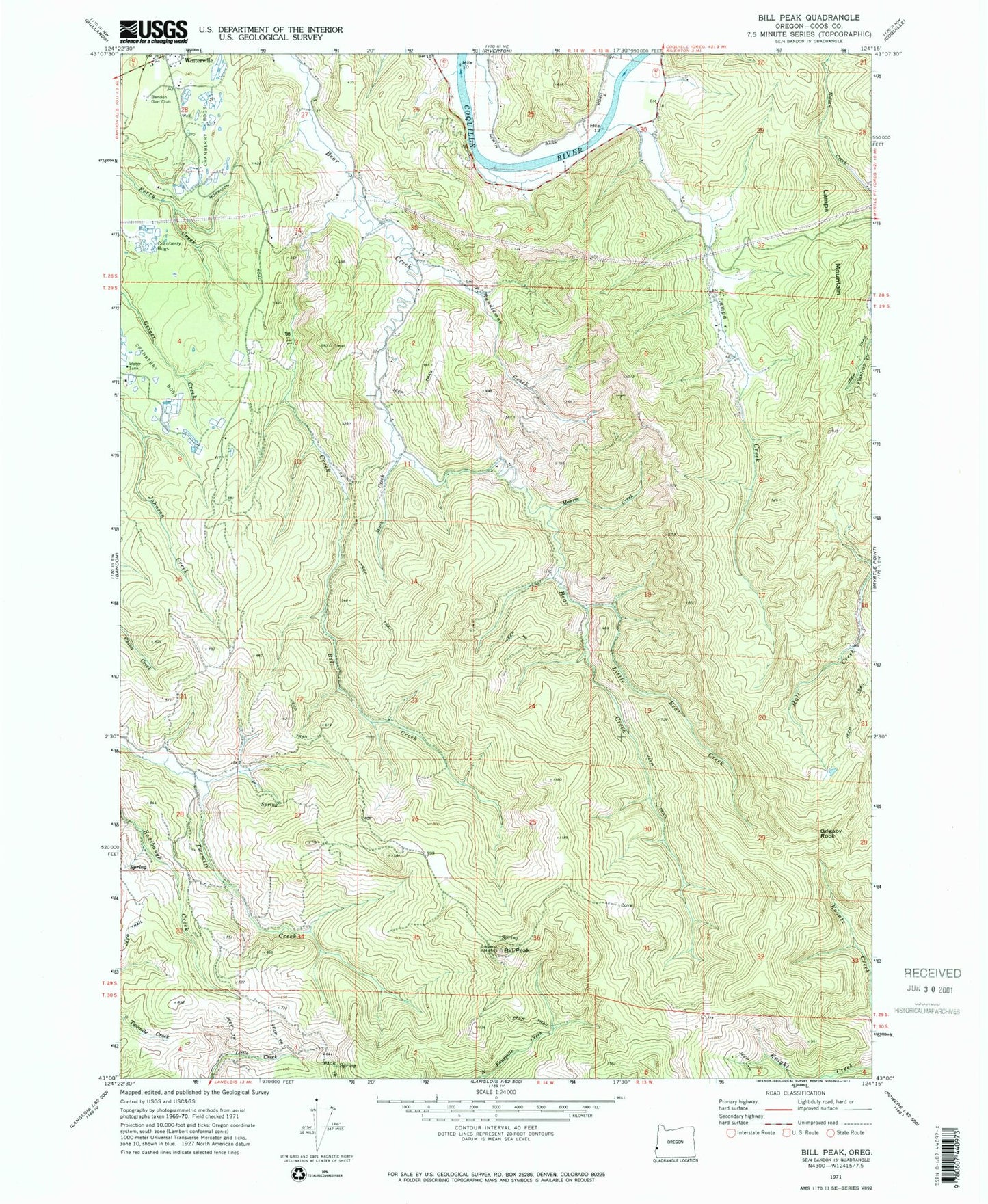
Classic USGS Bill Peak Oregon 7.5'x7.5' Topo Map
Couldn't load pickup availability
Historical USGS topographic quad map of Bill Peak in the state of Oregon. Map scale may vary for some years, but is generally around 1:24,000. Print size is approximately 24" x 27"
This quadrangle is in the following counties: Coos.
The map contains contour lines, roads, rivers, towns, and lakes. Printed on high-quality waterproof paper with UV fade-resistant inks, and shipped rolled.
Contains the following named places: Bandon Gun Club, Bear Creek Cemetery, Bill Creek, Bill Peak, Doyle Ranch, Grigsby Rock, Iowa Mine, Lampa, Lampa Creek, Lampa Creek Cemetery, Lampa Mine, Lampa Mountain, Lampa Post Office, Little Bear Creek, Mack Creek, Monroe Creek, Randleman Creek, Sweet Myrtle State Natural Site, Timon, Timon Post Office, Upper Twomile School, Waddington Creek, Winterville, ZIP Code: 97411