MyTopo
Classic USGS Billingsville Missouri 7.5'x7.5' Topo Map
Couldn't load pickup availability
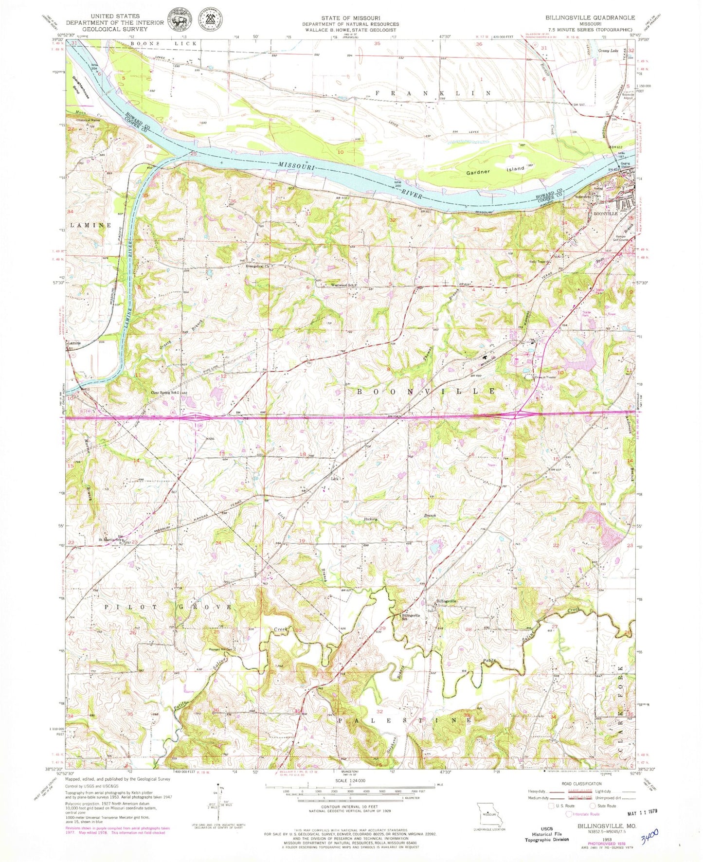
Historical USGS topographic quad map of Billingsville in the state of Missouri. Map scale may vary for some years, but is generally around 1:24,000. Print size is approximately 24" x 27"
This quadrangle is in the following counties: Cooper, Howard.
The map contains contour lines, roads, rivers, towns, and lakes. Printed on high-quality waterproof paper with UV fade-resistant inks, and shipped rolled.
Contains the following named places: Bartlett Creek, Billingsville, Billingsville School, Boonslick Technical Education Center, Boonville Bends, Boonville High School, Boonville Municipal Airport, Clear Spring School, Cooper County Fire Protection District Station 2, Cooper County Fire Protection District Station 4, De Bourgmont Access, East Oakland School, Evangelical Church, Friedrich Lake, Friedrich Lake Dam, Gardner Island, Grassy Branch, Grassy Lake, Hannah Cole Primary School, Hickory Branch, Hickory Grove School, Holtzclaw Lake Dam, KDBX-FM (Boonville), Kemper Golf Course, Kingsbury, KWRT-AM (Boonville), Lamine, Lamine River, Lamine River Bend, Lick, Lick Branch, Martin Branch, McCoy Number 1 Reservoir, Moon Creek, Old Channel Salt Creek, Oswald Lake Dam, Pleasant Hill Cemetery, Prairie View School, River of Life Assembly of God Church, Rupe Branch, Saint Martin School, Schrader Lake Dam, Southwest Dam Number 1, Stephens Branch, Stony Point School, Thomas Branch, Township of Boonville, Trout Dam, Trout Lake, Westwood School