MyTopo
Classic USGS Bills Creek Wyoming 7.5'x7.5' Topo Map
Regular price
$16.95
Regular price
Sale price
$16.95
Unit price
per
Couldn't load pickup availability
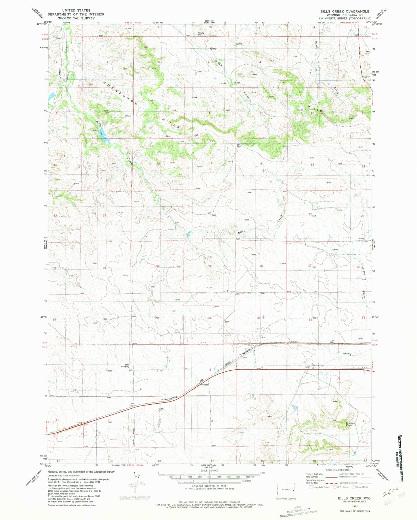
Historical USGS topographic quad map of Bills Creek in the state of Wyoming. Map scale may vary for some years, but is generally around 1:24,000. Print size is approximately 24" x 27"
This quadrangle is in the following counties: Niobrara.
The map contains contour lines, roads, rivers, towns, and lakes. Printed on high-quality waterproof paper with UV fade-resistant inks, and shipped rolled.
Contains the following named places: Bills Creek, Bliss Number 1 Dam, Bliss Number 1 Reservoir, Four Hundred Acre Spring, Horseshoe Hills, Jireh Cemetery, Lance Creek Number 2 Dam, Lance Creek Number 2 Reservoir, Middle Creek Spring, Shelton Peak