MyTopo
Classic USGS Billy Goat Mountain Washington 7.5'x7.5' Topo Map
Couldn't load pickup availability
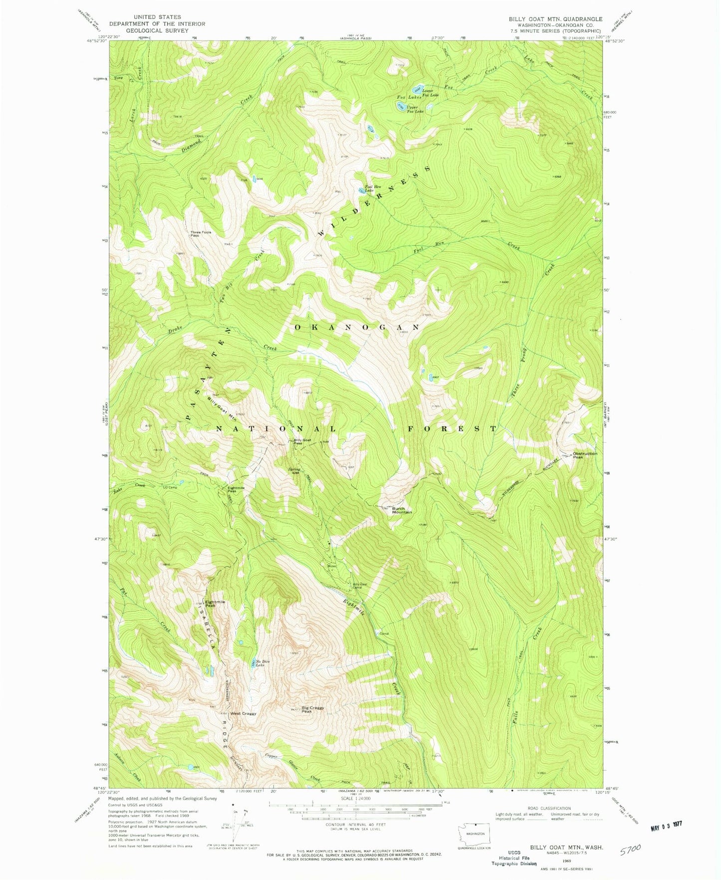
Historical USGS topographic quad map of Billy Goat Mountain in the state of Washington. Map scale may vary for some years, but is generally around 1:24,000. Print size is approximately 24" x 27"
This quadrangle is in the following counties: Okanogan.
The map contains contour lines, roads, rivers, towns, and lakes. Printed on high-quality waterproof paper with UV fade-resistant inks, and shipped rolled.
Contains the following named places: Big Craggy Peak, Billy Goat Corral, Billy Goat Mountain, Billy Goat Pass, Billy Goat Trailhead, Burch Mountain, Carol Creek, Early Winters Division, Eightmile Pass, Eightmile Peak, Fool Hen Creek, Fool Hen Lake, Fox Creek, Fox Lakes, Isabella Ridge, Larch Creek, Lower Fox Lake, Newland Creek, No Dice Lake, Obstruction Peak, Three Fools Pass, Tony Creek, Two Bit Creek, Upper Fox Lake, West Craggy