
MyTopo
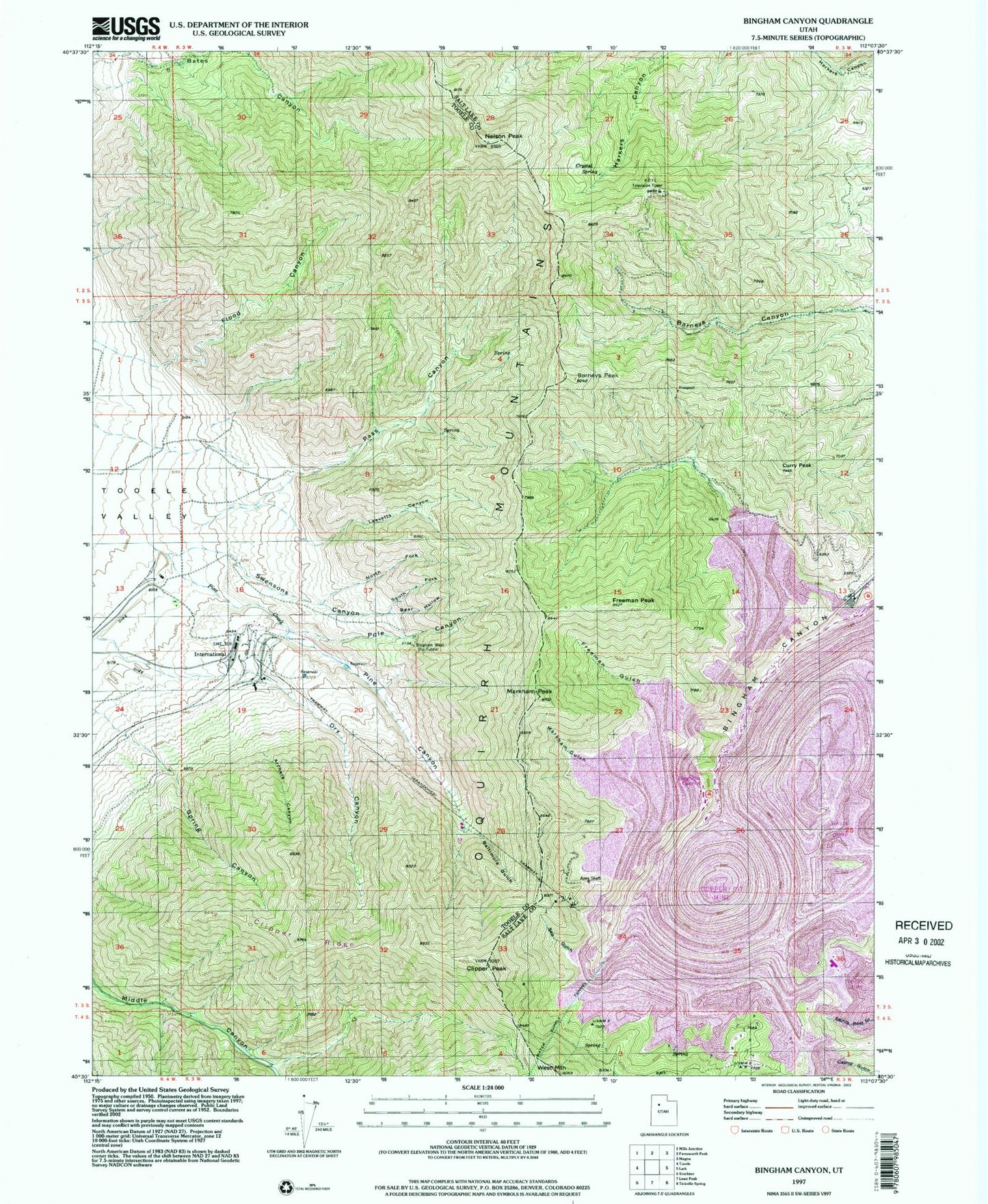
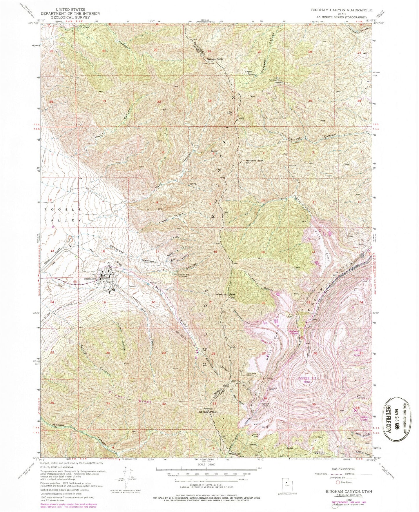
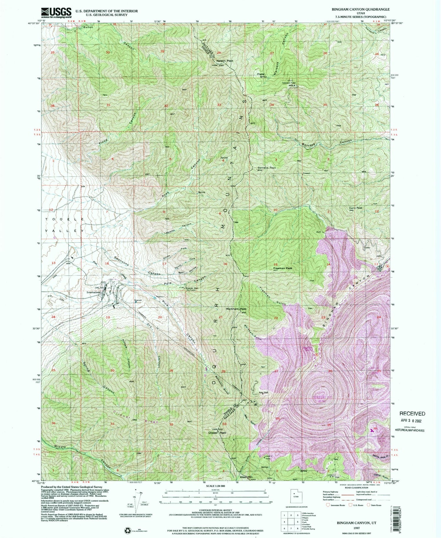
Classic USGS Bingham Canyon Utah 7.5'x7.5' Topo Map
Couldn't load pickup availability
Historical USGS topographic quad map of Bingham Canyon in the state of Utah. Map scale may vary for some years, but is generally around 1:24,000. Print size is approximately 24" x 27"
This quadrangle is in the following counties: Salt Lake, Tooele.
The map contains contour lines, roads, rivers, towns, and lakes. Printed on high-quality waterproof paper with UV fade-resistant inks, and shipped rolled.
Contains the following named places: Anaconda Reservoir, Anaconda Tailing Dam, Apex Shaft, Apex Tunnel, Archers Canyon, Armstrong Tunnel, Baltimore Gulch, Barneys Peak, Bear Hollow, Bingham Canyon, Bingham Copper Mine, Bingham West Dip Tunnel, Chandler Cemetery, Clipper Peak, Clipper Ridge, Crystal Spring, Curry Peak, Dry Canyon, Dry Fork Bingham Canyon, Flood Canyon, Freeman Gulch, Freeman Peak, Highland Tunnel, International, KALL-FM (Salt Lake City), KBYU-FM (Provo), KBYU-TV (Provo), KCPX-FM (Salt Lake City), KTVX-TV (Salt Lake City), KUED-TV (Salt Lake City), KUER-FM (Salt Lake City), KUTV-TV (Salt Lake City), Leavetts Canyon, Markham Gulch, Markham Peak, Nelson Peak, North Fork Swensons Canyon, Oquirrh Mountains, Pass Canyon, Pine Canyon, Pine Creek, Pole Canyon, Sap Gulch, South Fork Swensons Canyon, Spring Canyon, Swensons Canyon, Utah Metal Company Tunnel, West Mountain