MyTopo
Classic USGS Birch Point Washington 7.5'x7.5' Topo Map
Couldn't load pickup availability
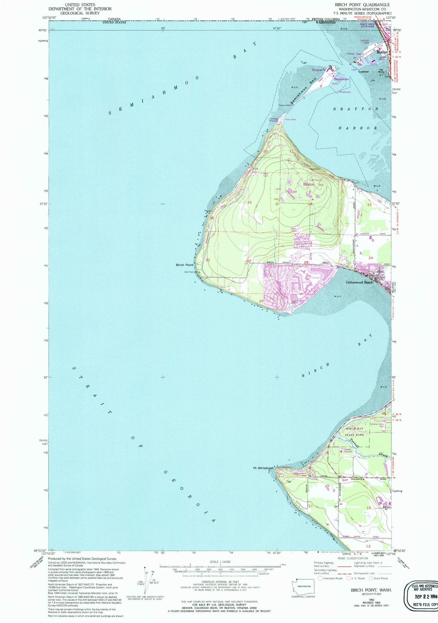
Historical USGS topographic quad map of Birch Point in the state of Washington. Map scale may vary for some years, but is generally around 1:24,000. Print size is approximately 24" x 27"
This quadrangle is in the following counties: Whatcom.
The map contains contour lines, roads, rivers, towns, and lakes. Printed on high-quality waterproof paper with UV fade-resistant inks, and shipped rolled.
Contains the following named places: Birch Bay, Birch Bay Census Designated Place, Birch Bay Sewage Treatment Plant, Birch Bay State Park, Birch Bay Village Golf Course, Birch Bay Village Marina, Birch Point, Blaine Division, Blaine Visitors Center, Blaine Wastewater Treatment Plant, Cottonwood Beach, Drayton Harbor, North Bay Mobile Home Park, North Whatcom Fire Rescue Station 62 Semiahmoo, Point Whitehorn, Port of Blaine, Semiahmoo, Semiahmoo Bay, Semiahmoo Golf and Country Club, Semiahmoo Marina, Semiahmoo Park Maritime Museum, Semiahmoo Spit, Semiahmoo Yacht Club, Terrell Creek, Tongue Point, Unruh Reservoir, Unruh Reservoir Dam, Whatcom County Fire District 7 Station 44 - Birch Bay