MyTopo
Classic USGS Bird Valley California 7.5'x7.5' Topo Map
Regular price
$16.95
Regular price
Sale price
$16.95
Unit price
per
Couldn't load pickup availability
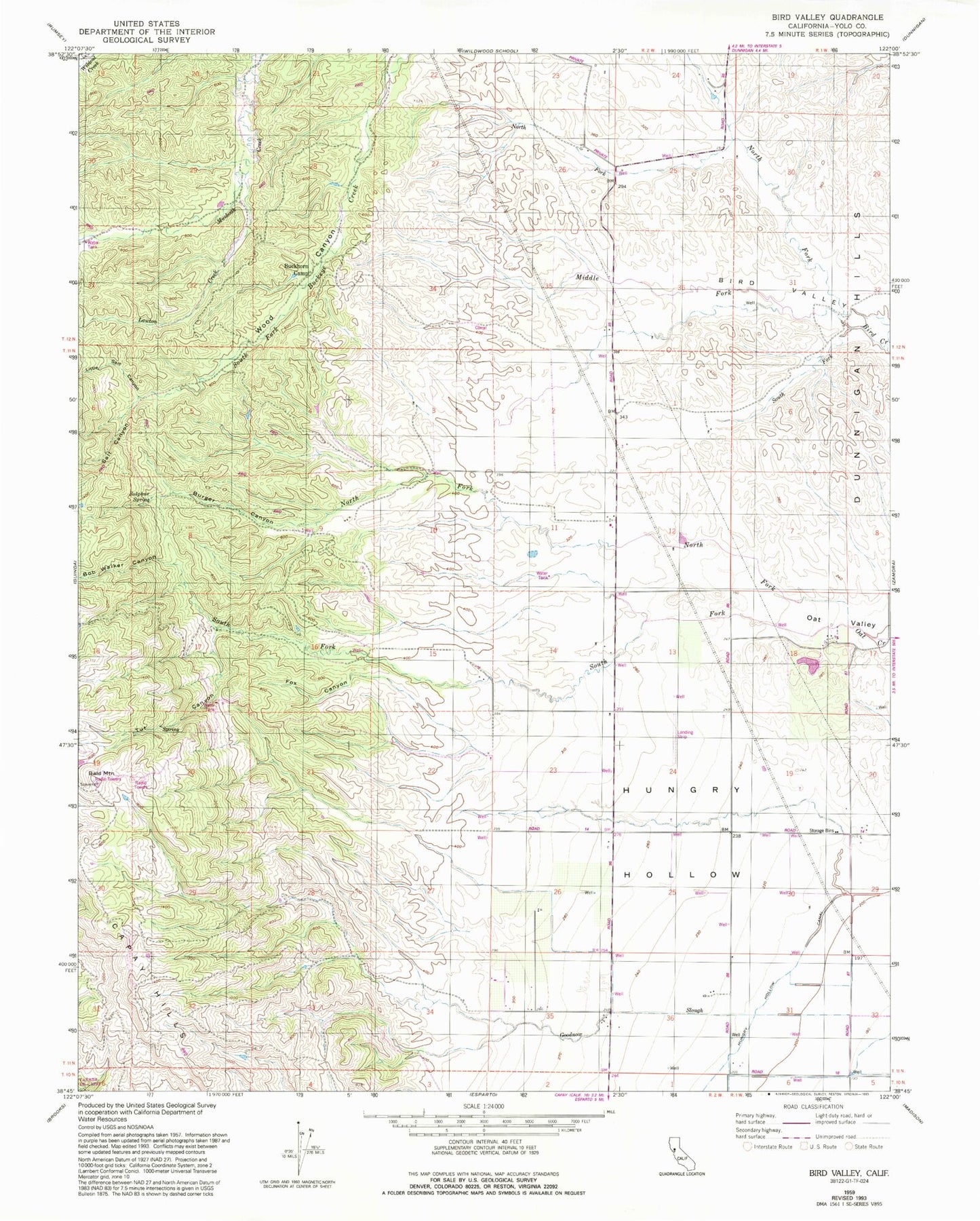
Historical USGS topographic quad map of Bird Valley in the state of California. Map scale may vary for some years, but is generally around 1:24,000. Print size is approximately 24" x 27"
This quadrangle is in the following counties: Yolo.
The map contains contour lines, roads, rivers, towns, and lakes. Printed on high-quality waterproof paper with UV fade-resistant inks, and shipped rolled.
Contains the following named places: Bald Mountain, Bob Walker Canyon, Buckhorn Camp, Burger Canyon, Fox Canyon, Lawton Creek, Little Salt Canyon, Middle Fork Bird Creek, North Fork Oat Creek, Salt Canyon, South Fork Bird Creek, South Fork Oat Creek, Sulphur Spring, Tut Canyon, Wood Canyon