
MyTopo
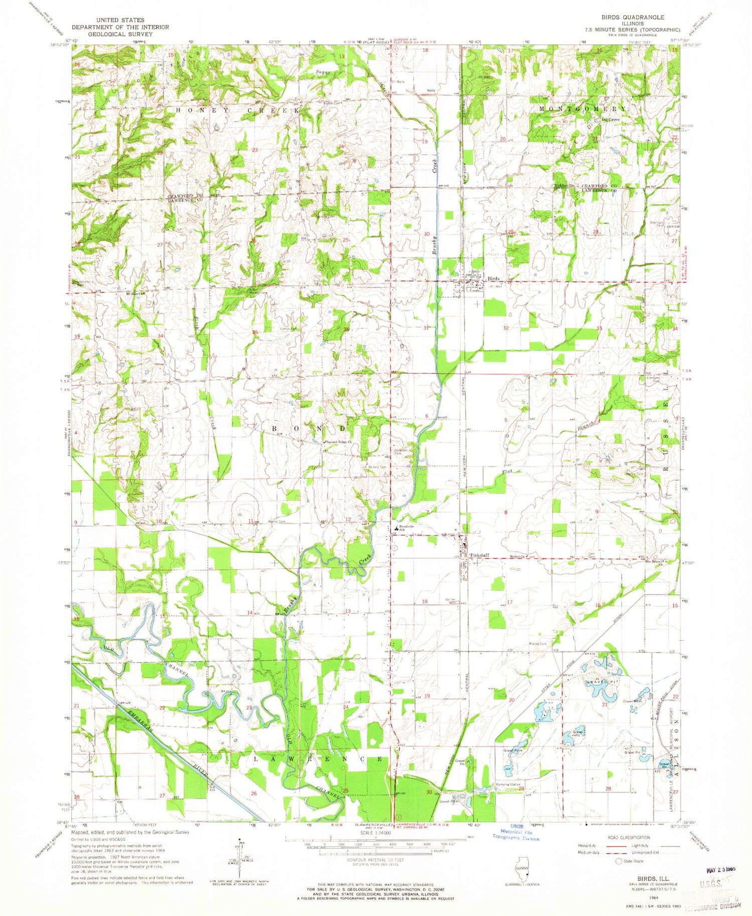
Classic USGS Birds Illinois 7.5'x7.5' Topo Map
Couldn't load pickup availability
Historical USGS topographic quad map of Birds in the state of Illinois. Map scale may vary for some years, but is generally around 1:24,000. Print size is approximately 24" x 27"
This quadrangle is in the following counties: Crawford, Lawrence.
The map contains contour lines, roads, rivers, towns, and lakes. Printed on high-quality waterproof paper with UV fade-resistant inks, and shipped rolled.
Contains the following named places: Bee Branch Church, Bethel Church, Birch Creek, Birds, Birds Census Designated Place, Bond School, Brookside Elementary School, Brushy Creek, Castle School, Charlottesville Cemetery, Conover Cemetery, Conover School, Cotton Cemetery, Crawfordsville, Derr Cemetery, Dollahan Cemetery, Emmons Cemetery, Fairview School, Flat Branch, Ford School, Gadd School, Goines Cemetery, Hillsboro School, Lindsay School, Maple Grove School, Mickey Cemetery, Morris Cemetery, Mount Zion Church, Newell Farms, Nuttle Cemetery, Oil Grove, Otter Pond Ditch, Otterbein Cemetery, Pinkstaff, Pinkstaff Post Office, Pleasant Ridge Church, Pleasant Ridge School, Pollard Cemetery, Portee Cemetery, Riddleville, Sugar Creek, Tann Cemetery, Township of Bond, Village of Birds, Waters School, ZIP Code: 62427


