MyTopo
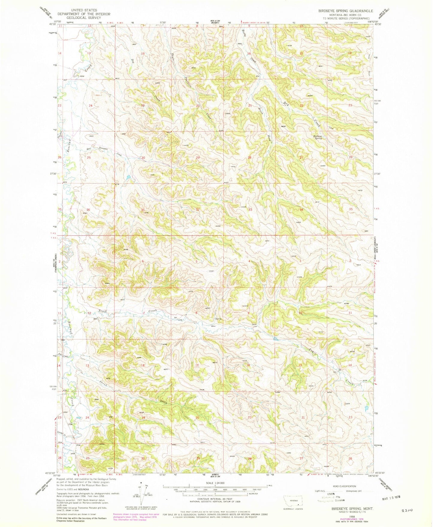
Classic USGS Birdseye Spring Montana 7.5'x7.5' Topo Map
Couldn't load pickup availability
Historical USGS topographic quad map of Birdseye Spring in the state of Montana. Map scale may vary for some years, but is generally around 1:24,000. Print size is approximately 24" x 27"
This quadrangle is in the following counties: Big Horn.
The map contains contour lines, roads, rivers, towns, and lakes. Printed on high-quality waterproof paper with UV fade-resistant inks, and shipped rolled.
Contains the following named places: 04S38E13ABBC01 Well, 04S38E36BCBA01 Well, 04S38E36BCBB01 Well, 04S38E36BCBD01 Well, 04S39E16BDBD01 Well, 05S39E07ACDD01 Well, 59016, Birdseye Spring, Corral Creek, Dry Creek, East Thompson Creek, Hutton Post Office, Pine Creek, Skunk Creek, South Fork Busby Creek, Thompson Creek, Trail Creek, Wolf Creek