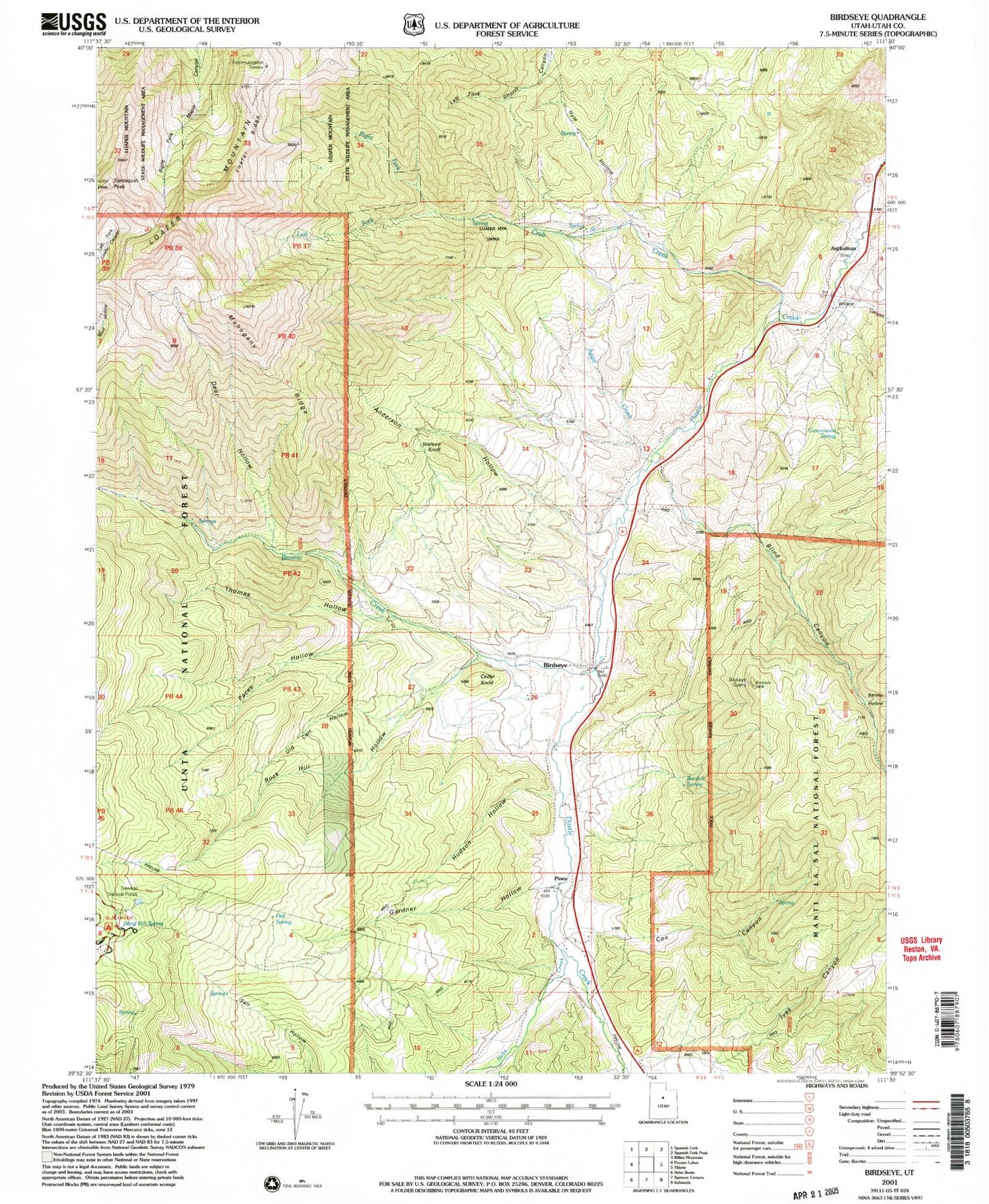
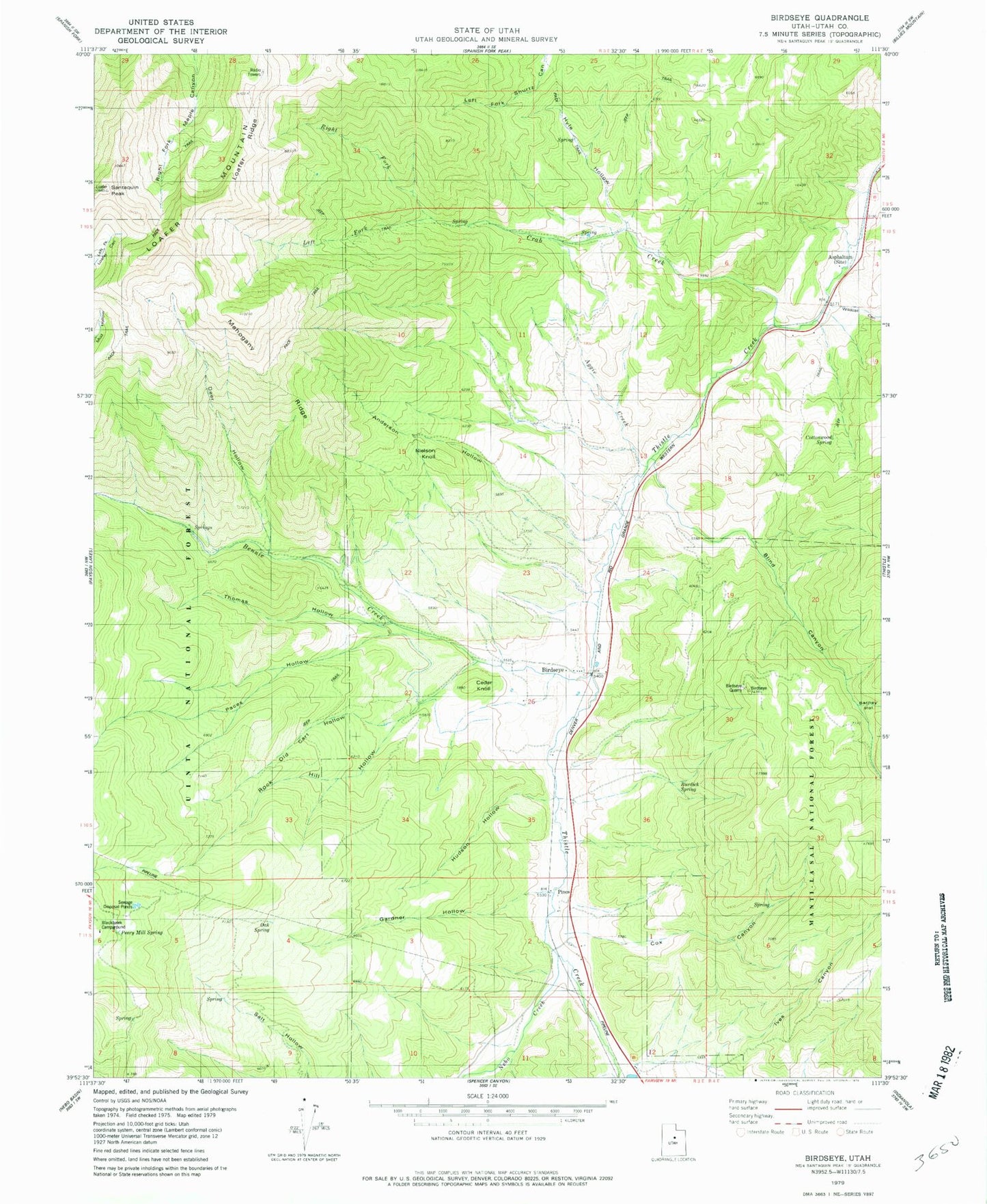
MyTopo
Classic USGS Birdseye Utah 7.5'x7.5' Topo Map
Couldn't load pickup availability
Historical USGS topographic quad map of Birdseye in the state of Utah. Map scale may vary for some years, but is generally around 1:24,000. Print size is approximately 24" x 27"
This quadrangle is in the following counties: Utah.
The map contains contour lines, roads, rivers, towns, and lakes. Printed on high-quality waterproof paper with UV fade-resistant inks, and shipped rolled.
Contains the following named places: Aggie Creek, Anderson Hollow, Asphaltum, Barney Hollow, Bennie Creek, Birdseye, Birdseye Quarry, Blackhawk Campground, Blind Canyon, Burdick Spring, Cat Canyon, Cedar Knoll, Cottonwood Spring, Cox Canyon, Cox Canyon Spring, Crab Creek, Deer Hollow, Gardner Hollow, Hudson Hollow, Hyle Hollow, Ives Canyon, Jackson Wildlife Management Area, Left Fork Crab Creek, Loafer Mountain, Loafer Ridge, Mahogany Ridge, Nebo Creek, Nielson Knoll, Oak Spring, Old Cart Hollow, Paces Hollow, Peery Mill Spring, Pines, Right Fork Crab Creek, Rock Hill Hollow, Santaquin Peak, The Church of Jesus Christ of Latter Day Saints, Thomas Hollow, Wildcat Canyon